

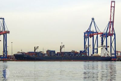
LUTETIA
Container Ship

Current Trip
| Time Travelled | 2 days |
|---|---|
| Remaining Time | 10 h, 12 mins |
| Distance Travelled | 415.31 nm |
| Remaining Distance | 45.15 nm |
| AVG Speed | 9.7 Knop |
| MAX Speed | 12 Knop |
| AVG Wind | 10.6 knots |
| MAX Wind | 15.8 knots |
| MIN Temp | 12.1°C / 53.78°F |
| MAX Temp | 16.5°C / 61.7°F |
| Djupgående | 11.6 m |
| Position mottagen | 2 m sen |
Current Position
| Longitud | --- |
|---|---|
| Latitude | --- |
| Status | Under way using engine |
| Fart | 4.2 Knop |
| Kurs | 267° |
| Område | Alboran Sea |
| Station | T-AIS |
| Position mottagen | 2 m sen |
Information
The current position of LUTETIA is in Alboran Sea with coordinates 36.22521° / -4.51059° as reported on 2025-03-27 13:55 by AIS to our vessel tracker app. The vessel's current speed is 4.2 Knop and is heading at the port of ALGECIRAS. The estimated time of arrival as calculated by MyShipTracking vessel tracking app is 2025-03-28 01:10 LT
The vessel LUTETIA (IMO: 9246695, MMSI: 636090856) is a Container Ship that was built in 2005 ( 20 År gammal ). It's sailing under the flag of [LR] Liberia.
In this page you can find informations about the vessels current position, last detected port calls, and current voyage information. If the vessels is not in coverage by AIS you will find the latest position.
The current position of LUTETIA is detected by our AIS receivers and we are not responsible for the reliability of the data. The last position was recorded while the vessel was in Coverage by the Ais receivers of our vessel tracking app.
The current draught of LUTETIA as reported by AIS is 11.6 meters
Weather
| Temperature | 16.4°C / 61.52°F |
|---|---|
| Wind Speed | 11 knots |
| Direction | 249° WSW |
| Pressure | 1016.2 hPa |
| Humidity | 81 % |
| Cloud Coverage | 14 % |


Featured Company
Last Port Calls
| Port | Arrival | Departure | Time In Port |
|---|---|---|---|
| 2025-03-23 13:36 | 2025-03-25 07:22 | 1 d | |
| 2025-03-16 13:32 | 2025-03-17 08:52 | 19 h | |
| 2025-03-09 13:10 | 2025-03-11 09:49 | 1 d | |
| 2025-03-03 07:13 | 2025-03-04 17:21 | 1 d | |
| 2025-02-28 17:13 | 2025-03-02 17:25 | 2 d | |
| 2025-02-15 22:59 | 2025-02-17 00:58 | 1 d | |
| 2025-02-12 17:50 | 2025-02-13 11:24 | 17 h | |
| 2025-02-06 16:07 | 2025-02-07 17:36 | 1 d | |
| 2025-01-24 18:25 | 2025-01-26 09:13 | 1 d | |
| 2025-01-20 17:57 | 2025-01-22 14:20 | 1 d |
Last Trips
| Origin | Departure | Destination | Arrival | Distance | |
|---|---|---|---|---|---|
| 2025-03-17 08:52 | 2025-03-23 13:36 | 1943.84 nm | |||
| 2025-03-11 09:49 | 2025-03-16 13:32 | 1871.57 nm | |||
| 2025-03-04 17:21 | 2025-03-09 13:10 | 379.04 nm | |||
| 2025-03-02 17:25 | 2025-03-03 07:13 | 148.88 nm | |||
| 2025-02-17 00:58 | 2025-02-28 17:13 | 3495.85 nm | |||
| 2025-02-13 11:24 | 2025-02-15 22:59 | 127.85 nm | |||
| 2025-02-07 17:36 | 2025-02-12 17:50 | 574.91 nm | |||
| 2025-01-26 09:13 | 2025-02-06 16:07 | 3885.55 nm | |||
| 2025-01-22 14:20 | 2025-01-24 18:25 | 152.21 nm | |||
| 2025-01-19 03:41 | 2025-01-20 17:57 | 625.66 nm |
Events
| Tid | Event | Detaljer | Position / Dest | Information |
|---|---|---|---|---|
| 2025-03-27 12:18 | Status ändrad | Under way using engine Default |
36.22116 / -4.36044
ESALG
|
Fart: 3.7 kn Kurs: 271° |
| 2025-03-27 12:16 | Status ändrad | Default Under way using engine |
36.22126 / -4.35800
ESALG
|
Fart: 2.4 kn Kurs: 285° |
| 2025-03-27 12:09 | Status ändrad | Under way using engine Default |
36.22052 / -4.35141
ESALG
|
Fart: 2.9 kn Kurs: 261° |
| 2025-03-27 11:59 | Status ändrad | Default Under way using engine |
36.22629 / -4.35262
ESALG
|
Fart: 1.7 kn Kurs: 179° |
| 2025-03-27 11:59 | Status ändrad | Under way using engine Default |
36.22640 / -4.35306
ESALG
|
Fart: 1.7 kn Kurs: 180° |
| 2025-03-27 11:59 | I täckningsområde |
36.22050 / -4.35154
Alboran Sea
|
Fart: 2.4 kn Kurs: 252.4° |
|
| 2025-03-27 11:00 | Status ändrad | Default Under way using engine |
36.23140 / -4.38671
ESALG
|
Fart: 1.6 kn Kurs: 189° |
| 2025-03-27 10:53 | UTANFÖR täckningsområde |
36.23198 / -4.39026
Alboran Sea
|
Fart: 1.6 kn Kurs: 103.9° |
|
| 2025-03-27 10:49 | Status ändrad | Under way using engine Default |
36.23234 / -4.39243
ESALG
|
Fart: 1.6 kn Kurs: 192° |
| 2025-03-27 10:48 | Status ändrad | Default Under way using engine |
36.23244 / -4.39305
ESALG
|
Fart: 1.5 kn Kurs: 192° |