

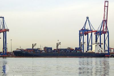
LUTETIA
Container Ship

Current Trip
| Time Travelled | 5 days |
|---|---|
| Remaining Time | 21 h, 18 mins |
| Distance Travelled | 1601.96 nm |
| Remaining Distance | 362.83 nm |
| AVG Speed | 13.2 Knots |
| MAX Speed | 16.4 Knots |
| AVG Wind | 17.3 knots |
| MAX Wind | 28 knots |
| MIN Temp | 12°C / 53.6°F |
| MAX Temp | 21.7°C / 71.06°F |
| Dybgang | 9.3 m |
| Position Modtaget | 2 h, 11 m siden |
Current Position
| Longitude | --- |
|---|---|
| Latitude | --- |
| Status | Under way using engine |
| Fart | 14.4 Knots |
| Kurs | 81° |
| Område | Alboran Sea |
| Station | T-AIS |
| Position Modtaget | 2 h, 11 m siden |
Information
The current position of LUTETIA is in Alboran Sea with coordinates 36.06454° / -4.66214° as reported on 2025-03-22 08:17 by AIS to our vessel tracker app. The vessel's current speed is 14.4 Knots and is heading at the port of VALENCIA. The estimated time of arrival as calculated by MyShipTracking vessel tracking app is 2025-03-23 08:47 LT
The vessel LUTETIA (IMO: 9246695, MMSI: 636090856) is a Container Ship that was built in 2005 ( 20 år gamle ). It's sailing under the flag of [LR] Liberia.
In this page you can find informations about the vessels current position, last detected port calls, and current voyage information. If the vessels is not in coverage by AIS you will find the latest position.
The current position of LUTETIA is detected by our AIS receivers and we are not responsible for the reliability of the data. The last position was recorded while the vessel was in Coverage by the Ais receivers of our vessel tracking app.
The current draught of LUTETIA as reported by AIS is 9.3 meters
Weather
| Temperature | 14.3°C / 57.74°F |
|---|---|
| Wind Speed | 21 knots |
| Direction | 288° WNW |
| Pressure | 1017.3 hPa |
| Humidity | 59.9 % |
| Cloud Coverage | 50 % |


Featured Company
Last Port Calls
| Port | Arrival | Departure | Time In Port |
|---|---|---|---|
| 2025-03-16 13:32 | 2025-03-17 08:52 | 19 h | |
| 2025-03-09 13:10 | 2025-03-11 09:49 | 1 d | |
| 2025-03-03 07:13 | 2025-03-04 17:21 | 1 d | |
| 2025-02-28 17:13 | 2025-03-02 17:25 | 2 d | |
| 2025-02-15 22:59 | 2025-02-17 00:58 | 1 d | |
| 2025-02-12 17:50 | 2025-02-13 11:24 | 17 h | |
| 2025-02-06 16:07 | 2025-02-07 17:36 | 1 d | |
| 2025-01-24 18:25 | 2025-01-26 09:13 | 1 d | |
| 2025-01-20 17:57 | 2025-01-22 14:20 | 1 d | |
| 2025-01-18 04:49 | 2025-01-19 03:41 | 22 h |
Last Trips
| Origin | Departure | Destination | Arrival | Distance | |
|---|---|---|---|---|---|
| 2025-03-11 09:49 | 2025-03-16 13:32 | 1871.57 nm | |||
| 2025-03-04 17:21 | 2025-03-09 13:10 | 379.04 nm | |||
| 2025-03-02 17:25 | 2025-03-03 07:13 | 148.88 nm | |||
| 2025-02-17 00:58 | 2025-02-28 17:13 | 3495.85 nm | |||
| 2025-02-13 11:24 | 2025-02-15 22:59 | 127.85 nm | |||
| 2025-02-07 17:36 | 2025-02-12 17:50 | 574.91 nm | |||
| 2025-01-26 09:13 | 2025-02-06 16:07 | 3885.55 nm | |||
| 2025-01-22 14:20 | 2025-01-24 18:25 | 152.21 nm | |||
| 2025-01-19 03:41 | 2025-01-20 17:57 | 625.66 nm | |||
| 2025-01-09 00:33 | 2025-01-18 04:49 | 3060.05 nm |
Events
| Tid | Hændelsen | Detaljer | Position / Dest | Info |
|---|---|---|---|---|
| 2025-03-22 08:19 | Status er ændret | Default Under way using engine |
36.06540 / -4.65537
ESVLC
|
Fart: 14.4 kn Kurs: 81° |
| 2025-03-22 08:17 | Udenfor Dækning |
36.06454 / -4.66214
Alboran Sea
ESVLC
|
Fart: 14.4 kn Kurs: 81° |
|
| 2025-03-22 08:13 | Status er ændret | Under way using engine Default |
36.06163 / -4.68513
ESVLC
|
Fart: 15 kn Kurs: 81° |
| 2025-03-22 08:08 | Status er ændret | Default Under way using engine |
36.05882 / -4.70688
ESVLC
|
Fart: 15 kn Kurs: 80.2° |
| 2025-03-22 06:38 | Status er ændret | Under way using engine Default |
35.99768 / -5.17077
ESVLC
|
Fart: 16.4 kn Kurs: 82° |
| 2025-03-22 06:30 | Status er ændret | Default Under way using engine |
35.99368 / -5.21150
ESVLC
|
Fart: 16.4 kn Kurs: 82° |
| 2025-03-22 06:21 | Ændre havområde | Spanish part of the Alboran Sea Spanish part of the Strait of Gibraltar |
35.98797 / -5.26133
Alboran Sea
ESVLC
|
Fart: 16.4 kn Kurs: 81.5° |
| 2025-03-22 06:21 | Status er ændret | Under way using engine Default |
35.98797 / -5.26133
ESVLC
|
Fart: 16.3 kn Kurs: 81° |
| 2025-03-22 06:14 | Status er ændret | Default Under way using engine |
35.98271 / -5.30445
ESVLC
|
Fart: 16 kn Kurs: 76.9° |
| 2025-03-22 06:01 | Ændre havområde | Spanish part of the Strait of Gibraltar Moroccan part of the Strait of Gibraltar |
35.97209 / -5.37106
Strait of Gibraltar
ESVLC
|
Fart: 15.8 kn Kurs: 76.6° |