

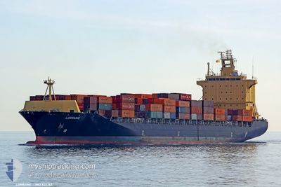
LORRAINE
Container Ship

Current Trip
| Time Travelled | 2 days |
|---|---|
| Remaining Time | 4 days |
| Distance Travelled | 1048.39 nm |
| Remaining Distance | 2169.67 nm |
| AVG Speed | 18.2 Knop |
| MAX Speed | 19.7 Knop |
| AVG Wind | 5.6 knots |
| MAX Wind | 14.3 knots |
| MIN Temp | 12.1°C / 53.78°F |
| MAX Temp | 16.6°C / 61.88°F |
| Djupgående | 10.6 m |
| Position mottagen | 4 h, 43 m sen |
Current Position
| Longitud | --- |
|---|---|
| Latitude | --- |
| Status | Under way using engine |
| Fart | 18.8 Knop |
| Kurs | 285.6° |
| Område | Mediterranean Sea - Eastern Basin |
| Station | T-AIS |
| Position mottagen | 4 h, 43 m sen |
Information
The current position of LORRAINE is in Mediterranean Sea - Eastern Basin with coordinates 36.54586° / 14.34996° as reported on 2025-02-19 04:24 by AIS to our vessel tracker app. The vessel's current speed is 18.8 Knop and is heading at the port of SOUTHAMPTON. The estimated time of arrival as calculated by MyShipTracking vessel tracking app is 2025-02-23 22:27 LT
The vessel LORRAINE (IMO: 9311763, MMSI: 636012905) is a Container Ship that was built in 2006 ( 19 År gammal ). It's sailing under the flag of [LR] Liberia.
In this page you can find informations about the vessels current position, last detected port calls, and current voyage information. If the vessels is not in coverage by AIS you will find the latest position.
The current position of LORRAINE is detected by our AIS receivers and we are not responsible for the reliability of the data. The last position was recorded while the vessel was in Coverage by the Ais receivers of our vessel tracking app.
The current draught of LORRAINE as reported by AIS is 10.6 meters
Weather
| Temperature | 14.1°C / 57.38°F |
|---|---|
| Wind Speed | 8 knots |
| Direction | 113° ESE |
| Pressure | 1023.2 hPa |
| Humidity | 79.4 % |
| Cloud Coverage | 11 % |


Featured Company
Last Port Calls
| Port | Arrival | Departure | Time In Port |
|---|---|---|---|
| 2025-02-16 13:29 | 2025-02-16 21:58 | 8 h | |
| 2025-02-15 20:25 | 2025-02-16 10:29 | 14 h | |
| 2025-02-13 06:30 | 2025-02-14 13:24 | 1 d | |
| 2025-02-10 22:10 | 2025-02-11 23:19 | 1 d | |
| 2025-02-08 16:21 | 2025-02-10 12:09 | 1 d | |
| 2025-01-30 00:18 | 2025-01-30 10:29 | 10 h | |
| 2025-01-26 18:14 | 2025-01-27 07:12 | 12 h | |
| 2025-01-23 23:52 | 2025-01-25 12:36 | 1 d | |
| 2025-01-16 09:13 | 2025-01-16 23:29 | 14 h | |
| 2025-01-07 20:56 | 2025-01-08 21:35 | 1 d |
Last Trips
| Origin | Departure | Destination | Arrival | Distance | |
|---|---|---|---|---|---|
| 2025-02-16 10:29 | 2025-02-16 13:29 | 18.92 nm | |||
| 2025-02-14 13:24 | 2025-02-15 20:25 | 265.70 nm | |||
| 2025-02-11 23:19 | 2025-02-13 06:30 | 365.86 nm | |||
| 2025-02-10 12:09 | 2025-02-10 22:10 | 135.45 nm | |||
| 2025-01-30 10:29 | 2025-02-08 16:21 | 3241.27 nm | |||
| 2025-01-27 07:12 | 2025-01-30 00:18 | 413.88 nm | |||
| 2025-01-25 12:36 | 2025-01-26 18:14 | 317.80 nm | |||
| 2025-01-16 23:29 | 2025-01-23 23:52 | 170.62 nm | |||
| 2025-01-08 21:35 | 2025-01-16 09:13 | 428.54 nm | |||
| 2024-11-23 19:13 | 2025-01-07 20:56 | 14261.02 nm |
Events
| Tid | Event | Detaljer | Position / Dest | Information |
|---|---|---|---|---|
| 2025-02-19 04:26 | Status ändrad | Default Under way using engine |
36.54804 / 14.33726
GBSOU
|
Fart: 18.8 kn Kurs: 285.6° |
| 2025-02-19 04:24 | Status ändrad | Under way using engine Default |
36.54586 / 14.34996
GBSOU
|
Fart: 19 kn Kurs: 294° |
| 2025-02-19 04:24 | UTANFÖR täckningsområde |
36.54586 / 14.34996
Mediterranean Sea - Eastern Basin
GBSOU
|
Fart: 18.8 kn Kurs: 285.6° |
|
| 2025-02-19 04:18 | Status ändrad | Default Under way using engine |
36.53560 / 14.38147
GBSOU
|
Fart: 19.1 kn Kurs: 293.5° |
| 2025-02-19 04:10 | Byter havsområde | Italian part of the Mediterranean Sea - Eastern Basin Greek part of the Mediterranean Sea - Eastern Basin |
36.51687 / 14.43426
Mediterranean Sea - Eastern Basin
GBSOU
|
Fart: 19.1 kn Kurs: 293.5° |
| 2025-02-19 04:10 | Status ändrad | Under way using engine Default |
36.51687 / 14.43426
GBSOU
|
Fart: 19 kn Kurs: 291° |
| 2025-02-19 04:05 | I täckningsområde |
36.51687 / 14.43426
Mediterranean Sea - Eastern Basin
GBSOU
|
Fart: 19.1 kn Kurs: 293.5° |
|
| 2025-02-18 05:51 | Status ändrad | Default Under way using engine |
34.91664 / 22.92986
GBSOU
|
Fart: 18.7 kn Kurs: 283.2° |
| 2025-02-18 05:42 | Upptäckt i hav | Greek part of the Mediterranean Sea - Eastern Basin |
34.90662 / 22.98732
Mediterranean Sea - Eastern Basin
GBSOU
|
Fart: 18.7 kn Kurs: 283.2° |
| 2025-02-18 05:42 | UTANFÖR täckningsområde |
34.90662 / 22.98732
Mediterranean Sea - Eastern Basin
GBSOU
|
Fart: 18.7 kn Kurs: 283.2° |