
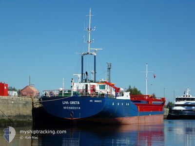
LIVA GRETA
General Cargo
Current Trip
| Time Travelled | 9 days |
|---|---|
| Remaining Time | --- |
| Distance Travelled | 105.04 nm |
| Remaining Distance | --- |
| AVG Speed | 6.6 Knop |
| MAX Speed | 10.5 Knop |
| AVG Wind | 19 knots |
| MAX Wind | 41.4 knots |
| MIN Temp | 1.5°C / 34.7°F |
| MAX Temp | 14.6°C / 58.28°F |
| Djupgående | 2.2 m |
| Position mottagen | 3 m sen |
Current Position
| Longitud | --- |
|---|---|
| Latitude | --- |
| Status | Under way using engine |
| Fart | 7.6 Knop |
| Kurs | 235.6° |
| Område | North Sea |
| Station | T-AIS |
| Position mottagen | 3 m sen |
Info
Information
The current position of LIVA GRETA is in North Sea with coordinates 53.54592° / 5.00230° as reported on 2024-11-28 16:50 by AIS to our vessel tracker app. The vessel's current speed is 7.6 Knop and is heading at the port of DROGHEDA. The estimated time of arrival as calculated by MyShipTracking vessel tracking app is 2024-12-02 12:00 LT
The vessel LIVA GRETA (IMO: 8801072, MMSI: 636020786) is a General Cargo that was built in 1988 ( 36 År gammal ). It's sailing under the flag of [LR] Liberia.
In this page you can find informations about the vessels current position, last detected port calls, and current voyage information. If the vessels is not in coverage by AIS you will find the latest position.
The current position of LIVA GRETA is detected by our AIS receivers and we are not responsible for the reliability of the data. The last position was recorded while the vessel was in Coverage by the Ais receivers of our vessel tracking app.
The current draught of LIVA GRETA as reported by AIS is 2.2 meters
Weather
| Temperature | 9.4°C / 48.92°F |
|---|---|
| Wind Speed | 14 knots |
| Direction | 335° NNW |
| Pressure | 1027.7 hPa |
| Humidity | 65.1 % |
| Cloud Coverage | 30 % |
Featured Company
Last Port Calls
| Port | Arrival | Departure | Time In Port |
|---|---|---|---|
| 2024-11-18 15:16 | 2024-11-19 11:56 | 20 h | |
| 2024-11-13 08:48 | 2024-11-15 22:54 | 2 d | |
| 2024-11-11 07:28 | 2024-11-12 20:20 | 1 d | |
| 2024-11-09 03:41 | 2024-11-10 18:17 | 1 d | |
| 2024-11-04 21:10 | 2024-11-05 09:28 | 12 h | |
| 2024-11-01 06:43 | 2024-11-01 17:59 | 11 h | |
| 2024-10-31 07:12 | 2024-10-31 15:30 | 8 h | |
| 2024-10-29 09:39 | 2024-10-29 21:46 | 12 h | |
| 2024-10-25 03:02 | 2024-10-25 13:26 | 10 h | |
| 2024-10-08 10:09 | 2024-10-17 19:37 | 9 d |
Most Visited Ports (Last year)
| Port | Arrivals | |
|---|---|---|
| 11 | ||
| 9 | ||
| 9 | ||
| 9 | ||
| 8 | ||
| 8 |
Last Trips
| Origin | Departure | Destination | Arrival | Distance | |
|---|---|---|---|---|---|
| 2024-11-15 22:54 | 2024-11-18 15:16 | 300.98 nm | |||
| 2024-11-12 20:20 | 2024-11-13 08:48 | 54.82 nm | |||
| 2024-11-10 18:17 | 2024-11-11 07:28 | 54.72 nm | |||
| 2024-11-05 09:28 | 2024-11-09 03:41 | 670.01 nm | |||
| 2024-11-01 17:59 | 2024-11-04 21:10 | 445.16 nm | |||
| 2024-10-31 15:30 | 2024-11-01 06:43 | 115.43 nm | |||
| 2024-10-29 21:46 | 2024-10-31 07:12 | 188.59 nm | |||
| 2024-10-25 13:26 | 2024-10-29 09:39 | 534.60 nm | |||
| 2024-10-17 19:37 | 2024-10-25 03:02 | 933.73 nm | |||
| 2024-10-04 18:11 | 2024-10-08 10:09 | 476.90 nm |
Events
| Tid | Event | Detaljer | Position / Dest | Information |
|---|---|---|---|---|
| 2024-11-28 16:50 | Status ändrad | Under way using engine Default |
53.54592 / 5.00230
IEDRO
|
Fart: 6.2 kn Kurs: 244° |
| 2024-11-28 16:27 | Status ändrad | Default Under way using engine |
53.55973 / 5.06790
IEDRO
|
Fart: 6.5 kn Kurs: 251.8° |
| 2024-11-28 16:26 | Status ändrad | Under way using engine Default |
53.56077 / 5.07299
IEDRO
|
Fart: 6 kn Kurs: 247° |
| 2024-11-28 16:20 | Status ändrad | Default Under way using engine |
53.56403 / 5.08847
IEDRO
|
Fart: 6.3 kn Kurs: 248.3° |
| 2024-11-28 12:23 | Djupgående ändrat | 2.2 2.3 |
53.59389 / 5.78112
IEDRO
|
Fart: 8.6 kn Kurs: 269° |
| 2024-11-28 12:23 | ETA ändrat | 2024/12/02 12:00 2024/11/29 12:00 |
53.59389 / 5.78112
IEDRO
|
Fart: 8.6 kn Kurs: 269° |
| 2024-11-28 12:10 | Status ändrad | Under way using engine Default |
53.59508 / 5.82985
IEDRO
|
Fart: 7.8 kn Kurs: 264° |
| 2024-11-28 12:08 | Status ändrad | Default Under way using engine |
53.59519 / 5.83767
IEDRO
|
Fart: 8.3 kn Kurs: 274.1° |
| 2024-11-28 11:42 | Status ändrad | Under way using engine Default |
53.59705 / 5.93793
IEDRO
|
Fart: 8.2 kn Kurs: 274° |
| 2024-11-28 11:40 | Status ändrad | Default Under way using engine |
53.59719 / 5.94461
IEDRO
|
Fart: 7.4 kn Kurs: 277.6° |