
LINNEA
Cargo
Current Trip
| Time Travelled | 2 days |
|---|---|
| Remaining Time | --- |
| Distance Travelled | 68.17 nm |
| Remaining Distance | --- |
| AVG Speed | 5.7 Knop |
| MAX Speed | 7 Knop |
| AVG Wind | 4.3 knots |
| MAX Wind | 10 knots |
| MIN Temp | 11.3°C / 52.34°F |
| MAX Temp | 22°C / 71.6°F |
| Djupgående | 1.4 m |
| Position mottagen | 2 d sen |
Current Position
| Longitud | 6.18149° |
|---|---|
| Latitude | 49.19388° |
| Status | Under way using engine |
| Fart | 4 Knop |
| Kurs | 337.9° |
| Område | North Sea |
| Station | T-AIS |
| Position mottagen | 2 d sen |
Info
Information
The current position of LINNEA is in North Sea with coordinates 49.19388° / 6.18149° as reported on 2024-04-30 09:50 by AIS to our vessel tracker app. The vessel's current speed is 4 Knop and is heading at the port of NIEUWEGEIN. The estimated time of arrival as calculated by MyShipTracking vessel tracking app is 2024-05-05 17:10 LT
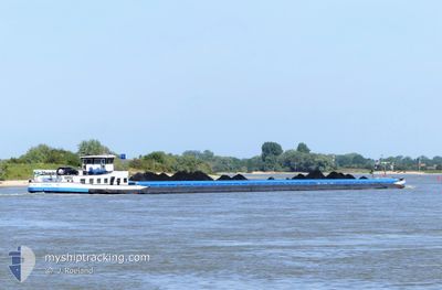
The vessel LINNEA (MMSI: 244384750) is a Cargo It's sailing under the flag of [NL] Netherlands.
In this page you can find informations about the vessels current position, last detected port calls, and current voyage information. If the vessels is not in coverage by AIS you will find the latest position.
The current position of LINNEA is detected by our AIS receivers and we are not responsible for the reliability of the data. The last position was recorded while the vessel was in Coverage by the Ais receivers of our vessel tracking app.
The current draught of LINNEA as reported by AIS is 1.4 meters
Weather
| Temperature | 21.2°C / 70.16°F |
|---|---|
| Wind Speed | --- |
| Direction | 295° WNW |
| Pressure | 997.6 hPa |
| Humidity | 59 % |
| Cloud Coverage | 100 % |
Featured Company
Last Port Calls
| Port | Arrival | Departure | Time In Port |
|---|---|---|---|
| 2024-04-27 16:44 | 2024-04-30 09:14 | 2 d | |
| 2024-04-23 13:55 | 2024-04-23 14:05 | 10 m | |
| 2024-04-22 17:05 | 2024-04-22 18:12 | 1 h | |
| 2024-04-21 14:27 | 2024-04-21 15:53 | 1 h | |
| 2024-04-20 12:12 | 2024-04-21 10:31 | 22 h | |
| 2024-04-19 20:53 | 2024-04-20 06:02 | 9 h | |
| 2024-04-19 04:54 | 2024-04-19 15:06 | 10 h | |
| 2024-04-13 12:08 | 2024-04-13 14:55 | 2 h | |
| 2024-04-12 00:26 | 2024-04-12 11:47 | 11 h | |
| 2024-04-10 13:45 | 2024-04-10 15:05 | 1 h |
Most Visited Ports (Last year)
| Port | Arrivals | |
|---|---|---|
| 14 | ||
| 14 | ||
| 14 | ||
| 13 | ||
| 11 | ||
| 10 |
Last Trips
| Origin | Departure | Destination | Arrival | Distance | |
|---|---|---|---|---|---|
| 2024-04-23 16:05 | 2024-04-27 18:44 | 159.33 nm | |||
| 2024-04-22 20:12 | 2024-04-23 15:55 | 77.40 nm | |||
| 2024-04-21 17:53 | 2024-04-22 19:05 | 119.83 nm | |||
| 2024-04-21 12:31 | 2024-04-21 16:27 | 26.74 nm | |||
| 2024-04-20 08:02 | 2024-04-20 14:12 | 46.31 nm | |||
| 2024-04-19 17:06 | 2024-04-19 22:53 | 38.38 nm | |||
| 2024-04-13 16:55 | 2024-04-19 06:54 | 203.64 nm | |||
| 2024-04-12 13:47 | 2024-04-13 14:08 | 51.94 nm | |||
| 2024-04-10 17:05 | 2024-04-12 02:26 | 124.38 nm | |||
| 2024-04-10 01:48 | 2024-04-10 15:45 | 65.92 nm |
Events
| Tid | Event | Detaljer | Position / Dest | Information |
|---|---|---|---|---|
| 2024-05-02 08:50 | STARTAR förflyttning | 4.44 nm, North West of BERNKASTEL |
49.97167 / 7.00167
AMERIKAHAVEN
|
Fart: 7 kn Kurs: 24° |
| 2024-05-02 06:59 | STARTAR förflyttning | 4.25 nm, West of BERNKASTEL |
49.90167 / 6.96167
AMERIKAHAVEN
|
Fart: 7 kn Kurs: 65° |
| 2024-05-01 15:26 | STARTAR förflyttning | 1.62 nm, South of TRIER |
49.73333 / 6.62500
AMERIKAHAVEN
|
Fart: 4 kn Kurs: -1° |
| 2024-05-01 10:20 | STOPPAR förflyttning | 1.93 nm, South of TRIER |
49.72833 / 6.62167
AMERIKAHAVEN
|
Fart: Kurs: -1° |
| 2024-04-30 19:32 | STOPPAR förflyttning | 7.28 nm, South West of MERTERT |
49.59500 / 6.37833
AMERIKAHAVEN
|
Fart: Kurs: -1° |
| 2024-04-30 17:32 | STARTAR förflyttning | 14.23 nm, South of MERTERT |
49.47167 / 6.36833
AMERIKAHAVEN
|
Fart: 4 kn Kurs: -1° |
| 2024-04-30 14:59 | STARTAR förflyttning | 15.78 nm, North of LA MAXE |
49.41833 / 6.28833
AMERIKAHAVEN
|
Fart: 6 kn Kurs: 73° |
| 2024-04-30 13:16 | STARTAR förflyttning | 12.29 nm, North of LA MAXE |
49.36666 / 6.19500
AMERIKAHAVEN
|
Fart: 6 kn Kurs: 77° |
| 2024-04-30 12:28 | STOPPAR förflyttning | 10.97 nm, North of LA MAXE |
49.34333 / 6.16667
AMERIKAHAVEN
|
Fart: Kurs: -1° |
| 2024-04-30 09:50 | UTANFÖR täckningsområde |
49.19388 / 6.18149
North Sea
AMERIKAHAVEN
|
Fart: 4 kn Kurs: 337.9° |