
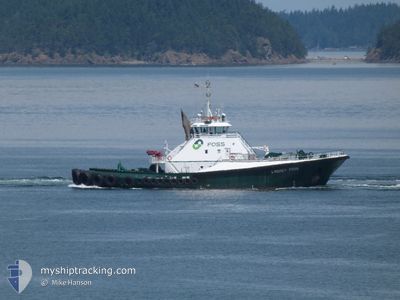
LINDSEY FOSS
Tug
Current Trip
| Time Travelled | 2 h, 33 mins |
|---|---|
| Remaining Time | 3 mins |
| Distance Travelled | 19.94 nm |
| Remaining Distance | 1.86 nm |
| AVG Speed | 7.9 Knop |
| MAX Speed | 10.4 Knop |
| AVG Wind | 5.1 knots |
| MAX Wind | 7.3 knots |
| MIN Temp | 8.4°C / 47.12°F |
| MAX Temp | 9.7°C / 49.46°F |
| Djupgående | 7 m |
| Position mottagen | 1 m sen |
Current Position
| Longitud | -122.72210° |
|---|---|
| Latitude | 48.79624° |
| Status | At anchor |
| Fart | 0.3 Knop |
| Kurs | 1° |
| Område | The Coastal Waters of Southeast Alaska and British Columbia |
| Station | T-AIS |
| Position mottagen | 1 m sen |
Info
Information
The current position of LINDSEY FOSS is in The Coastal Waters of Southeast Alaska and British Columbia with coordinates 48.79624° / -122.72210° as reported on 2024-05-22 17:36 by AIS to our vessel tracker app. The vessel's current speed is 0.3 Knop and is heading at the port of FERNDALE. The estimated time of arrival as calculated by MyShipTracking vessel tracking app is 2024-05-22 17:40 LT
The vessel LINDSEY FOSS (IMO: 9070254, MMSI: 366767150) is a Tug that was built in 1993 ( 31 År gammal ). It's sailing under the flag of [US] USA.
In this page you can find informations about the vessels current position, last detected port calls, and current voyage information. If the vessels is not in coverage by AIS you will find the latest position.
The current position of LINDSEY FOSS is detected by our AIS receivers and we are not responsible for the reliability of the data. The last position was recorded while the vessel was in Coverage by the Ais receivers of our vessel tracking app.
The current draught of LINDSEY FOSS as reported by AIS is 7 meters
Weather
| Temperature | 9.5°C / 49.1°F |
|---|---|
| Wind Speed | 4 knots |
| Direction | 248° WSW |
| Pressure | 1012.6 hPa |
| Humidity | 78.3 % |
| Cloud Coverage | 95 % |
Featured Company
Last Port Calls
| Port | Arrival | Departure | Time In Port |
|---|---|---|---|
| 2024-05-22 13:49 | 2024-05-22 15:04 | 1 h | |
| 2024-05-22 10:20 | 2024-05-22 12:38 | 2 h | |
| 2024-05-22 07:13 | 2024-05-22 08:02 | 49 m | |
| 2024-05-22 03:26 | 2024-05-22 04:44 | 1 h | |
| 2024-05-21 01:46 | 2024-05-21 20:27 | 18 h | |
| 2024-05-20 22:13 | 2024-05-20 22:46 | 32 m | |
| 2024-05-20 16:14 | 2024-05-20 19:10 | 2 h | |
| 2024-05-20 13:19 | 2024-05-20 14:14 | 55 m | |
| 2024-05-19 16:50 | 2024-05-19 17:42 | 52 m | |
| 2024-05-19 03:04 | 2024-05-19 16:26 | 13 h |
Most Visited Ports (Last year)
| Port | Arrivals | |
|---|---|---|
| 276 | ||
| 109 | ||
| 74 | ||
| 72 | ||
| 44 | ||
| 31 |
Last Trips
| Origin | Departure | Destination | Arrival | Distance | |
|---|---|---|---|---|---|
| 2024-05-22 05:38 | 2024-05-22 06:49 | 3.54 nm | |||
| 2024-05-22 01:02 | 2024-05-22 03:20 | 21.92 nm | |||
| 2024-05-21 21:44 | 2024-05-22 00:13 | 22.47 nm | |||
| 2024-05-21 13:27 | 2024-05-21 20:26 | 66.32 nm | |||
| 2024-05-20 15:46 | 2024-05-20 18:46 | 24.53 nm | |||
| 2024-05-20 12:10 | 2024-05-20 15:13 | 21.22 nm | |||
| 2024-05-20 07:14 | 2024-05-20 09:14 | 22.47 nm | |||
| 2024-05-19 10:42 | 2024-05-20 06:19 | 108.41 nm | |||
| 2024-05-19 09:26 | 2024-05-19 09:50 | 2.78 nm | |||
| 2024-05-18 19:29 | 2024-05-18 20:04 | 5.34 nm |
Events
| Tid | Event | Detaljer | Position / Dest | Information |
|---|---|---|---|---|
| 2024-05-22 17:34 | Status ändrad | At anchor Under way using engine |
48.79620 / -122.72232
FERNDALE
|
Fart: 0.3 kn Kurs: 353° |
| 2024-05-22 17:33 | STOPPAR förflyttning | 1.74 nm, South of FERNDALE |
48.79620 / -122.72232
FERNDALE
|
Fart: 0.3 kn Kurs: 353° |
| 2024-05-22 17:30 | STARTAR förflyttning | 1.76 nm, South of FERNDALE |
48.79595 / -122.72271
FERNDALE
|
Fart: 6.5 kn Kurs: 7.2° |
| 2024-05-22 17:25 | STOPPAR förflyttning | 1.88 nm, South of FERNDALE |
48.79387 / -122.72296
FERNDALE
|
Fart: 0.1 kn Kurs: 26° |
| 2024-05-22 17:21 | STARTAR förflyttning | 1.81 nm, South of FERNDALE |
48.79512 / -122.72277
FERNDALE
|
Fart: 5.4 kn Kurs: 172.1° |
| 2024-05-22 17:14 | STOPPAR förflyttning | 1.71 nm, South of FERNDALE |
48.79688 / -122.72395
FERNDALE
|
Fart: 0.2 kn Kurs: 357° |
| 2024-05-22 15:06 | Destination ändrad | FERNDALE ANACORTES |
48.51725 / -122.57159
FERNDALE
|
Fart: 9.1 kn Kurs: 5.3° |
| 2024-05-22 15:06 | ETA ändrat | 2024/05/22 17:30 2024/05/22 14:00 |
48.51725 / -122.57159
FERNDALE
|
Fart: 9.1 kn Kurs: 5.3° |
| 2024-05-22 15:04 | AVGÅTT HAMN |
|
48.51385 / -122.57107
ANACORTES
|
Fart: 9.1 kn Kurs: 353° |
| 2024-05-22 15:02 | STARTAR förflyttning |
48.50977 / -122.57251
[US] ANACORTES
|
Fart: 5.9 kn Kurs: 22° |