
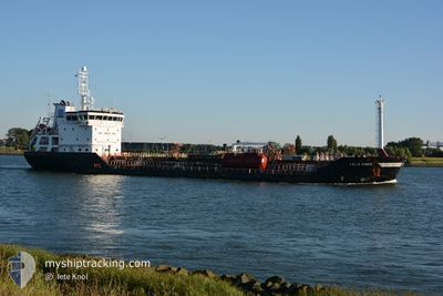
LILLO SWAN
Oil/Chemical Tanker
Current Trip
| Time Travelled | 20 h, 57 mins |
|---|---|
| Remaining Time | 6 days |
| Distance Travelled | 218.78 nm |
| Remaining Distance | 1547.32 nm |
| AVG Speed | 10.4 Knop |
| MAX Speed | 12.8 Knop |
| AVG Wind | 18.7 knots |
| MAX Wind | 23.7 knots |
| MIN Temp | 9.3°C / 48.74°F |
| MAX Temp | 12.7°C / 54.86°F |
| Djupgående | 5.3 m |
| Position mottagen | 3 m sen |
Current Position
| Longitud | --- |
|---|---|
| Latitude | --- |
| Status | Under way using engine |
| Fart | 9.8 Knop |
| Kurs | 254° |
| Område | English Channel |
| Station | T-AIS |
| Position mottagen | 3 m sen |
Info
Information
The current position of LILLO SWAN is in English Channel with coordinates 50.42830° / -0.48572° as reported on 2024-11-26 05:25 by AIS to our vessel tracker app. The vessel's current speed is 9.8 Knop and is heading at the port of TENERIFE. The estimated time of arrival as calculated by MyShipTracking vessel tracking app is 2024-12-02 14:54 LT
The vessel LILLO SWAN (IMO: 9390329, MMSI: 256838000) is a Oil/Chemical Tanker that was built in 2007 ( 17 År gammal ). It's sailing under the flag of [MT] Malta.
In this page you can find informations about the vessels current position, last detected port calls, and current voyage information. If the vessels is not in coverage by AIS you will find the latest position.
The current position of LILLO SWAN is detected by our AIS receivers and we are not responsible for the reliability of the data. The last position was recorded while the vessel was in Coverage by the Ais receivers of our vessel tracking app.
The current draught of LILLO SWAN as reported by AIS is 5.3 meters
Weather
| Temperature | 11.6°C / 52.88°F |
|---|---|
| Wind Speed | 18 knots |
| Direction | 250° WSW |
| Pressure | 1013.6 hPa |
| Humidity | 70.3 % |
| Cloud Coverage | 100 % |
Featured Company
Last Port Calls
| Port | Arrival | Departure | Time In Port |
|---|---|---|---|
| 2024-11-23 00:39 | 2024-11-25 09:31 | 2 d | |
| 2024-11-20 21:32 | 2024-11-22 23:06 | 2 d | |
| 2024-11-19 23:06 | 2024-11-20 20:28 | 21 h | |
| 2024-11-17 22:03 | 2024-11-19 21:41 | 1 d | |
| 2024-11-13 10:49 | 2024-11-17 20:24 | 4 d | |
| 2024-11-08 10:45 | 2024-11-12 09:25 | 3 d | |
| 2024-11-01 01:05 | 2024-11-01 12:48 | 11 h | |
| 2024-10-31 18:09 | 2024-11-01 00:39 | 6 h | |
| 2024-09-22 15:03 | 2024-09-22 23:27 | 8 h | |
| 2024-09-11 18:46 | 2024-09-15 16:57 | 3 d |
Most Visited Ports (Last year)
| Port | Arrivals | |
|---|---|---|
| 6 | ||
| 5 | ||
| 4 | ||
| 3 | ||
| 3 | ||
| 2 |
Last Trips
| Origin | Departure | Destination | Arrival | Distance | |
|---|---|---|---|---|---|
| 2024-11-22 23:06 | 2024-11-23 00:39 | 12.54 nm | |||
| 2024-11-20 20:28 | 2024-11-20 21:32 | 11.63 nm | |||
| 2024-11-19 21:41 | 2024-11-19 23:06 | 9.64 nm | |||
| 2024-11-17 20:24 | 2024-11-17 22:03 | 17.07 nm | |||
| 2024-11-12 09:25 | 2024-11-13 10:49 | 232.47 nm | |||
| 2024-11-01 12:48 | 2024-11-08 10:45 | 1778.90 nm | |||
| 2024-11-01 00:39 | 2024-11-01 01:05 | 2.04 nm | |||
| 2024-09-22 23:27 | 2024-10-31 18:09 | 7011.72 nm | |||
| 2024-09-15 16:57 | 2024-09-22 15:03 | 1771.89 nm | |||
| 2024-09-10 05:27 | 2024-09-11 18:46 | 250.44 nm |
Events
| Tid | Event | Detaljer | Position / Dest | Information |
|---|---|---|---|---|
| 2024-11-26 04:43 | Status ändrad | Under way using engine Default |
50.45747 / -.32578
ESSCT
|
Fart: 8.5 kn Kurs: 257° |
| 2024-11-26 04:42 | Status ändrad | Default Under way using engine |
50.45804 / -.32217
ESSCT
|
Fart: 8.5 kn Kurs: 257° |
| 2024-11-26 01:14 | Status ändrad | Under way using engine Default |
50.62487 / .58802
ESSCT
|
Fart: 11.2 kn Kurs: 233° |
| 2024-11-26 01:08 | Status ändrad | Default Under way using engine |
50.63507 / .60855
ESSCT
|
Fart: 11.4 kn Kurs: 232° |
| 2024-11-25 21:13 | Byter havsområde | United Kingdom part of the English Channel United Kingdom part of the North Sea |
51.07837 / 1.47245
English Channel
ESSCT
|
Fart: 8.9 kn Kurs: 229° |
| 2024-11-25 15:40 | Byter havsområde | United Kingdom part of the North Sea Belgian part of the North Sea |
51.78280 / 2.45463
North Sea
ESSCT
|
Fart: 11.7 kn Kurs: 222° |
| 2024-11-25 15:10 | Byter havsområde | Belgian part of the North Sea Dutch part of the North Sea |
51.85212 / 2.56373
North Sea
ESSCT
|
Fart: 11.4 kn Kurs: 224° |
| 2024-11-25 13:01 | Status ändrad | Under way using engine Default |
52.04573 / 3.07332
ESSCT
|
Fart: 10.4 kn Kurs: 267° |
| 2024-11-25 13:01 | Status ändrad | Default Under way using engine |
52.04582 / 3.07640
ESSCT
|
Fart: 10.2 kn Kurs: 267° |
| 2024-11-25 12:05 | Status ändrad | Under way using engine Default |
52.05353 / 3.33362
ESSCT
|
Fart: 10.1 kn Kurs: 267° |