
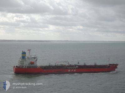
LILAC RAY
Tanker
Current Trip
| Time Travelled | 6 h, 9 mins |
|---|---|
| Remaining Time | 1 day |
| Distance Travelled | 64.64 nm |
| Remaining Distance | 494.46 nm |
| AVG Speed | 10.7 Knop |
| MAX Speed | 12.8 Knop |
| AVG Wind | 22.9 knots |
| MAX Wind | 25 knots |
| MIN Temp | 23.2°C / 73.76°F |
| MAX Temp | 25.8°C / 78.44°F |
| Djupgående | 8 m |
| Position mottagen | Nu |
Current Position
| Longitud | -94.41638° |
|---|---|
| Latitude | 28.67928° |
| Status | Under way using engine |
| Fart | 10.8 Knop |
| Kurs | 175.2° |
| Område | Gulf of Mexico |
| Station | T-AIS |
| Position mottagen | Nu |
Info
Information
The current position of LILAC RAY is in Gulf of Mexico with coordinates 28.67928° / -94.41638° as reported on 2024-04-28 04:04 by AIS to our vessel tracker app. The vessel's current speed is 10.8 Knop and is heading at the port of TUXPAN. The estimated time of arrival as calculated by MyShipTracking vessel tracking app is 2024-04-29 22:16 LT
The vessel LILAC RAY (IMO: 9883481, MMSI: 636019637) is a Tanker It's sailing under the flag of [LR] Liberia.
In this page you can find informations about the vessels current position, last detected port calls, and current voyage information. If the vessels is not in coverage by AIS you will find the latest position.
The current position of LILAC RAY is detected by our AIS receivers and we are not responsible for the reliability of the data. The last position was recorded while the vessel was in Coverage by the Ais receivers of our vessel tracking app.
The current draught of LILAC RAY as reported by AIS is 8 meters
Weather
| Temperature | 23.2°C / 73.76°F |
|---|---|
| Wind Speed | 24 knots |
| Direction | 135° SE |
| Pressure | 1012.6 hPa |
| Humidity | 89.8 % |
| Cloud Coverage | 20 % |
Featured Company
Last Port Calls
| Port | Arrival | Departure | Time In Port |
|---|---|---|---|
| 2024-04-26 22:23 | 2024-04-27 21:56 | 23 h | |
| 2024-04-24 00:46 | 2024-04-24 20:03 | 19 h | |
| 2024-04-20 07:42 | 2024-04-20 23:37 | 15 h | |
| 2024-04-19 15:55 | 2024-04-20 05:52 | 13 h | |
| 2024-04-15 11:31 | 2024-04-17 04:53 | 1 d | |
| 2024-04-12 11:54 | 2024-04-13 04:44 | 16 h | |
| 2024-04-09 18:56 | 2024-04-11 12:36 | 1 d | |
| 2024-04-04 09:55 | 2024-04-05 03:58 | 18 h | |
| 2024-03-30 16:10 | 2024-03-30 17:29 | 1 h | |
| 2024-03-29 09:02 | 2024-03-29 10:59 | 1 h |
Last Trips
| Origin | Departure | Destination | Arrival | Distance | |
|---|---|---|---|---|---|
| 2024-04-24 15:03 | 2024-04-26 17:23 | 42.96 nm | |||
| 2024-04-20 18:37 | 2024-04-23 19:46 | 31.85 nm | |||
| 2024-04-20 00:52 | 2024-04-20 02:42 | 18.84 nm | |||
| 2024-04-16 23:53 | 2024-04-19 10:55 | 50.97 nm | |||
| 2024-04-12 23:44 | 2024-04-15 06:31 | 508.09 nm | |||
| 2024-04-11 07:36 | 2024-04-12 06:54 | 251.09 nm | |||
| 2024-04-04 23:58 | 2024-04-09 13:56 | 999.69 nm | |||
| 2024-03-30 13:29 | 2024-04-04 05:55 | 1294.31 nm | |||
| 2024-03-29 06:59 | 2024-03-30 12:10 | 6.41 nm | |||
| 2024-03-28 01:11 | 2024-03-29 05:02 | 268.14 nm |
Events
| Tid | Event | Detaljer | Position / Dest | Information |
|---|---|---|---|---|
| 2024-04-28 03:52 | Status ändrad | Under way using engine Default |
28.71412 / -94.41899
MX TUX
|
Fart: 10.9 kn Kurs: 178° |
| 2024-04-28 03:48 | Status ändrad | Default Under way using engine |
28.72665 / -94.41977
MX TUX
|
Fart: 10.6 kn Kurs: 179.2° |
| 2024-04-28 03:41 | Status ändrad | Under way using engine Default |
28.74758 / -94.42083
MX TUX
|
Fart: 11.1 kn Kurs: 178° |
| 2024-04-28 03:25 | I täckningsområde |
28.74101 / -94.42060
Gulf of Mexico
MX TUX
|
Fart: 10.6 kn Kurs: 179.2° |
|
| 2024-04-28 01:06 | Status ändrad | Default Under way using engine |
29.20308 / -94.52659
MX TUX
|
Fart: 11.1 kn Kurs: 134.7° |
| 2024-04-28 00:58 | Status ändrad | Under way using engine Default |
29.22125 / -94.54651
MX TUX
|
Fart: 11 kn Kurs: 136° |
| 2024-04-28 00:58 | UTANFÖR täckningsområde |
29.22125 / -94.54651
Gulf of Mexico
MX TUX
|
Fart: 11.1 kn Kurs: 134.7° |
|
| 2024-04-28 00:38 | I täckningsområde |
29.22125 / -94.54651
Gulf of Mexico
MX TUX
|
Fart: 11.1 kn Kurs: 134.7° |
|
| 2024-04-27 23:46 | Status ändrad | Default Under way using engine |
29.34480 / -94.71990
MX TUX
|
Fart: 12.3 kn Kurs: 84.7° |
| 2024-04-27 23:38 | UTANFÖR täckningsområde |
29.34268 / -94.75198
Gulf of Mexico
MX TUX
|
Fart: 12.3 kn Kurs: 84.7° |