
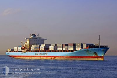
LICA MAERSK
Container Ship
Current Trip
| Time Travelled | 2 days |
|---|---|
| Remaining Time | --- |
| Distance Travelled | 895.80 nm |
| Remaining Distance | 2355.48 nm |
| AVG Speed | 13.4 Knop |
| MAX Speed | 18.8 Knop |
| AVG Wind | 15.1 knots |
| MAX Wind | 19.9 knots |
| MIN Temp | 14.8°C / 58.64°F |
| MAX Temp | 17.8°C / 64.04°F |
| Djupgående | 12.3 m |
| Position mottagen | 1 d sen |
Current Position
| Longitud | -10.59726° |
|---|---|
| Latitude | 36.40791° |
| Status | Under way using engine |
| Fart | 12.6 Knop |
| Kurs | 291.3° |
| Område | North Atlantic Ocean |
| Station | T-AIS |
| Position mottagen | 1 d sen |
Info
Information
The current position of LICA MAERSK is in North Atlantic Ocean with coordinates 36.40791° / -10.59726° as reported on 2024-05-14 20:56 by AIS to our vessel tracker app. The vessel's current speed is 12.6 Knop and is heading at the port of NEW YORK. The estimated time of arrival as calculated by MyShipTracking vessel tracking app is 2024-05-24 08:00 LT
The vessel LICA MAERSK (IMO: 9190779, MMSI: 477714300) is a Container Ship that was built in 2001 ( 23 År gammal ). It's sailing under the flag of [HK] Hong Kong.
In this page you can find informations about the vessels current position, last detected port calls, and current voyage information. If the vessels is not in coverage by AIS you will find the latest position.
The current position of LICA MAERSK is detected by our AIS receivers and we are not responsible for the reliability of the data. The last position was recorded while the vessel was in Coverage by the Ais receivers of our vessel tracking app.
The current draught of LICA MAERSK as reported by AIS is 12.3 meters
Weather
| Temperature | 16.8°C / 62.24°F |
|---|---|
| Wind Speed | 15 knots |
| Direction | 351° N |
| Pressure | 1022.2 hPa |
| Humidity | 81.9 % |
| Cloud Coverage | 44 % |
Featured Company
Last Port Calls
| Port | Arrival | Departure | Time In Port |
|---|---|---|---|
| 2024-05-13 10:33 | 2024-05-14 00:32 | 13 h | |
| 2024-05-06 13:46 | 2024-05-07 18:37 | 1 d | |
| 2024-05-04 15:04 | 2024-05-06 05:36 | 1 d | |
| 2024-05-01 04:31 | 2024-05-03 17:13 | 2 d | |
| 2024-04-29 12:39 | 2024-04-30 12:59 | 1 d | |
| 2024-04-25 10:57 | 2024-04-26 07:14 | 20 h | |
| 2024-04-24 13:44 | 2024-04-25 06:09 | 16 h | |
| 2024-04-12 01:17 | 2024-04-13 21:34 | 1 d | |
| 2024-04-08 23:42 | 2024-04-09 02:03 | 2 h | |
| 2024-04-08 03:54 |
Most Visited Ports (Last year)
| Port | Arrivals | |
|---|---|---|
| 16 | ||
| 11 | ||
| 11 | ||
| 9 | ||
| 6 | ||
| 6 |
Last Trips
| Origin | Departure | Destination | Arrival | Distance | |
|---|---|---|---|---|---|
| 2024-05-07 21:37 | 2024-05-13 12:33 | 1946.16 nm | |||
| 2024-05-06 08:36 | 2024-05-06 16:46 | 62.55 nm | |||
| 2024-05-03 20:13 | 2024-05-04 18:04 | 326.81 nm | |||
| 2024-04-30 15:59 | 2024-05-01 07:31 | 277.83 nm | |||
| 2024-04-26 09:14 | 2024-04-29 15:39 | 1520.38 nm | |||
| 2024-04-25 07:09 | 2024-04-25 12:57 | 38.31 nm | |||
| 2024-04-13 16:34 | 2024-04-24 14:44 | 4341.62 nm | |||
| 2024-04-08 21:03 | 2024-04-11 20:17 | 826.43 nm | |||
| 2024-04-07 22:33 | 2024-04-08 18:42 | 2.91 nm | |||
| 2024-04-07 22:33 | 2024-04-07 22:54 | 0.17 nm |
Events
| Tid | Event | Detaljer | Position / Dest | Information |
|---|---|---|---|---|
| 2024-05-14 21:05 | Status ändrad | Default Under way using engine |
36.42153 / -10.64139
ESALG > USEWR
|
Fart: 12.6 kn Kurs: 291.3° |
| 2024-05-14 20:56 | Status ändrad | Under way using engine Default |
36.40791 / -10.59726
ESALG > USEWR
|
Fart: 12.6 kn Kurs: 292° |
| 2024-05-14 20:56 | UTANFÖR täckningsområde |
36.40791 / -10.59726
North Atlantic Ocean
ESALG > USEWR
|
Fart: 12.6 kn Kurs: 291.3° |
|
| 2024-05-14 20:54 | I täckningsområde |
36.40791 / -10.59726
North Atlantic Ocean
ESALG > USEWR
|
Fart: 12.6 kn Kurs: 291.3° |
|
| 2024-05-14 18:13 | Status ändrad | Default Under way using engine |
36.20334 / -9.93500
ESALG > USEWR
|
Fart: 12.7 kn Kurs: 290.4° |
| 2024-05-14 17:43 | UTANFÖR täckningsområde |
36.15350 / -9.77259
North Atlantic Ocean
ESALG > USEWR
|
Fart: 12.7 kn Kurs: 290.4° |
|
| 2024-05-14 15:51 | Status ändrad | Under way using engine Default |
36.03595 / -9.29849
ESALG > USEWR
|
Fart: 13 kn Kurs: 272° |
| 2024-05-14 15:34 | I täckningsområde |
36.03595 / -9.29849
North Atlantic Ocean
ESALG > USEWR
|
Fart: 13.2 kn Kurs: 272.7° |
|
| 2024-05-14 14:52 | Status ändrad | Default Under way using engine |
36.03155 / -9.09096
ESALG > USEWR
|
Fart: 12.9 kn Kurs: 272.3° |
| 2024-05-14 14:20 | UTANFÖR täckningsområde |
36.02444 / -8.90283
North Atlantic Ocean
ESALG > USEWR
|
Fart: 12.9 kn Kurs: 272.3° |