
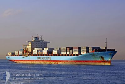
LICA MAERSK
Container Ship
Current Trip
| Time Travelled | 3 days |
|---|---|
| Remaining Time | 1 day |
| Distance Travelled | 1344.19 nm |
| Remaining Distance | 523.67 nm |
| AVG Speed | 18 Noeuds |
| MAX Speed | 21.4 Noeuds |
| AVG Wind | 7.9 knots |
| MAX Wind | 18 knots |
| MIN Temp | 14.4°C / 57.92°F |
| MAX Temp | 24.9°C / 76.82°F |
| Tirant d eau | 11.1 m |
| Position reçue | 1 h, 21 m depuis |
Current Position
| Longitude | 5.50746° |
|---|---|
| Latitude | 37.48694° |
| Etat | Under way using engine |
| Vitesse | 20.7 Noeuds |
| Parcours | 264.5° |
| Zone | Mediterranean Sea - Western Basin |
| Station | T-AIS |
| Position reçue | 1 h, 21 m depuis |
Info
Information
The current position of LICA MAERSK is in Mediterranean Sea - Western Basin with coordinates 37.48694° / 5.50746° as reported on 2024-05-10 18:34 by AIS to our vessel tracker app. The vessel's current speed is 20.7 Noeuds and is heading at the port of TANGER MED. The estimated time of arrival as calculated by MyShipTracking vessel tracking app is 2024-05-11 21:08 LT
The vessel LICA MAERSK (IMO: 9190779, MMSI: 477714300) is a Container Ship that was built in 2001 ( 23 Age ). It's sailing under the flag of [HK] Hong Kong.
In this page you can find informations about the vessels current position, last detected port calls, and current voyage information. If the vessels is not in coverage by AIS you will find the latest position.
The current position of LICA MAERSK is detected by our AIS receivers and we are not responsible for the reliability of the data. The last position was recorded while the vessel was in Coverage by the Ais receivers of our vessel tracking app.
The current draught of LICA MAERSK as reported by AIS is 11.1 meters
Weather
| Temperature | 18.3°C / 64.94°F |
|---|---|
| Wind Speed | 10 knots |
| Direction | 85° E |
| Pressure | 1017.5 hPa |
| Humidity | 80.2 % |
| Cloud Coverage | 3 % |
Featured Company
Last Port Calls
| Port | Arrival | Departure | Time In Port |
|---|---|---|---|
| 2024-05-06 13:46 | 2024-05-07 18:37 | 1 d | |
| 2024-05-04 15:04 | 2024-05-06 05:36 | 1 d | |
| 2024-05-01 04:31 | 2024-05-03 17:13 | 2 d | |
| 2024-04-29 12:39 | 2024-04-30 12:59 | 1 d | |
| 2024-04-25 10:57 | 2024-04-26 07:14 | 20 h | |
| 2024-04-24 13:44 | 2024-04-25 06:09 | 16 h | |
| 2024-04-12 01:17 | 2024-04-13 21:34 | 1 d | |
| 2024-04-08 23:42 | 2024-04-09 02:03 | 2 h | |
| 2024-04-08 03:54 | |||
| 2024-04-07 23:09 | 2024-04-08 03:33 | 4 h |
Most Visited Ports (Last year)
| Port | Arrivals | |
|---|---|---|
| 15 | ||
| 11 | ||
| 11 | ||
| 9 | ||
| 6 | ||
| 6 |
Last Trips
| Origin | Departure | Destination | Arrival | Distance | |
|---|---|---|---|---|---|
| 2024-05-06 08:36 | 2024-05-06 16:46 | 62.55 nm | |||
| 2024-05-03 20:13 | 2024-05-04 18:04 | 326.81 nm | |||
| 2024-04-30 15:59 | 2024-05-01 07:31 | 277.83 nm | |||
| 2024-04-26 09:14 | 2024-04-29 15:39 | 1520.38 nm | |||
| 2024-04-25 07:09 | 2024-04-25 12:57 | 38.31 nm | |||
| 2024-04-13 16:34 | 2024-04-24 14:44 | 4341.62 nm | |||
| 2024-04-08 21:03 | 2024-04-11 20:17 | 826.43 nm | |||
| 2024-04-07 22:33 | 2024-04-08 18:42 | 2.91 nm | |||
| 2024-04-07 22:33 | 2024-04-07 22:54 | 0.17 nm | |||
| 2024-04-06 18:57 | 2024-04-07 18:09 | 69.45 nm |
Events
| Heure | Evenement | Détails | Position/ Destination | Info |
|---|---|---|---|---|
| 2024-05-10 18:41 | Etat Changé | Default Under way using engine |
37.48315 / 5.45775
MAPTM
|
Vitesse: 20.7 kn Parcours: 264.5° |
| 2024-05-10 18:34 | Hors de la zone couverte |
37.48694 / 5.50746
Mediterranean Sea - Western Basin
MAPTM
|
Vitesse: 20.7 kn Parcours: 264.5° |
|
| 2024-05-10 18:16 | Etat Changé | Under way using engine Default |
37.49580 / 5.63379
MAPTM
|
Vitesse: 20.5 kn Parcours: 263° |
| 2024-05-10 18:00 | Dans la zone couverte |
37.49580 / 5.63379
Mediterranean Sea - Western Basin
MAPTM
|
Vitesse: 20.7 kn Parcours: 265.5° |
|
| 2024-05-10 15:10 | Etat Changé | Default Under way using engine |
37.58500 / 6.97333
MAPTM
|
Vitesse: 20.8 kn Parcours: 266.1° |
| 2024-05-10 15:08 | Hors de la zone couverte |
37.58752 / 6.99199
Mediterranean Sea - Western Basin
MAPTM
|
Vitesse: 20.8 kn Parcours: 266.1° |
|
| 2024-05-10 14:16 | Changement de zone | Algerian part of the Mediterranean Sea - Western Basin Tunisian part of the Mediterranean Sea - Western Basin |
37.60626 / 7.36711
Mediterranean Sea - Western Basin
MAPTM
|
Vitesse: 21 kn Parcours: 266° |
| 2024-05-10 14:16 | Etat Changé | Under way using engine Default |
37.60626 / 7.36711
MAPTM
|
Vitesse: 20 kn Parcours: 258° |
| 2024-05-10 14:16 | Dans la zone couverte |
37.60626 / 7.36711
Mediterranean Sea - Western Basin
MAPTM
|
Vitesse: 21 kn Parcours: 266° |
|
| 2024-05-10 05:47 | Hors de la zone couverte |
37.52386 / 10.85880
Mediterranean Sea - Western Basin
MAPTM
|
Vitesse: 19.4 kn Parcours: 274.2° |