

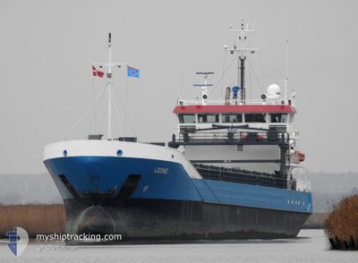
LEONIE
General Cargo

Current Trip
| Time Travelled | 3 days |
|---|---|
| Remaining Time | 17 h, 59 mins |
| Distance Travelled | 785.84 nm |
| Remaining Distance | 187.50 nm |
| AVG Speed | 8.6 Knop |
| MAX Speed | 13.8 Knop |
| AVG Wind | 7.8 knots |
| MAX Wind | 16 knots |
| MIN Temp | 3.6°C / 38.48°F |
| MAX Temp | 12.6°C / 54.68°F |
| Djupgående | 5.4 m |
| Position mottagen | 20 m sen |
Current Position
| Longitud | --- |
|---|---|
| Latitude | --- |
| Status | Under way using engine |
| Fart | 10.3 Knop |
| Kurs | 30.2° |
| Område | Baltic Sea |
| Station | T-AIS |
| Position mottagen | 20 m sen |
Information
The current position of LEONIE is in Baltic Sea with coordinates 58.36423° / 18.85349° as reported on 2025-03-30 02:29 by AIS to our vessel tracker app. The vessel's current speed is 10.3 Knop and is heading at the port of GAVLE. The estimated time of arrival as calculated by MyShipTracking vessel tracking app is 2025-03-30 20:49 LT
The vessel LEONIE (IMO: 9331361, MMSI: 244772000) is a General Cargo that was built in 2007 ( 18 År gammal ). It's sailing under the flag of [NL] Netherlands.
In this page you can find informations about the vessels current position, last detected port calls, and current voyage information. If the vessels is not in coverage by AIS you will find the latest position.
The current position of LEONIE is detected by our AIS receivers and we are not responsible for the reliability of the data. The last position was recorded while the vessel was in Coverage by the Ais receivers of our vessel tracking app.
The current draught of LEONIE as reported by AIS is 5.4 meters
Weather
| Temperature | 4.4°C / 39.92°F |
|---|---|
| Wind Speed | 8 knots |
| Direction | 275° W |
| Pressure | 1008.1 hPa |
| Humidity | 80.5 % |
| Cloud Coverage | 2 % |


Featured Company
Last Port Calls
| Port | Arrival | Departure | Time In Port |
|---|---|---|---|
| 2025-03-24 14:36 | 2025-03-26 16:30 | 2 d | |
| 2025-03-16 07:54 | 2025-03-17 17:01 | 1 d | |
| 2025-03-11 14:39 | 2025-03-12 17:36 | 1 d | |
| 2025-02-14 19:07 | 2025-03-11 13:20 | 24 d | |
| 2025-02-01 09:59 | 2025-02-04 09:42 | 2 d | |
| 2025-01-28 05:17 | 2025-01-28 05:20 | 3 m | |
| 2025-01-21 11:03 | 2025-01-26 03:09 | 4 d | |
| 2025-01-17 05:03 | 2025-01-17 20:38 | 15 h | |
| 2025-01-07 01:52 | 2025-01-07 01:54 | 2 m |
Last Trips
| Origin | Departure | Destination | Arrival | Distance | |
|---|---|---|---|---|---|
| 2025-03-17 18:01 | 2025-03-24 15:36 | 1111.81 nm | |||
| 2025-03-12 18:36 | 2025-03-16 08:54 | 571.02 nm | |||
| 2025-03-11 14:20 | 2025-03-11 15:39 | 7.31 nm | |||
| 2025-02-04 10:42 | 2025-02-14 20:07 | 776.42 nm | |||
| 2025-01-28 06:20 | 2025-02-01 10:59 | 913.21 nm | |||
| 2025-01-26 03:09 | 2025-01-28 06:17 | 412.00 nm | |||
| 2025-01-17 21:38 | 2025-01-21 11:03 | 740.00 nm | |||
| 2025-01-07 02:54 | 2025-01-17 06:03 | 1302.46 nm | |||
| 2024-12-29 21:12 | 2025-01-07 02:52 | 1106.00 nm |
Events
| Tid | Event | Detaljer | Position / Dest | Information |
|---|---|---|---|---|
| 2025-03-30 02:38 | Status ändrad | Default Under way using engine |
58.38503 / 18.87704
SEGVX
|
Fart: 10.3 kn Kurs: 30.2° |
| 2025-03-30 02:29 | Status ändrad | Under way using engine Default |
58.36423 / 18.85349
SEGVX
|
Fart: 10.3 kn Kurs: 30° |
| 2025-03-30 02:06 | Status ändrad | Default Under way using engine |
58.30614 / 18.78800
SEGVX
|
Fart: 10.4 kn Kurs: 30.8° |
| 2025-03-30 02:01 | Status ändrad | Under way using engine Default |
58.29375 / 18.77391
SEGVX
|
Fart: 10.3 kn Kurs: 31° |
| 2025-03-30 01:50 | Status ändrad | Default Under way using engine |
58.26651 / 18.74356
SEGVX
|
Fart: 10.3 kn Kurs: 30° |
| 2025-03-30 01:44 | Status ändrad | Under way using engine Default |
58.25079 / 18.72626
SEGVX
|
Fart: 10.2 kn Kurs: 29° |
| 2025-03-30 01:42 | Status ändrad | Default Under way using engine |
58.24661 / 18.72170
SEGVX
|
Fart: 10.2 kn Kurs: 29.8° |
| 2025-03-29 20:12 | Status ändrad | Under way using engine Default |
57.43764 / 17.81594
SEGVX
|
Fart: 10.1 kn Kurs: 23° |
| 2025-03-29 20:10 | Status ändrad | Default Under way using engine |
57.43260 / 17.81146
SEGVX
|
Fart: 10.2 kn Kurs: 23.1° |
| 2025-03-29 20:02 | Status ändrad | Under way using engine Default |
57.41075 / 17.79426
SEGVX
|
Fart: 10.2 kn Kurs: 21° |