
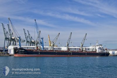
LAVENDER
Bulk Carrier
Current Trip
| Time Travelled | 7 days |
|---|---|
| Remaining Time | --- |
| Distance Travelled | 1811.15 nm |
| Remaining Distance | --- |
| AVG Speed | 11.1 Knop |
| MAX Speed | 13.9 Knop |
| AVG Wind | 13.4 knots |
| MAX Wind | 27 knots |
| MIN Temp | 14.4°C / 57.92°F |
| MAX Temp | 32.1°C / 89.78°F |
| Djupgående | 6.4 m |
| Position mottagen | Nu |
Current Position
| Longitud | 25.54849° |
|---|---|
| Latitude | 39.09368° |
| Status | Under way using engine |
| Fart | 11.7 Knop |
| Kurs | 15.1° |
| Område | Aegean Sea |
| Station | T-AIS |
| Position mottagen | Nu |
Info
Information
The current position of LAVENDER is in Aegean Sea with coordinates 39.09368° / 25.54849° as reported on 2024-05-04 17:23 by AIS to our vessel tracker app. The vessel's current speed is 11.7 Knop and is heading at the port of KAVKAZ. The estimated time of arrival as calculated by MyShipTracking vessel tracking app is 2024-05-07 01:00 LT
The vessel LAVENDER (IMO: 9463750, MMSI: 538003950) is a Bulk Carrier that was built in 2010 ( 14 År gammal ). It's sailing under the flag of [MH] Marshall Is.
In this page you can find informations about the vessels current position, last detected port calls, and current voyage information. If the vessels is not in coverage by AIS you will find the latest position.
The current position of LAVENDER is detected by our AIS receivers and we are not responsible for the reliability of the data. The last position was recorded while the vessel was in Coverage by the Ais receivers of our vessel tracking app.
The current draught of LAVENDER as reported by AIS is 6.4 meters
Weather
| Temperature | 15.7°C / 60.26°F |
|---|---|
| Wind Speed | 21 knots |
| Direction | 343° NNW |
| Pressure | 1007.4 hPa |
| Humidity | 78.2 % |
| Cloud Coverage | 82 % |
Featured Company
Last Port Calls
| Port | Arrival | Departure | Time In Port |
|---|---|---|---|
| 2024-05-02 02:46 | 2024-05-02 11:28 | 8 h | |
| 2024-04-21 15:23 | 2024-04-26 22:48 | 5 d | |
| 2024-04-16 09:03 | 2024-04-16 18:39 | 9 h | |
| 2024-04-05 17:35 | 2024-04-08 22:59 | 3 d | |
| 2024-03-31 05:39 | 2024-03-31 15:11 | 9 h | |
| 2024-03-27 17:18 | 2024-03-27 18:34 | 1 h | |
| 2024-03-18 17:09 | 2024-03-23 07:35 | 4 d | |
| 2024-03-01 09:57 | 2024-03-12 12:38 | 11 d |
Most Visited Ports (Last year)
| Port | Arrivals | |
|---|---|---|
| 7 | ||
| 2 | ||
| 2 | ||
| 2 | ||
| 1 | ||
| 1 |
Last Trips
| Origin | Departure | Destination | Arrival | Distance | |
|---|---|---|---|---|---|
| 2024-04-27 01:48 | 2024-05-02 04:46 | 1128.24 nm | |||
| 2024-04-16 21:39 | 2024-04-21 18:23 | 228.54 nm | |||
| 2024-04-09 01:59 | 2024-04-16 12:03 | 216.89 nm | |||
| 2024-03-27 21:34 | 2024-04-05 20:35 | 2256.68 nm | |||
| 2024-03-27 21:34 | 2024-03-31 07:39 | 821.04 nm | |||
| 2024-03-23 09:35 | 2024-03-27 20:18 | 454.65 nm | |||
| 2024-03-12 15:38 | 2024-03-18 19:09 | 525.34 nm | |||
| 2024-02-12 23:43 | 2024-03-01 12:57 | 3772.68 nm |
Events
| Tid | Event | Detaljer | Position / Dest | Information |
|---|---|---|---|---|
| 2024-05-03 20:53 | Byter havsområde | Greek part of the Aegean Sea Greek part of the Mediterranean Sea - Eastern Basin |
35.77998 / 27.54525
Aegean Sea
RU KZP
|
Fart: 10.6 kn Kurs: 311.6° |
| 2024-05-03 15:57 | Status ändrad | Under way using engine Default |
35.09358 / 28.30866
RU KZP
|
Fart: 11.4 kn Kurs: 315° |
| 2024-05-03 15:20 | Status ändrad | Default Under way using engine |
35.00667 / 28.40667
RU KZP
|
Fart: 10.9 kn Kurs: 318.6° |
| 2024-05-03 14:55 | Status ändrad | Under way using engine Default |
34.95268 / 28.46756
RU KZP
|
Fart: 11.2 kn Kurs: 317° |
| 2024-05-03 14:33 | Status ändrad | Default Under way using engine |
34.90174 / 28.52506
RU KZP
|
Fart: 11.3 kn Kurs: 320.4° |
| 2024-05-03 14:14 | Status ändrad | Under way using engine Default |
34.85654 / 28.57001
RU KZP
|
Fart: 11 kn Kurs: 321° |
| 2024-05-03 14:05 | I täckningsområde |
34.85780 / 28.56873
Mediterranean Sea - Eastern Basin
RU KZP
|
Fart: 11.3 kn Kurs: 319.9° |
|
| 2024-05-03 11:33 | STARTAR förflyttning |
34.48430 / 28.97331
RU KZP
|
Fart: 11 kn Kurs: 318° |
|
| 2024-05-03 11:27 | STOPPAR förflyttning |
34.47136 / 28.99054
RU KZP
|
Fart: Kurs: 314° |
|
| 2024-05-03 10:53 | UTANFÖR täckningsområde |
34.39226 / 29.07312
Mediterranean Sea - Eastern Basin
RU KZP
|
Fart: 11.1 kn Kurs: 317.7° |