
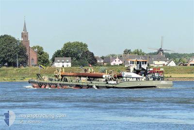
KREEFT
Dredging or underwater ops
Current Trip
MAASTRICHT
| Time Travelled | 8 days |
|---|---|
| Remaining Time | --- |
| Distance Travelled | 127.58 nm |
| Remaining Distance | --- |
| AVG Speed | 6.4 Knop |
| MAX Speed | 10.2 Knop |
| AVG Wind | 5.9 knots |
| MAX Wind | 14 knots |
| MIN Temp | 4.5°C / 40.1°F |
| MAX Temp | 22.7°C / 72.86°F |
| Djupgående | 0.2 m |
| Position mottagen | 2 m sen |
Current Position
| Longitud | 5.70922° |
|---|---|
| Latitude | 50.88592° |
| Status | Moored |
| Fart | |
| Kurs | --- |
| Område | North Sea |
| Station | T-AIS |
| Position mottagen | 2 m sen |
Info
Information
The current position of KREEFT is in North Sea with coordinates 50.88592° / 5.70922° as reported on 2024-05-02 12:34 by AIS to our vessel tracker app. The vessel's current speed is 0 Knop
The vessel KREEFT (MMSI: 244398000) is a Dredging or underwater ops It's sailing under the flag of [NL] Netherlands.
In this page you can find informations about the vessels current position, last detected port calls, and current voyage information. If the vessels is not in coverage by AIS you will find the latest position.
The current position of KREEFT is detected by our AIS receivers and we are not responsible for the reliability of the data. The last position was recorded while the vessel was in Coverage by the Ais receivers of our vessel tracking app.
The current draught of KREEFT as reported by AIS is 0.2 meters
Weather
| Temperature | 20.5°C / 68.9°F |
|---|---|
| Wind Speed | 11 knots |
| Direction | 243° WSW |
| Pressure | 999.5 hPa |
| Humidity | 74 % |
| Cloud Coverage | 28 % |
Featured Company
Last Port Calls
| Port | Arrival | Departure | Time In Port |
|---|---|---|---|
| 2024-04-18 12:56 | 2024-04-24 07:45 | 5 d | |
| 2024-04-18 12:13 | 2024-04-18 12:17 | 4 m | |
| 2024-04-11 09:18 | 2024-04-18 05:32 | 6 d | |
| 2024-04-11 08:32 | 2024-04-11 09:10 | 37 m | |
| 2024-03-26 10:35 | 2024-03-26 11:12 | 36 m |
Most Visited Ports (Last year)
| Port | Arrivals | |
|---|---|---|
| 5 | ||
| 5 | ||
| 4 | ||
| 1 | ||
| 1 |
Last Trips
| Origin | Departure | Destination | Arrival | Distance | |
|---|---|---|---|---|---|
| 2024-04-18 14:17 | 2024-04-18 14:56 | 4.36 nm | |||
| 2024-04-18 07:32 | 2024-04-18 14:13 | 4.69 nm | |||
| 2024-04-11 11:10 | 2024-04-11 11:18 | 0.65 nm | |||
| 2024-03-26 12:12 | 2024-04-11 10:32 | 17.40 nm | |||
| 2024-01-29 15:35 | 2024-03-26 11:35 | 7.96 nm |
Events
| Tid | Event | Detaljer | Position / Dest | Information |
|---|---|---|---|---|
| 2024-05-01 11:23 | Status ändrad | Moored Under way using engine |
50.88592 / 5.70925
MAASTRICHT
|
Fart: Kurs: 511° |
| 2024-05-01 11:05 | STOPPAR förflyttning | 1.19 nm, South of ITTEREN |
50.88593 / 5.70920
MAASTRICHT
|
Fart: 0.1 kn Kurs: 511° |
| 2024-05-01 10:58 | STARTAR förflyttning | 0.97 nm, South of ITTEREN |
50.88914 / 5.71224
MAASTRICHT
|
Fart: 3.5 kn Kurs: 243.3° |
| 2024-05-01 10:50 | STOPPAR förflyttning | 1.15 nm, South of ITTEREN |
50.88546 / 5.71596
MAASTRICHT
|
Fart: 0.2 kn Kurs: 511° |
| 2024-05-01 08:28 | STARTAR förflyttning | 1.69 nm, South of BARGE TERMINAL BORN |
51.03395 / 5.79834
MAASTRICHT
|
Fart: 4 kn Kurs: 199.2° |
| 2024-05-01 08:11 | STOPPAR förflyttning | 1.57 nm, South of BARGE TERMINAL BORN |
51.03576 / 5.79924
MAASTRICHT
|
Fart: 0.3 kn Kurs: 511° |
| 2024-05-01 07:21 | I täckningsområde |
51.10369 / 5.84636
North Sea
|
Fart: 5.9 kn Kurs: 209.4° |
|
| 2024-04-30 15:43 | UTANFÖR täckningsområde |
51.63632 / 5.99664
North Sea
|
Fart: 7.9 kn Kurs: 110° |
|
| 2024-04-30 15:43 | I täckningsområde |
51.63632 / 5.99664
North Sea
|
Fart: 7.9 kn Kurs: 110° |
|
| 2024-04-30 14:20 | UTANFÖR täckningsområde |
51.72179 / 5.89346
North Sea
|
Fart: 7.3 kn Kurs: 127.3° |