
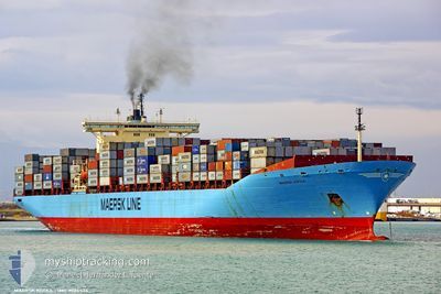
KOTKA
Container Ship
Current Trip
| Time Travelled | 12 h, 26 mins |
|---|---|
| Remaining Time | --- |
| Distance Travelled | 78.78 nm |
| Remaining Distance | --- |
| AVG Speed | 14.3 Knop |
| MAX Speed | 19 Knop |
| AVG Wind | 5.4 knots |
| MAX Wind | 9.8 knots |
| MIN Temp | 22.7°C / 72.86°F |
| MAX Temp | 25.7°C / 78.26°F |
| Djupgående | 13 m |
| Position mottagen | 7 h, 51 m sen |
Current Position
| Longitud | -79.87755° |
|---|---|
| Latitude | 31.55288° |
| Status | Under way using engine |
| Fart | 18.9 Knop |
| Kurs | 127.9° |
| Område | North Atlantic Ocean |
| Station | T-AIS |
| Position mottagen | 7 h, 51 m sen |
Info
Information
The current position of KOTKA is in North Atlantic Ocean with coordinates 31.55288° / -79.87755° as reported on 2024-05-17 16:31 by AIS to our vessel tracker app. The vessel's current speed is 18.9 Knop and is heading at the port of ABU DHABI. The estimated time of arrival as calculated by MyShipTracking vessel tracking app is 2024-06-13 02:00 LT
The vessel KOTKA (IMO: 9085534, MMSI: 636018933) is a Container Ship that was built in 1996 ( 28 År gammal ). It's sailing under the flag of [LR] Liberia.
In this page you can find informations about the vessels current position, last detected port calls, and current voyage information. If the vessels is not in coverage by AIS you will find the latest position.
The current position of KOTKA is detected by our AIS receivers and we are not responsible for the reliability of the data. The last position was recorded while the vessel was in Coverage by the Ais receivers of our vessel tracking app.
The current draught of KOTKA as reported by AIS is 13 meters
Weather
| Temperature | 25.5°C / 77.9°F |
|---|---|
| Wind Speed | 5 knots |
| Direction | 136° SE |
| Pressure | 1013.1 hPa |
| Humidity | 72.5 % |
| Cloud Coverage | 100 % |
Featured Company
Last Port Calls
| Port | Arrival | Departure | Time In Port |
|---|---|---|---|
| 2024-05-16 09:40 | 2024-05-17 07:56 | 22 h | |
| 2024-05-14 07:45 | 2024-05-15 10:42 | 1 d | |
| 2024-05-11 15:54 | 2024-05-12 13:58 | 22 h | |
| 2024-05-07 05:34 | 2024-05-07 20:12 | 14 h | |
| 2024-05-02 14:52 | 2024-05-03 21:52 | 1 d | |
| 2024-04-23 14:53 | 2024-04-24 10:23 | 19 h | |
| 2024-03-30 06:03 | 2024-03-31 04:43 | 22 h | |
| 2024-03-13 20:53 | 2024-03-16 01:26 | 2 d |
Last Trips
| Origin | Departure | Destination | Arrival | Distance | |
|---|---|---|---|---|---|
| 2024-05-15 10:42 | 2024-05-16 09:40 | 386.63 nm | |||
| 2024-05-12 13:58 | 2024-05-14 07:45 | 419.33 nm | |||
| 2024-05-07 20:12 | 2024-05-11 15:54 | 291.88 nm | |||
| 2024-05-03 21:52 | 2024-05-07 05:34 | 720.05 nm | |||
| 2024-04-24 10:23 | 2024-05-02 14:52 | 2995.81 nm | |||
| 2024-03-31 04:43 | 2024-04-23 14:53 | 8904.66 nm | |||
| 2024-03-16 01:26 | 2024-03-30 06:03 | 2331.99 nm |
Events
| Tid | Event | Detaljer | Position / Dest | Information |
|---|---|---|---|---|
| 2024-05-17 16:38 | Status ändrad | Default Under way using engine |
31.52698 / -79.83858
AEAUH
|
Fart: 18.9 kn Kurs: 127.9° |
| 2024-05-17 16:31 | UTANFÖR täckningsområde |
31.55288 / -79.87755
North Atlantic Ocean
AEAUH
|
Fart: 18.9 kn Kurs: 127.9° |
|
| 2024-05-17 16:25 | Status ändrad | Under way using engine Default |
31.57000 / -79.90242
AEAUH
|
Fart: 18.8 kn Kurs: 128° |
| 2024-05-17 16:19 | Status ändrad | Default Under way using engine |
31.59158 / -79.93468
AEAUH
|
Fart: 18.9 kn Kurs: 127.3° |
| 2024-05-17 15:07 | Status ändrad | Under way using engine Default |
31.80144 / -80.29233
AEAUH
|
Fart: 18.2 kn Kurs: 124° |
| 2024-05-17 15:03 | Status ändrad | Default Under way using engine |
31.81457 / -80.31471
AEAUH
|
Fart: 17.7 kn Kurs: 125.2° |
| 2024-05-17 11:56 | AVGÅTT HAMN |
|
32.08026 / -81.05158
AEAUH
|
Fart: 6 kn Kurs: 88° |
| 2024-05-17 11:03 | STARTAR förflyttning |
32.12559 / -81.13566
[US] SAVANNAH
|
Fart: 3.1 kn Kurs: 148° |
|
| 2024-05-17 10:38 | Status ändrad | Under way using engine Moored |
32.12637 / -81.13666
[US] SAVANNAH
|
Fart: Kurs: 157° |
| 2024-05-17 10:06 | ETA ändrat | 2024/06/12 22:00 2024/05/16 12:00 |
32.12636 / -81.13665
[US] SAVANNAH
|
Fart: 0.1 kn Kurs: 157° |