
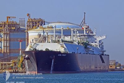
KOOL FROST
Tanker A
Current Trip
FOR ORDERS
| Time Travelled | 6 days |
|---|---|
| Remaining Time | --- |
| Distance Travelled | 1605.99 nm |
| Remaining Distance | --- |
| AVG Speed | 13.5 Knop |
| MAX Speed | 16.5 Knop |
| AVG Wind | 6.8 knots |
| MAX Wind | 13 knots |
| MIN Temp | 25.8°C / 78.44°F |
| MAX Temp | 28.7°C / 83.66°F |
| Djupgående | 11.4 m |
| Position mottagen | 6 d sen |
Current Position
| Longitud | --- |
|---|---|
| Latitude | --- |
| Status | Under way using engine |
| Fart | 13.3 Knop |
| Kurs | 310.9° |
| Område | South China Sea |
| Station | T-AIS |
| Position mottagen | 6 d sen |
Info
Information
The current position of KOOL FROST is in South China Sea with coordinates 3.38665° / 112.89263° as reported on 2025-02-11 04:50 by AIS to our vessel tracker app. The vessel's current speed is 13.3 Knop
The vessel KOOL FROST (IMO: 9655042, MMSI: 538004975) is a Tanker A It's sailing under the flag of [MH] Marshall Is.
In this page you can find informations about the vessels current position, last detected port calls, and current voyage information. If the vessels is not in coverage by AIS you will find the latest position.
The current position of KOOL FROST is detected by our AIS receivers and we are not responsible for the reliability of the data. The last position was recorded while the vessel was in Coverage by the Ais receivers of our vessel tracking app.
The current draught of KOOL FROST as reported by AIS is 11.4 meters
Weather
| Temperature | 27.7°C / 81.86°F |
|---|---|
| Wind Speed | 12 knots |
| Direction | 64° ENE |
| Pressure | 1012.2 hPa |
| Humidity | 79.2 % |
| Cloud Coverage | 10 % |
Featured Company
Most Visited Ports (Last year)
| Port | Arrivals | |
|---|---|---|
| 2 | ||
| 2 | ||
| 1 | ||
| 1 | ||
| 1 | ||
| 1 |
Last Trips
| Origin | Departure | Destination | Arrival | Distance | |
|---|---|---|---|---|---|
| 2025-01-22 14:04 | 2025-02-10 07:52 | 5290.81 nm | |||
| 2024-11-25 08:09 | 2025-01-21 11:38 | 11897.60 nm |
Events
| Tid | Event | Detaljer | Position / Dest | Information |
|---|---|---|---|---|
| 2025-02-11 04:55 | Status ändrad | Default Under way using engine |
3.39932 / 112.87789
FOR ORDERS
|
Fart: 13.3 kn Kurs: 310.9° |
| 2025-02-11 04:50 | UTANFÖR täckningsområde |
3.38665 / 112.89263
South China Sea
FOR ORDERS
|
Fart: 13.3 kn Kurs: 310.9° |
|
| 2025-02-11 03:33 | AVGÅTT HAMN |
|
3.25957 / 113.04770
FOR ORDERS
|
Fart: 6.9 kn Kurs: 280° |
| 2025-02-11 03:23 | STARTAR förflyttning |
3.26288 / 113.06063
[MY] BINTULU
|
Fart: 3.1 kn Kurs: 230° |
|
| 2025-02-11 03:16 | Status ändrad | Under way using engine Moored |
3.26477 / 113.06315
[MY] BINTULU
|
Fart: 0.2 kn Kurs: 225° |
| 2025-02-11 02:53 | ETA ändrat | 2025/02/24 02:30 2025/02/24 23:00 |
3.26464 / 113.06343
[MY] BINTULU
|
Fart: Kurs: 229° |
| 2025-02-11 02:39 | Djupgående ändrat | 11.4 9.5 |
3.26469 / 113.06343
[MY] BINTULU
|
Fart: Kurs: 229° |
| 2025-02-11 02:39 | ETA ändrat | 2025/02/24 23:00 2025/02/09 23:00 |
3.26469 / 113.06343
[MY] BINTULU
|
Fart: Kurs: 229° |
| 2025-02-11 02:18 | Status ändrad | Moored Default |
3.26465 / 113.06340
[MY] BINTULU
|
Fart: Kurs: 229° |
| 2025-02-11 02:16 | Status ändrad | Default Moored |
3.26459 / 113.06347
[MY] BINTULU
|
Fart: Kurs: 229° |