
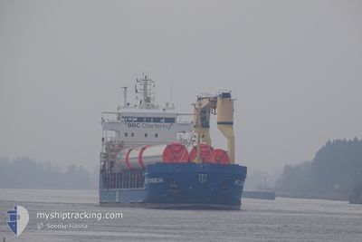
KIMBERLY
General Cargo
Current Trip
| Time Travelled | 3 days |
|---|---|
| Remaining Time | 5 days |
| Distance Travelled | 799.43 nm |
| Remaining Distance | 1040.88 nm |
| AVG Speed | 9 Knop |
| MAX Speed | 11.6 Knop |
| AVG Wind | 15.6 knots |
| MAX Wind | 32 knots |
| MIN Temp | 2.1°C / 35.78°F |
| MAX Temp | 11°C / 51.8°F |
| Djupgående | 6.1 m |
| Position mottagen | 1 m sen |
Current Position
| Longitud | 5.27482° |
|---|---|
| Latitude | 57.76251° |
| Status | Under way using engine |
| Fart | 7.2 Knop |
| Kurs | 100.6° |
| Område | North Sea |
| Station | T-AIS |
| Position mottagen | 1 m sen |
Info
Information
The current position of KIMBERLY is in North Sea with coordinates 57.76251° / 5.27482° as reported on 2024-05-01 15:45 by AIS to our vessel tracker app. The vessel's current speed is 7.2 Knop and is heading at the port of ST PETERSBURG. The estimated time of arrival as calculated by MyShipTracking vessel tracking app is 2024-05-07 13:17 LT
The vessel KIMBERLY (IMO: 9378242, MMSI: 305238000) is a General Cargo that was built in 2008 ( 16 År gammal ). It's sailing under the flag of [AG] Antigua Barbuda.
In this page you can find informations about the vessels current position, last detected port calls, and current voyage information. If the vessels is not in coverage by AIS you will find the latest position.
The current position of KIMBERLY is detected by our AIS receivers and we are not responsible for the reliability of the data. The last position was recorded while the vessel was in Coverage by the Ais receivers of our vessel tracking app.
The current draught of KIMBERLY as reported by AIS is 6.1 meters
Weather
| Temperature | 10.9°C / 51.62°F |
|---|---|
| Wind Speed | 31 knots |
| Direction | 95° E |
| Pressure | 1016.5 hPa |
| Humidity | 65.8 % |
| Cloud Coverage | 80 % |
Featured Company
Last Port Calls
| Port | Arrival | Departure | Time In Port |
|---|---|---|---|
| 2024-04-27 04:57 | 2024-04-28 03:09 | 22 h | |
| 2024-04-23 09:54 | 2024-04-23 11:05 | 1 h | |
| 2024-04-19 22:08 | 2024-04-23 08:37 | 3 d | |
| 2024-04-12 15:42 | 2024-04-14 17:10 | 2 d | |
| 2024-04-04 23:31 | 2024-04-09 15:00 | 4 d | |
| 2024-04-03 08:53 | 2024-04-04 08:52 | 23 h | |
| 2024-03-29 04:56 | 2024-03-31 08:07 | 2 d | |
| 2024-03-25 05:57 | 2024-03-27 00:27 | 1 d | |
| 2024-03-19 09:33 | 2024-03-21 07:40 | 1 d | |
| 2024-03-12 11:20 | 2024-03-15 11:14 | 2 d |
Last Trips
| Origin | Departure | Destination | Arrival | Distance | |
|---|---|---|---|---|---|
| 2024-04-23 13:05 | 2024-04-27 05:57 | 734.10 nm | |||
| 2024-04-23 10:37 | 2024-04-23 11:54 | 9.57 nm | |||
| 2024-04-14 20:10 | 2024-04-20 00:08 | 1165.27 nm | |||
| 2024-04-09 17:00 | 2024-04-12 18:42 | 769.12 nm | |||
| 2024-04-04 10:52 | 2024-04-05 01:31 | 158.34 nm | |||
| 2024-03-31 11:07 | 2024-04-03 10:53 | 689.92 nm | |||
| 2024-03-27 01:27 | 2024-03-29 07:56 | 577.72 nm | |||
| 2024-03-21 10:40 | 2024-03-25 06:57 | 556.54 nm | |||
| 2024-03-15 12:14 | 2024-03-19 12:33 | 731.61 nm | |||
| 2024-03-09 12:50 | 2024-03-12 12:20 | 775.80 nm |
Events
| Tid | Event | Detaljer | Position / Dest | Information |
|---|---|---|---|---|
| 2024-05-01 10:53 | ETA ändrat | 2025/04/05 18:00 2024/04/05 11:00 |
57.92449 / 4.13237
RULED
|
Fart: 8.1 kn Kurs: 103.2° |
| 2024-05-01 10:38 | Byter havsområde | Norwegian part of the North Sea United Kingdom part of the North Sea |
57.93236 / 4.06896
North Sea
|
Fart: 8.5 kn Kurs: 101.9° |
| 2024-05-01 10:38 | I täckningsområde |
57.93236 / 4.06896
North Sea
|
Fart: 8.5 kn Kurs: 101.9° |
|
| 2024-05-01 10:29 | Status ändrad | Under way using engine Default |
57.93666 / 4.02905
RULED
|
Fart: 8 kn Kurs: 101° |
| 2024-04-30 09:10 | Status ändrad | Default Under way using engine |
58.69358 / -2.72153
RULED
|
Fart: 9.1 kn Kurs: 94.2° |
| 2024-04-30 09:03 | UTANFÖR täckningsområde |
58.69651 / -2.75790
North Sea
|
Fart: 9.1 kn Kurs: 94.2° |
|
| 2024-04-30 07:23 | Status ändrad | Under way using engine Default |
58.71176 / -3.14846
RULED
|
Fart: 8.3 kn Kurs: 87° |
| 2024-04-30 07:14 | Status ändrad | Default Under way using engine |
58.70993 / -3.18352
RULED
|
Fart: 7.9 kn Kurs: 73.4° |
| 2024-04-30 06:33 | Status ändrad | Under way using engine Default |
58.70594 / -3.36591
RULED
|
Fart: 8.6 kn Kurs: 90° |
| 2024-04-30 06:30 | Status ändrad | Default Under way using engine |
58.70576 / -3.37599
RULED
|
Fart: 9.1 kn Kurs: 81.7° |