
KIMBERLY
General Cargo
Current Trip
| Time Travelled | 3 days |
|---|---|
| Remaining Time | --- |
| Distance Travelled | 795.56 nm |
| Remaining Distance | --- |
| AVG Speed | 8.8 Knots |
| MAX Speed | 17 Knots |
| AVG Wind | 12.9 knots |
| MAX Wind | 22.1 knots |
| MIN Temp | 5.9°C / 42.62°F |
| MAX Temp | 16.5°C / 61.7°F |
| Dybgang | 5.7 m |
| Position Modtaget | 1 h, 21 m siden |
Current Position
| Longitude | 9.37482° |
|---|---|
| Latitude | 54.15380° |
| Status | Under way using engine |
| Fart | 6.6 Knots |
| Kurs | 239.5° |
| Område | Baltic Sea |
| Station | T-AIS |
| Position Modtaget | 1 h, 21 m siden |
Info
Information
The current position of KIMBERLY is in Baltic Sea with coordinates 54.15380° / 9.37482° as reported on 2024-05-16 07:13 by AIS to our vessel tracker app. The vessel's current speed is 6.6 Knots and is heading at the port of CASTELLON. The estimated time of arrival as calculated by MyShipTracking vessel tracking app is 2024-05-25 06:00 LT
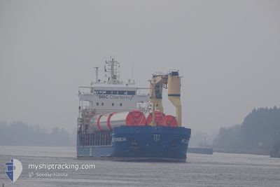
The vessel KIMBERLY (IMO: 9378242, MMSI: 305238000) is a General Cargo that was built in 2008 ( 16 år gamle ). It's sailing under the flag of [AG] Antigua Barbuda.
In this page you can find informations about the vessels current position, last detected port calls, and current voyage information. If the vessels is not in coverage by AIS you will find the latest position.
The current position of KIMBERLY is detected by our AIS receivers and we are not responsible for the reliability of the data. The last position was recorded while the vessel was in Coverage by the Ais receivers of our vessel tracking app.
The current draught of KIMBERLY as reported by AIS is 5.7 meters
Weather
| Temperature | 16.4°C / 61.52°F |
|---|---|
| Wind Speed | 12 knots |
| Direction | 96° E |
| Pressure | 1010.4 hPa |
| Humidity | 72 % |
| Cloud Coverage | 5 % |
Featured Company
Last Port Calls
| Port | Arrival | Departure | Time In Port |
|---|---|---|---|
| 2024-05-07 05:52 | 2024-05-12 23:40 | 5 d | |
| 2024-04-27 05:57 | 2024-04-28 04:09 | 22 h | |
| 2024-04-23 11:54 | 2024-04-23 13:05 | 1 h | |
| 2024-04-20 00:08 | 2024-04-23 10:37 | 3 d | |
| 2024-04-12 18:42 | 2024-04-14 20:10 | 2 d | |
| 2024-04-05 01:31 | 2024-04-09 17:00 | 4 d | |
| 2024-04-03 10:53 | 2024-04-04 10:52 | 23 h | |
| 2024-03-29 07:56 | 2024-03-31 11:07 | 2 d | |
| 2024-03-25 06:57 | 2024-03-27 01:27 | 1 d | |
| 2024-03-19 12:33 | 2024-03-21 10:40 | 1 d |
Last Trips
| Origin | Departure | Destination | Arrival | Distance | |
|---|---|---|---|---|---|
| 2024-04-28 04:09 | 2024-05-07 05:52 | 1831.17 nm | |||
| 2024-04-23 13:05 | 2024-04-27 05:57 | 734.10 nm | |||
| 2024-04-23 10:37 | 2024-04-23 11:54 | 9.57 nm | |||
| 2024-04-14 20:10 | 2024-04-20 00:08 | 1165.27 nm | |||
| 2024-04-09 17:00 | 2024-04-12 18:42 | 769.12 nm | |||
| 2024-04-04 10:52 | 2024-04-05 01:31 | 158.34 nm | |||
| 2024-03-31 11:07 | 2024-04-03 10:53 | 689.92 nm | |||
| 2024-03-27 01:27 | 2024-03-29 07:56 | 577.72 nm | |||
| 2024-03-21 10:40 | 2024-03-25 06:57 | 556.54 nm | |||
| 2024-03-15 12:14 | 2024-03-19 12:33 | 731.61 nm |
Events
| Tid | Hændelsen | Detaljer | Position / Dest | Info |
|---|---|---|---|---|
| 2024-05-16 07:19 | Status er ændret | Default Under way using engine |
54.14834 / 9.35922
ESCAS
|
Fart: 6.6 kn Kurs: 239.5° |
| 2024-05-16 07:13 | Udenfor Dækning |
54.15380 / 9.37482
Baltic Sea
ESCAS
|
Fart: 6.6 kn Kurs: 239.5° |
|
| 2024-05-16 02:13 | Dybgangen er ændret | 5.7 5 |
54.37104 / 10.10763
ESCAS
|
Fart: 1.6 kn Kurs: 288° |
| 2024-05-16 02:13 | ETA er ændret | 2024/05/25 04:00 |
54.37104 / 10.10763
ESCAS
|
Fart: 1.6 kn Kurs: 288° |
| 2024-05-16 02:01 | Dybgangen er ændret | 5 5.7 |
54.36907 / 10.12031
ESCAS
|
Fart: 4.8 kn Kurs: 283° |
| 2024-05-16 01:54 | START Sejllads | 1.4 nm, South West of STICKENHΟRN SPORT |
54.36646 / 10.13950
ESCAS
|
Fart: 3.7 kn Kurs: 287° |
| 2024-05-16 01:21 | STOP Sejllads | 1.35 nm, South West of STICKENHΟRN SPORT |
54.36590 / 10.14270
ESCAS
|
Fart: 0.3 kn Kurs: 284° |
| 2024-05-15 22:58 | Ændre havområde | German part of the Baltic Sea Danish part of the Baltic Sea |
54.56442 / 10.55734
Baltic Sea
ESCAS
|
Fart: 9.5 kn Kurs: 246.5° |
| 2024-05-15 22:02 | Fundet i havområde | Danish part of the Baltic Sea |
54.58534 / 10.80410
Baltic Sea
ESCAS
|
Fart: 9.4 kn Kurs: 264.9° |
| 2024-05-15 20:02 | Fundet i havområde | German part of the Baltic Sea |
54.56562 / 11.32440
Baltic Sea
ESCAS
|
Fart: 10.5 kn Kurs: 295.8° |