
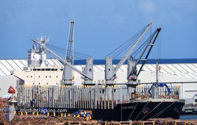
KEN HARU
Cargo
Current Trip
| Time Travelled | 2 days |
|---|---|
| Remaining Time | 2 days |
| Distance Travelled | 708.88 nm |
| Remaining Distance | 673.62 nm |
| AVG Speed | 10.9 Knop |
| MAX Speed | 13.3 Knop |
| AVG Wind | 17.1 knots |
| MAX Wind | 26 knots |
| MIN Temp | 13.8°C / 56.84°F |
| MAX Temp | 21.9°C / 71.42°F |
| Djupgående | 8.5 m |
| Position mottagen | 19 h, 7 m sen |
Current Position
| Longitud | 120.65317° |
|---|---|
| Latitude | -35.53085° |
| Status | Under way using engine |
| Fart | 11.2 Knop |
| Kurs | 89.7° |
| Område | Great Australian Bight |
| Station | T-AIS |
| Position mottagen | 19 h, 7 m sen |
Info
Information
The current position of KEN HARU is in Great Australian Bight with coordinates -35.53085° / 120.65317° as reported on 2024-09-16 06:44 by AIS to our vessel tracker app. The vessel's current speed is 11.2 Knop and is heading at the port of ADELAIDE. The estimated time of arrival as calculated by MyShipTracking vessel tracking app is 2024-09-19 19:28 LT
The vessel KEN HARU (IMO: 9894741, MMSI: 373807000) is a Cargo It's sailing under the flag of [PA] Panama.
In this page you can find informations about the vessels current position, last detected port calls, and current voyage information. If the vessels is not in coverage by AIS you will find the latest position.
The current position of KEN HARU is detected by our AIS receivers and we are not responsible for the reliability of the data. The last position was recorded while the vessel was in Coverage by the Ais receivers of our vessel tracking app.
The current draught of KEN HARU as reported by AIS is 8.5 meters
Weather
| Temperature | 14.9°C / 58.82°F |
|---|---|
| Wind Speed | 18 knots |
| Direction | 339° NNW |
| Pressure | 1025.3 hPa |
| Humidity | 81.6 % |
| Cloud Coverage | --- |
Featured Company
Last Port Calls
| Port | Arrival | Departure | Time In Port |
|---|---|---|---|
| 2024-09-11 07:59 | 2024-09-14 17:25 | 3 d | |
| 2024-08-17 06:14 | 2024-08-22 17:33 | 5 d | |
| 2024-08-13 08:36 | 2024-08-14 18:13 | 1 d | |
| 2024-08-12 16:10 | 2024-08-12 22:08 | 5 h |
Most Visited Ports (Last year)
| Port | Arrivals | |
|---|---|---|
| 6 | ||
| 2 | ||
| 2 | ||
| 1 | ||
| 1 | ||
| 1 |
Last Trips
| Origin | Departure | Destination | Arrival | Distance | |
|---|---|---|---|---|---|
| 2024-08-22 17:33 | 2024-09-11 07:59 | 3672.90 nm | |||
| 2024-08-14 18:13 | 2024-08-17 06:14 | 101.13 nm | |||
| 2024-08-12 22:08 | 2024-08-13 08:36 | 130.52 nm | |||
| 2024-06-10 20:47 | 2024-08-12 16:10 | 8855.58 nm |
Events
| Tid | Event | Detaljer | Position / Dest | Information |
|---|---|---|---|---|
| 2024-09-16 06:52 | Status ändrad | Default Under way using engine |
-35.53071 / 120.68256
AU ADL
|
Fart: 11.2 kn Kurs: 89.7° |
| 2024-09-16 06:44 | UTANFÖR täckningsområde |
-35.53085 / 120.65317
Great Australian Bight
AU ADL
|
Fart: 11.2 kn Kurs: 89.7° |
|
| 2024-09-16 06:43 | Status ändrad | Under way using engine Default |
-35.53087 / 120.64741
AU ADL
|
Fart: 11 kn Kurs: 90° |
| 2024-09-16 06:20 | Status ändrad | Default Under way using engine |
-35.53073 / 120.56151
AU ADL
|
Fart: 11.1 kn Kurs: 89.3° |
| 2024-09-16 06:18 | Status ändrad | Under way using engine Default |
-35.53064 / 120.55461
AU ADL
|
Fart: 11 kn Kurs: 89° |
| 2024-09-16 06:02 | Status ändrad | Default Under way using engine |
-35.53177 / 120.49387
AU ADL
|
Fart: 11 kn Kurs: 90.2° |
| 2024-09-16 05:54 | Status ändrad | Under way using engine Default |
-35.53224 / 120.46282
AU ADL
|
Fart: 11 kn Kurs: 89° |
| 2024-09-16 05:47 | Status ändrad | Default Under way using engine |
-35.53274 / 120.43748
AU ADL
|
Fart: 10.9 kn Kurs: 91.1° |
| 2024-09-16 05:40 | Status ändrad | Under way using engine Default |
-35.53263 / 120.41215
AU ADL
|
Fart: 10.8 kn Kurs: 91° |
| 2024-09-16 05:31 | Status ändrad | Default Under way using engine |
-35.53200 / 120.37832
AU ADL
|
Fart: 10.7 kn Kurs: 89.5° |