
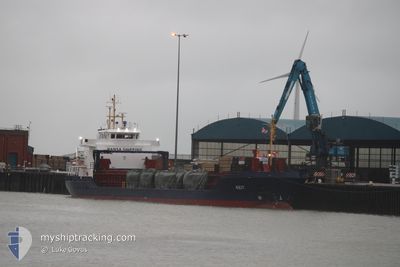
KEIT
General Cargo
Current Trip
| Time Travelled | 1 day |
|---|---|
| Remaining Time | 12 h, 6 mins |
| Distance Travelled | 319.15 nm |
| Remaining Distance | 173.51 nm |
| AVG Speed | 11.9 Knop |
| MAX Speed | 12.6 Knop |
| AVG Wind | 6.3 knots |
| MAX Wind | 11.6 knots |
| MIN Temp | 5.9°C / 42.62°F |
| MAX Temp | 14.3°C / 57.74°F |
| Djupgående | 4 m |
| Position mottagen | 18 h, 53 m sen |
Current Position
| Longitud | 16.40498° |
|---|---|
| Latitude | 54.74020° |
| Status | Under way using engine |
| Fart | 11.9 Knop |
| Kurs | 60.8° |
| Område | Baltic Sea |
| Station | T-AIS |
| Position mottagen | 18 h, 53 m sen |
Info
Information
The current position of KEIT is in Baltic Sea with coordinates 54.74020° / 16.40498° as reported on 2024-04-27 02:17 by AIS to our vessel tracker app. The vessel's current speed is 11.9 Knop and is heading at the port of RIGA. The estimated time of arrival as calculated by MyShipTracking vessel tracking app is 2024-04-28 09:16 LT
The vessel KEIT (IMO: 9333450, MMSI: 248275000) is a General Cargo that was built in 2005 ( 19 År gammal ). It's sailing under the flag of [MT] Malta.
In this page you can find informations about the vessels current position, last detected port calls, and current voyage information. If the vessels is not in coverage by AIS you will find the latest position.
The current position of KEIT is detected by our AIS receivers and we are not responsible for the reliability of the data. The last position was recorded while the vessel was in Coverage by the Ais receivers of our vessel tracking app.
The current draught of KEIT as reported by AIS is 4 meters
Weather
| Temperature | 5.9°C / 42.62°F |
|---|---|
| Wind Speed | 4 knots |
| Direction | 194° SSW |
| Pressure | 1018.3 hPa |
| Humidity | 85.8 % |
| Cloud Coverage | 8 % |
Featured Company
Last Port Calls
| Port | Arrival | Departure | Time In Port |
|---|---|---|---|
| 2024-04-23 06:43 | 2024-04-26 15:39 | 3 d | |
| 2024-04-18 06:39 | 2024-04-20 08:48 | 2 d | |
| 2024-04-15 17:52 | 2024-04-16 17:34 | 23 h | |
| 2024-04-09 21:29 | 2024-04-11 13:41 | 1 d | |
| 2024-03-31 22:32 | 2024-04-05 01:25 | 4 d | |
| 2024-03-26 05:24 | 2024-03-26 21:57 | 16 h | |
| 2024-03-24 06:17 | 2024-03-25 13:33 | 1 d | |
| 2024-03-21 20:38 | 2024-03-23 11:48 | 1 d | |
| 2024-03-17 00:49 | 2024-03-19 09:50 | 2 d | |
| 2024-03-08 12:18 | 2024-03-11 16:21 | 3 d |
Most Visited Ports (Last year)
| Port | Arrivals | |
|---|---|---|
| 10 | ||
| 4 | ||
| 4 | ||
| 4 | ||
| 3 | ||
| 3 |
Last Trips
| Origin | Departure | Destination | Arrival | Distance | |
|---|---|---|---|---|---|
| 2024-04-20 11:48 | 2024-04-23 08:43 | 710.42 nm | |||
| 2024-04-16 19:34 | 2024-04-18 09:39 | 388.33 nm | |||
| 2024-04-11 14:41 | 2024-04-15 19:52 | 1003.67 nm | |||
| 2024-04-05 02:25 | 2024-04-09 22:29 | 35.05 nm | |||
| 2024-03-26 23:57 | 2024-03-31 23:32 | 989.75 nm | |||
| 2024-03-25 15:33 | 2024-03-26 07:24 | 112.14 nm | |||
| 2024-03-23 12:48 | 2024-03-24 08:17 | 207.43 nm | |||
| 2024-03-19 12:50 | 2024-03-21 21:38 | 577.74 nm | |||
| 2024-03-11 17:21 | 2024-03-17 03:49 | 1173.58 nm | |||
| 2024-03-07 16:42 | 2024-03-08 13:18 | 111.76 nm |
Events
| Tid | Event | Detaljer | Position / Dest | Information |
|---|---|---|---|---|
| 2024-04-27 02:20 | Status ändrad | Default Under way using engine |
54.74453 / 16.41831
LV RIX
|
Fart: 11.9 kn Kurs: 60.8° |
| 2024-04-27 02:17 | UTANFÖR täckningsområde |
54.74020 / 16.40498
Baltic Sea
LV RIX
|
Fart: 11.9 kn Kurs: 60.8° |
|
| 2024-04-26 20:59 | Status ändrad | Under way using engine Default |
54.21796 / 14.85205
LV RIX
|
Fart: 11.9 kn Kurs: 60° |
| 2024-04-26 20:48 | I täckningsområde |
54.22195 / 14.86422
Baltic Sea
LV RIX
|
Fart: 11.8 kn Kurs: 61° |
|
| 2024-04-26 16:45 | Status ändrad | Default Under way using engine |
53.65604 / 14.54310
LV RIX
|
Fart: 12.2 kn Kurs: 322.3° |
| 2024-04-26 16:44 | UTANFÖR täckningsområde |
53.65336 / 14.54660
Baltic Sea
LV RIX
|
Fart: 12.2 kn Kurs: 322.3° |
|
| 2024-04-26 15:39 | AVGÅTT HAMN |
|
53.46244 / 14.60024
LV RIX
|
Fart: 9 kn Kurs: 12° |
| 2024-04-26 15:25 | STARTAR förflyttning |
53.43168 / 14.58506
[PL] SZCZECIN
|
Fart: 4.1 kn Kurs: 13° |
|
| 2024-04-26 15:11 | Djupgående ändrat | 4 3.6 |
53.42995 / 14.58326
[PL] SZCZECIN
|
Fart: Kurs: 196° |
| 2024-04-26 14:59 | Status ändrad | Under way using engine Moored |
53.42990 / 14.58323
[PL] SZCZECIN
|
Fart: Kurs: 196° |