
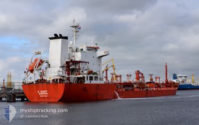
K INSET
Oil/Chemical Tanker
Current Trip
| Trip Time | 6 days |
|---|---|
| Trip Distance | 1248.63 nm |
| AVG Speed | 10.7 Knop |
| MAX Speed | 13.1 Knop |
| Djupgående | 8.3 m |
| AVG Wind | 10.4 knots |
| MAX Wind | 22.2 knots |
| MIN Temp | 8.8°C / 47.84°F |
| MAX Temp | 18.7°C / 65.66°F |
| Position mottagen | 3 d sen |
Current Position
| Longitud | 12.14917° |
|---|---|
| Latitude | 37.02247° |
| Status | Under way using engine |
| Fart | 11.6 Knop |
| Kurs | 288° |
| Område | Mediterranean Sea - Eastern Basin |
| Station | T-AIS |
| Position mottagen | 3 d sen |
Info
Information
The current position of K INSET is in Mediterranean Sea - Eastern Basin with coordinates 37.02247° / 12.14917° as reported on 2024-04-27 17:53 by AIS to our vessel tracker app. The vessel's current speed is 11.6 Knop and is currently inside the port of BEJAIA.
The vessel K INSET (IMO: 9311634, MMSI: 636022086) is a Oil/Chemical Tanker that was built in 2005 ( 19 År gammal ). It's sailing under the flag of [LR] Liberia.
In this page you can find informations about the vessels current position, last detected port calls, and current voyage information. If the vessels is not in coverage by AIS you will find the latest position.
The current position of K INSET is detected by our AIS receivers and we are not responsible for the reliability of the data. The last position was recorded while the vessel was in Coverage by the Ais receivers of our vessel tracking app.
The current draught of K INSET as reported by AIS is 8.3 meters
Weather
| Temperature | 14.8°C / 58.64°F |
|---|---|
| Wind Speed | 7 knots |
| Direction | 222° SW |
| Pressure | 1012.5 hPa |
| Humidity | 64.5 % |
| Cloud Coverage | 1 % |
Featured Company
Most Visited Ports (Last year)
| Port | Arrivals | |
|---|---|---|
| 6 | ||
| 3 | ||
| 3 | ||
| 2 | ||
| 2 | ||
| 2 |
Events
| Tid | Event | Detaljer | Position / Dest | Information |
|---|---|---|---|---|
| 2024-04-30 15:27 | STOPPAR förflyttning |
36.74538 / 5.08670
[DZ] BEJAIA
|
Fart: Kurs: 186° |
|
| 2024-04-30 15:05 | ANLÄNDER HAMN |
|
36.75272 / 5.09802
[DZ] BEJAIA
|
Fart: 4.5 kn Kurs: 278° |
| 2024-04-30 14:13 | STARTAR förflyttning | 3.26 nm, East of BEJAIA |
36.73330 / 5.15873
ITPMA>DZBJA
|
Fart: 3.1 kn Kurs: 269° |
| 2024-04-29 06:35 | STOPPAR förflyttning | 3.53 nm, East of BEJAIA |
36.73115 / 5.16368
ITPMA>DZBJA
|
Fart: 0.1 kn Kurs: 309° |
| 2024-04-27 17:59 | Status ändrad | Default Under way using engine |
37.02952 / 12.12790
ITPMA>DZBJA
|
Fart: 11.6 kn Kurs: 288° |
| 2024-04-27 17:53 | UTANFÖR täckningsområde |
37.02247 / 12.14917
Mediterranean Sea - Eastern Basin
ITPMA>DZBJA
|
Fart: 11.6 kn Kurs: 288° |
|
| 2024-04-27 17:51 | Status ändrad | Under way using engine Default |
37.02083 / 12.15558
ITPMA>DZBJA
|
Fart: 11.5 kn Kurs: 284° |
| 2024-04-27 17:10 | Status ändrad | Default Under way using engine |
36.98548 / 12.31403
ITPMA>DZBJA
|
Fart: 11.7 kn Kurs: 287° |
| 2024-04-27 17:06 | Status ändrad | Under way using engine Default |
36.98085 / 12.33290
ITPMA>DZBJA
|
Fart: 11.7 kn Kurs: 286° |
| 2024-04-27 16:23 | Status ändrad | Default Under way using engine |
36.93725 / 12.49928
ITPMA>DZBJA
|
Fart: 12 kn Kurs: 287° |