
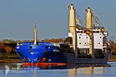
JUNO
General Cargo
Current Trip
| Time Travelled | 24 days |
|---|---|
| Remaining Time | --- |
| Distance Travelled | 3791.72 nm |
| Remaining Distance | --- |
| AVG Speed | 9.4 Knop |
| MAX Speed | 12 Knop |
| AVG Wind | 11.2 knots |
| MAX Wind | 20.8 knots |
| MIN Temp | 21.8°C / 71.24°F |
| MAX Temp | 31.2°C / 88.16°F |
| Djupgående | 6.1 m |
| Position mottagen | 1 m sen |
Current Position
| Longitud | -12.86409° |
|---|---|
| Latitude | 33.62097° |
| Status | Under way using engine |
| Fart | 10.2 Knop |
| Kurs | 63.6° |
| Område | North Atlantic Ocean |
| Station | T-AIS |
| Position mottagen | 1 m sen |
Info
Information
The current position of JUNO is in North Atlantic Ocean with coordinates 33.62097° / -12.86409° as reported on 2024-08-01 18:59 by AIS to our vessel tracker app. The vessel's current speed is 10.2 Knop and is heading at the port of CEUTA. The estimated time of arrival as calculated by MyShipTracking vessel tracking app is 2024-08-03 12:00 LT
The vessel JUNO (IMO: 9421154, MMSI: 304693000) is a General Cargo that was built in 2009 ( 15 År gammal ). It's sailing under the flag of [AG] Antigua Barbuda.
In this page you can find informations about the vessels current position, last detected port calls, and current voyage information. If the vessels is not in coverage by AIS you will find the latest position.
The current position of JUNO is detected by our AIS receivers and we are not responsible for the reliability of the data. The last position was recorded while the vessel was in Coverage by the Ais receivers of our vessel tracking app.
The current draught of JUNO as reported by AIS is 6.1 meters
Weather
| Temperature | 21.9°C / 71.42°F |
|---|---|
| Wind Speed | 16 knots |
| Direction | 12° NNE |
| Pressure | 1018.2 hPa |
| Humidity | 80.7 % |
| Cloud Coverage | 23 % |
Featured Company
Events
| Tid | Event | Detaljer | Position / Dest | Information |
|---|---|---|---|---|
| 2024-08-01 17:37 | Status ändrad | Under way using engine Default |
33.52990 / -13.11972
ESCEU
|
Fart: 10.2 kn Kurs: 66° |
| 2024-08-01 17:27 | Status ändrad | Default Under way using engine |
33.51734 / -13.15292
ESCEU
|
Fart: 10.3 kn Kurs: 66.8° |
| 2024-08-01 17:12 | Djupgående ändrat | 6.1 7.4 |
33.50061 / -13.19890
ESCEU
|
Fart: 10 kn Kurs: 74.9° |
| 2024-08-01 17:12 | Destination ändrad | ESCEU VE PSU |
33.50061 / -13.19890
ESCEU
|
Fart: 10 kn Kurs: 74.9° |
| 2024-08-01 17:12 | ETA ändrat | 2024/08/03 12:00 2024/07/03 10:00 |
33.50061 / -13.19890
ESCEU
|
Fart: 10 kn Kurs: 74.9° |
| 2024-08-01 16:52 | Status ändrad | Under way using engine Default |
33.48120 / -13.25818
VE PSU
|
Fart: 9.7 kn Kurs: 69° |
| 2024-08-01 16:51 | Status ändrad | Default Under way using engine |
33.47940 / -13.26377
VE PSU
|
Fart: 9.9 kn Kurs: 77° |
| 2024-08-01 16:46 | Status ändrad | Under way using engine Default |
33.47483 / -13.27810
VE PSU
|
Fart: 10.1 kn Kurs: 67° |
| 2024-08-01 15:52 | Status ändrad | Default Under way using engine |
33.41749 / -13.44742
VE PSU
|
Fart: 10.3 kn Kurs: 67.1° |
| 2024-08-01 15:51 | Status ändrad | Under way using engine Default |
33.41636 / -13.45055
VE PSU
|
Fart: 10 kn Kurs: 70° |