
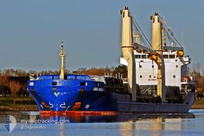
JUNO
General Cargo
Current Trip
| Time Travelled | 5 days |
|---|---|
| Remaining Time | 3 days |
| Distance Travelled | 1357.96 nm |
| Remaining Distance | 803.58 nm |
| AVG Speed | 10.3 Knopen |
| MAX Speed | 11.6 Knopen |
| AVG Wind | 16 knots |
| MAX Wind | 25 knots |
| MIN Temp | 13.9°C / 57.02°F |
| MAX Temp | 28.3°C / 82.94°F |
| Diepgang | 7.3 M |
| Positie ontvangen | 2 d geleden |
Current Position
| Lengtegraad | -17.96623° |
|---|---|
| Breedtegraat | 14.46337° |
| Status | Under way using engine |
| Snelheid | 10.8 Knopen |
| Koers | 175.4° |
| Gebied | North Atlantic Ocean |
| Station | T-AIS |
| Positie ontvangen | 2 d geleden |
Info
Information
The current position of JUNO is in North Atlantic Ocean with coordinates 14.46337° / -17.96623° as reported on 2024-05-02 09:15 by AIS to our vessel tracker app. The vessel's current speed is 10.8 Knopen and is heading at the port of TAKORADI. The estimated time of arrival as calculated by MyShipTracking vessel tracking app is 2024-05-07 17:09 LT
The vessel JUNO (IMO: 9421154, MMSI: 304693000) is a General Cargo that was built in 2009 ( 15 Jaar oud ). It's sailing under the flag of [AG] Antigua Barbuda.
In this page you can find informations about the vessels current position, last detected port calls, and current voyage information. If the vessels is not in coverage by AIS you will find the latest position.
The current position of JUNO is detected by our AIS receivers and we are not responsible for the reliability of the data. The last position was recorded while the vessel was in Coverage by the Ais receivers of our vessel tracking app.
The current draught of JUNO as reported by AIS is 7.3 meters
Weather
| Temperature | 28.2°C / 82.76°F |
|---|---|
| Wind Speed | 1 knots |
| Direction | 308° NW |
| Pressure | 1012.3 hPa |
| Humidity | 77.9 % |
| Cloud Coverage | 16 % |
Featured Company
Last Port Calls
| Port | Arrival | Departure | Time In Port |
|---|---|---|---|
| 2024-04-28 19:09 | 2024-04-29 01:54 | 6 h | |
| 2024-04-21 07:07 | |||
| 2024-04-03 15:00 | 2024-04-03 21:03 | 6 h | |
| 2024-03-21 16:43 | 2024-03-26 04:55 | 4 d | |
| 2024-03-08 00:28 | 2024-03-08 07:52 | 7 h |
Most Visited Ports (Last year)
| Port | Arrivals | |
|---|---|---|
| 4 | ||
| 3 | ||
| 2 | ||
| 2 | ||
| 1 | ||
| 1 |
Last Trips
| Origin | Departure | Destination | Arrival | Distance | |
|---|---|---|---|---|---|
| 2024-04-21 08:07 | 2024-04-28 20:09 | 1796.99 nm | |||
| 2024-03-26 04:55 | 2024-04-03 16:00 | 2004.48 nm | |||
| 2024-03-08 07:52 | 2024-03-21 16:43 | 2511.90 nm | |||
| 2024-02-27 22:19 | 2024-03-08 00:28 | 703.71 nm |
Events
| Tijd | Evenement | Details | Positie / Bestemming | Info |
|---|---|---|---|---|
| 2024-05-02 09:34 | Status Changed | Default Under way using engine |
14.38437 / -17.95764
GH TKD
|
Snelheid: 10.8 kn Koers: 175.4° |
| 2024-05-02 09:15 | Status Changed | Under way using engine Default |
14.46337 / -17.96623
GH TKD
|
Snelheid: 11 kn Koers: 178° |
| 2024-05-02 09:15 | Buitenbereik |
14.46337 / -17.96623
North Atlantic Ocean
GH TKD
|
Snelheid: 10.8 kn Koers: 175.4° |
|
| 2024-05-02 08:58 | Binnenbereik |
14.46337 / -17.96623
North Atlantic Ocean
GH TKD
|
Snelheid: 10.8 kn Koers: 175.4° |
|
| 2024-05-02 07:31 | Status Changed | Default Under way using engine |
14.77036 / -17.98992
GH TKD
|
Snelheid: 11.2 kn Koers: 181.9° |
| 2024-05-02 07:11 | Buitenbereik |
14.85459 / -17.99156
North Atlantic Ocean
GH TKD
|
Snelheid: 11.2 kn Koers: 181.9° |
|
| 2024-05-02 05:41 | Status Changed | Under way using engine Default |
15.13144 / -17.98662
GH TKD
|
Snelheid: 10.9 kn Koers: 183° |
| 2024-05-02 05:34 | Status Changed | Default Under way using engine |
15.13051 / -17.98664
GH TKD
|
Snelheid: 10.6 kn Koers: 181.2° |
| 2024-05-02 03:37 | Status Changed | Under way using engine Default |
15.50408 / -17.97784
GH TKD
|
Snelheid: 10.7 kn Koers: 180° |
| 2024-05-02 02:56 | Status Changed | Default Under way using engine |
15.60429 / -17.97416
GH TKD
|
Snelheid: 10.6 kn Koers: 178.6° |