
JOSEF JAEGERS
Tanker
Current Trip
| Time Travelled | 1 day |
|---|---|
| Remaining Time | --- |
| Distance Travelled | 2.29 nm |
| Remaining Distance | --- |
| AVG Speed | 7.5 Knop |
| MAX Speed | 7.8 Knop |
| AVG Wind | 10.5 knots |
| MAX Wind | 10.7 knots |
| MIN Temp | 13.5°C / 56.3°F |
| MAX Temp | 13.8°C / 56.84°F |
| Djupgående | 1.5 m |
| Position mottagen | 1 d sen |
Current Position
| Longitud | --- |
|---|---|
| Latitude | --- |
| Status | Moored |
| Fart | 6.3 Knop |
| Kurs | 81.1° |
| Område | North Sea |
| Station | T-AIS |
| Position mottagen | 1 d sen |
Information
The current position of JOSEF JAEGERS is in North Sea with coordinates 51.84823° / 6.13075° as reported on 2025-03-25 14:48 by AIS to our vessel tracker app. The vessel's current speed is 6.3 Knop
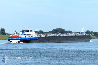
The vessel JOSEF JAEGERS (MMSI: 211500430) is a Tanker It's sailing under the flag of [DE] Germany.
In this page you can find informations about the vessels current position, last detected port calls, and current voyage information. If the vessels is not in coverage by AIS you will find the latest position.
The current position of JOSEF JAEGERS is detected by our AIS receivers and we are not responsible for the reliability of the data. The last position was recorded while the vessel was in Coverage by the Ais receivers of our vessel tracking app.
The current draught of JOSEF JAEGERS as reported by AIS is 1.5 meters
Weather
| Temperature | 13.9°C / 57.02°F |
|---|---|
| Wind Speed | 10 knots |
| Direction | 276° W |
| Pressure | 1019.1 hPa |
| Humidity | 56.6 % |
| Cloud Coverage | 87 % |
Featured Company
Last Port Calls
| Port | Arrival | Departure | Time In Port |
|---|---|---|---|
| 2025-03-17 07:10 | 2025-03-25 14:29 | 8 d | |
| 2025-03-16 17:31 | 2025-03-17 06:54 | 13 h | |
| 2025-03-16 16:56 | 2025-03-16 17:18 | 21 m | |
| 2025-03-13 13:25 | 2025-03-14 22:46 | 1 d | |
| 2025-03-09 15:47 | 2025-03-09 16:09 | 21 m | |
| 2025-03-08 17:35 | 2025-03-09 04:00 | 10 h | |
| 2025-03-07 11:06 | 2025-03-08 16:59 | 1 d | |
| 2025-03-02 21:06 | 2025-03-02 21:51 | 45 m | |
| 2025-02-28 20:02 | 2025-03-02 07:22 | 1 d | |
| 2025-02-28 09:09 | 2025-02-28 11:56 | 2 h |
Most Visited Ports (Last year)
| Port | Arrivals | |
|---|---|---|
| 42 | ||
| 39 | ||
| 28 | ||
| 20 | ||
| 11 | ||
| 5 |
Last Trips
| Origin | Departure | Destination | Arrival | Distance | |
|---|---|---|---|---|---|
| 2025-03-17 07:54 | 2025-03-17 08:10 | 1.54 nm | |||
| 2025-03-16 18:18 | 2025-03-16 18:31 | 0.88 nm | |||
| 2025-03-14 23:46 | 2025-03-16 17:56 | 72.54 nm | |||
| 2025-03-09 17:09 | 2025-03-13 14:25 | 473.55 nm | |||
| 2025-03-09 05:00 | 2025-03-09 16:47 | 76.05 nm | |||
| 2025-03-08 17:59 | 2025-03-08 18:35 | 3.45 nm | |||
| 2025-03-02 22:51 | 2025-03-07 12:06 | 455.31 nm | |||
| 2025-03-02 08:22 | 2025-03-02 22:06 | 89.01 nm | |||
| 2025-02-28 12:56 | 2025-02-28 21:02 | 59.47 nm | |||
| 2025-02-23 23:35 | 2025-02-28 10:09 | 493.85 nm |
Events
| Tid | Event | Detaljer | Position / Dest | Information |
|---|---|---|---|---|
| 2025-03-25 14:48 | UTANFÖR täckningsområde |
51.84823 / 6.13075
North Sea
|
Fart: 6.3 kn Kurs: 81.1° |
|
| 2025-03-25 14:29 | AVGÅTT HAMN |
|
51.85953 / 6.07529
ROTTERDAM
|
Fart: 5.6 kn Kurs: 122.3° |
| 2025-03-25 14:23 | I täckningsområde |
51.86605 / 6.06112
North Sea
[NL] MILLINGEN AAN DE RIJN
|
Fart: 5.6 kn Kurs: 122.3° |
|
| 2025-03-25 09:32 | UTANFÖR täckningsområde |
51.86907 / 6.04727
North Sea
[NL] MILLINGEN AAN DE RIJN
|
Fart: Kurs: 511° |
|
| 2025-03-25 08:56 | I täckningsområde |
51.86905 / 6.04726
North Sea
[NL] MILLINGEN AAN DE RIJN
|
Fart: Kurs: 511° |
|
| 2025-03-25 04:26 | UTANFÖR täckningsområde |
51.86906 / 6.04727
North Sea
[NL] MILLINGEN AAN DE RIJN
|
Fart: Kurs: 511° |
|
| 2025-03-25 04:05 | I täckningsområde |
51.86904 / 6.04727
North Sea
[NL] MILLINGEN AAN DE RIJN
|
Fart: Kurs: 511° |
|
| 2025-03-25 02:44 | UTANFÖR täckningsområde |
51.86905 / 6.04728
North Sea
[NL] MILLINGEN AAN DE RIJN
|
Fart: Kurs: 511° |
|
| 2025-03-25 02:44 | I täckningsområde |
51.86905 / 6.04728
North Sea
[NL] MILLINGEN AAN DE RIJN
|
Fart: Kurs: 511° |
|
| 2025-03-24 22:56 | UTANFÖR täckningsområde |
51.86904 / 6.04728
North Sea
[NL] MILLINGEN AAN DE RIJN
|
Fart: 0.2 kn Kurs: 511° |