
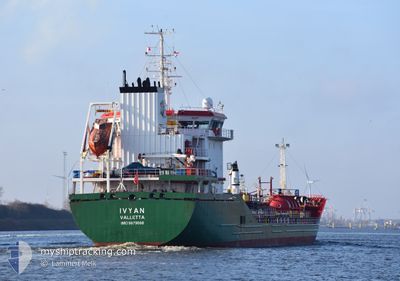
IVYAN
Tanker B
Current Trip
| Time Travelled | 21 h, 57 mins |
|---|---|
| Remaining Time | 3 h, 16 mins |
| Distance Travelled | 242.68 nm |
| Remaining Distance | 33.30 nm |
| AVG Speed | 10.7 Knop |
| MAX Speed | 12.2 Knop |
| AVG Wind | 10.2 knots |
| MAX Wind | 21.8 knots |
| MIN Temp | 12.1°C / 53.78°F |
| MAX Temp | 13.2°C / 55.76°F |
| Djupgående | 5.8 m |
| Position mottagen | 1 m sen |
Current Position
| Longitud | -8.15793° |
|---|---|
| Latitude | 43.83944° |
| Status | Under way using engine |
| Fart | 9.9 Knop |
| Kurs | 211.3° |
| Område | Bay of Biscay |
| Station | T-AIS |
| Position mottagen | 1 m sen |
Info
Information
The current position of IVYAN is in Bay of Biscay with coordinates 43.83944° / -8.15793° as reported on 2024-04-30 17:28 by AIS to our vessel tracker app. The vessel's current speed is 9.9 Knop and is heading at the port of CORUNA. The estimated time of arrival as calculated by MyShipTracking vessel tracking app is 2024-04-30 20:46 LT
The vessel IVYAN (IMO: 9879088, MMSI: 215867000) is a Tanker B It's sailing under the flag of [MT] Malta.
In this page you can find informations about the vessels current position, last detected port calls, and current voyage information. If the vessels is not in coverage by AIS you will find the latest position.
The current position of IVYAN is detected by our AIS receivers and we are not responsible for the reliability of the data. The last position was recorded while the vessel was in Coverage by the Ais receivers of our vessel tracking app.
The current draught of IVYAN as reported by AIS is 5.8 meters
Weather
| Temperature | 12.1°C / 53.78°F |
|---|---|
| Wind Speed | 20 knots |
| Direction | 258° WSW |
| Pressure | 1012 hPa |
| Humidity | 66.3 % |
| Cloud Coverage | 28 % |
Featured Company
Last Port Calls
| Port | Arrival | Departure | Time In Port |
|---|---|---|---|
| 2024-04-29 02:35 | 2024-04-29 19:33 | 16 h | |
| 2024-04-23 08:33 | 2024-04-26 00:41 | 2 d | |
| 2024-04-21 13:55 | 2024-04-23 06:38 | 1 d | |
| 2024-04-20 21:55 | 2024-04-21 13:45 | 15 h | |
| 2024-04-18 20:07 | 2024-04-20 20:24 | 2 d | |
| 2024-04-07 03:00 | 2024-04-08 08:23 | 1 d | |
| 2024-03-30 11:01 | 2024-03-31 10:21 | 23 h | |
| 2024-03-27 12:49 | 2024-03-30 10:25 | 2 d | |
| 2024-03-24 09:58 | 2024-03-27 05:37 | 2 d | |
| 2024-03-20 13:20 | 2024-03-23 17:53 | 3 d |
Last Trips
| Origin | Departure | Destination | Arrival | Distance | |
|---|---|---|---|---|---|
| 2024-04-26 02:41 | 2024-04-29 04:35 | 817.08 nm | |||
| 2024-04-23 08:38 | 2024-04-23 10:33 | 13.40 nm | |||
| 2024-04-21 15:45 | 2024-04-21 15:55 | 2.06 nm | |||
| 2024-04-20 22:24 | 2024-04-20 23:55 | 16.49 nm | |||
| 2024-04-08 10:23 | 2024-04-18 22:07 | 1869.80 nm | |||
| 2024-03-31 12:21 | 2024-04-07 05:00 | 867.89 nm | |||
| 2024-03-30 11:25 | 2024-03-30 12:01 | 3.31 nm | |||
| 2024-03-27 06:37 | 2024-03-27 13:49 | 80.54 nm | |||
| 2024-03-23 18:53 | 2024-03-24 10:58 | 79.26 nm | |||
| 2024-03-12 11:57 | 2024-03-20 14:20 | 2145.88 nm |
Events
| Tid | Event | Detaljer | Position / Dest | Information |
|---|---|---|---|---|
| 2024-04-30 17:13 | Byter havsområde | Spanish part of the North Atlantic Ocean Spanish part of the Bay of Biscay |
43.87524 / -8.12913
North Atlantic Ocean
ESBIO>ESLCG
|
Fart: 9.6 kn Kurs: 243° |
| 2024-04-30 17:13 | Status ändrad | Under way using engine Default |
43.87524 / -8.12913
ESBIO>ESLCG
|
Fart: 9.8 kn Kurs: 242° |
| 2024-04-30 16:56 | I täckningsområde |
43.87524 / -8.12913
North Atlantic Ocean
ESBIO>ESLCG
|
Fart: 9.6 kn Kurs: 243° |
|
| 2024-04-29 20:14 | Status ändrad | Default Under way using engine |
43.47686 / -3.17263
ESBIO>ESLCG
|
Fart: 10.5 kn Kurs: 334.2° |
| 2024-04-29 20:06 | UTANFÖR täckningsområde |
43.45294 / -3.15769
Bay of Biscay
ESBIO>ESLCG
|
Fart: 10.5 kn Kurs: 334.2° |
|
| 2024-04-29 19:33 | AVGÅTT HAMN |
|
43.38036 / -3.08186
ESBIO>ESLCG
|
Fart: 10.1 kn Kurs: 351° |
| 2024-04-29 19:32 | Status ändrad | Under way using engine Moored |
43.37657 / -3.08107
[ES] BILBAO
|
Fart: 9 kn Kurs: 0° |
| 2024-04-29 19:22 | Djupgående ändrat | 5.8 6.5 |
43.36684 / -3.09795
[ES] BILBAO
|
Fart: 6.8 kn Kurs: 71° |
| 2024-04-29 19:22 | Destination ändrad | ESBIO>ESLCG NLRTM>ESBIO |
43.36684 / -3.09795
[ES] BILBAO
|
Fart: 6.8 kn Kurs: 71° |
| 2024-04-29 19:22 | ETA ändrat | 2024/04/30 20:00 2024/04/29 02:00 |
43.36684 / -3.09795
[ES] BILBAO
|
Fart: 6.8 kn Kurs: 71° |