
INTERBALLAST III
Hopper Dredger
Current Trip
| Time Travelled | 5 days |
|---|---|
| Remaining Time | --- |
| Distance Travelled | 648.48 nm |
| Remaining Distance | --- |
| AVG Speed | 8.1 Knop |
| MAX Speed | 12.8 Knop |
| AVG Wind | 9 knots |
| MAX Wind | 23.4 knots |
| MIN Temp | 9.6°C / 49.28°F |
| MAX Temp | 20.3°C / 68.54°F |
| Djupgående | 3.8 m |
| Position mottagen | Nu |
Current Position
| Longitud | 3.28330° |
|---|---|
| Latitude | 51.54493° |
| Status | Under way using engine |
| Fart | 8.5 Knop |
| Kurs | 317.6° |
| Område | North Sea |
| Station | T-AIS |
| Position mottagen | Nu |
Info
Information
The current position of INTERBALLAST III is in North Sea with coordinates 51.54493° / 3.28330° as reported on 2024-06-07 21:48 by AIS to our vessel tracker app. The vessel's current speed is 8.5 Knop
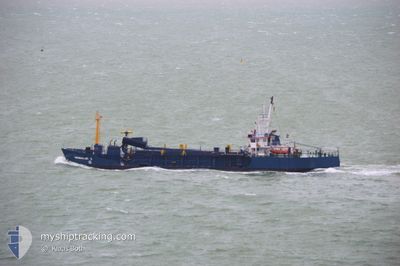
The vessel INTERBALLAST III (IMO: 8113463, MMSI: 244269000) is a Hopper Dredger that was built in 1981 ( 43 År gammal ). It's sailing under the flag of [NL] Netherlands.
In this page you can find informations about the vessels current position, last detected port calls, and current voyage information. If the vessels is not in coverage by AIS you will find the latest position.
The current position of INTERBALLAST III is detected by our AIS receivers and we are not responsible for the reliability of the data. The last position was recorded while the vessel was in Coverage by the Ais receivers of our vessel tracking app.
The current draught of INTERBALLAST III as reported by AIS is 3.8 meters
Weather
| Temperature | 14.6°C / 58.28°F |
|---|---|
| Wind Speed | 16 knots |
| Direction | 236° SW |
| Pressure | 1016.9 hPa |
| Humidity | 72.4 % |
| Cloud Coverage | 5 % |
Featured Company
Last Port Calls
| Port | Arrival | Departure | Time In Port |
|---|---|---|---|
| 2024-05-31 21:23 | 2024-06-02 19:39 | 1 d | |
| 2024-05-25 04:31 | 2024-05-27 20:33 | 2 d | |
| 2024-05-18 05:29 | 2024-05-20 19:19 | 2 d | |
| 2024-05-15 17:40 | 2024-05-16 11:15 | 17 h | |
| 2024-05-14 12:52 | 2024-05-15 02:02 | 13 h | |
| 2024-05-12 23:17 | 2024-05-14 07:58 | 1 d | |
| 2024-05-10 09:36 | 2024-05-12 19:50 | 2 d | |
| 2024-05-04 05:05 | 2024-05-05 18:13 | 1 d | |
| 2024-04-27 08:05 | 2024-04-28 18:26 | 1 d | |
| 2024-04-19 16:53 | 2024-04-21 18:46 | 2 d |
Most Visited Ports (Last year)
| Port | Arrivals | |
|---|---|---|
| 28 | ||
| 8 | ||
| 1 | ||
| 1 |
Last Trips
| Origin | Departure | Destination | Arrival | Distance | |
|---|---|---|---|---|---|
| 2024-05-27 22:33 | 2024-05-31 23:23 | 548.38 nm | |||
| 2024-05-20 21:19 | 2024-05-25 06:31 | 483.32 nm | |||
| 2024-05-16 13:15 | 2024-05-18 07:29 | 138.62 nm | |||
| 2024-05-15 04:02 | 2024-05-15 19:40 | 88.04 nm | |||
| 2024-05-14 09:58 | 2024-05-14 14:52 | 8.65 nm | |||
| 2024-05-12 21:50 | 2024-05-13 01:17 | 32.39 nm | |||
| 2024-05-05 20:13 | 2024-05-10 11:36 | 452.15 nm | |||
| 2024-04-28 20:26 | 2024-05-04 07:05 | 495.34 nm | |||
| 2024-04-21 20:46 | 2024-04-27 10:05 | 459.34 nm | |||
| 2024-04-14 22:45 | 2024-04-19 18:53 | 443.82 nm |
Events
| Tid | Event | Detaljer | Position / Dest | Information |
|---|---|---|---|---|
| 2024-06-07 19:55 | STARTAR förflyttning | 1.88 nm, East of BRESKENS |
51.38728 / 3.61451
DREDGING AREA
|
Fart: 8 kn Kurs: 271.4° |
| 2024-06-07 17:39 | STOPPAR förflyttning | 2.16 nm, East of BRESKENS |
51.38738 / 3.62235
DREDGING AREA
|
Fart: 0.3 kn Kurs: 93° |
| 2024-06-07 10:15 | STARTAR förflyttning | 2.11 nm, East of BRESKENS |
51.38777 / 3.62108
DREDGING AREA
|
Fart: 5.4 kn Kurs: 277.9° |
| 2024-06-07 01:34 | STOPPAR förflyttning | 2.21 nm, East of BRESKENS |
51.38811 / 3.62419
DREDGING AREA
|
Fart: 0.3 kn Kurs: 203° |
| 2024-06-07 00:25 | Byter havsområde | Dutch part of the North Sea Belgian part of the North Sea |
51.40646 / 3.33199
North Sea
|
Fart: 11.6 kn Kurs: 89.1° |
| 2024-06-06 21:22 | Byter havsområde | Belgian part of the North Sea Dutch part of the North Sea |
51.40843 / 3.32279
North Sea
|
Fart: 9.6 kn Kurs: 273.6° |
| 2024-06-06 20:11 | STARTAR förflyttning | 1.76 nm, South East of BRESKENS |
51.38641 / 3.61050
DREDGING AREA
|
Fart: 7 kn Kurs: 293.3° |
| 2024-06-06 17:18 | STOPPAR förflyttning | 1.88 nm, South East of BRESKENS |
51.38511 / 3.61286
DREDGING AREA
|
Fart: 0.2 kn Kurs: 98° |
| 2024-06-06 10:01 | STARTAR förflyttning | 2.14 nm, East of BRESKENS |
51.38740 / 3.62179
DREDGING AREA
|
Fart: 5.2 kn Kurs: 284.6° |
| 2024-06-06 08:16 | STOPPAR förflyttning | 2.27 nm, East of BRESKENS |
51.38732 / 3.62534
DREDGING AREA
|
Fart: 0.3 kn Kurs: 270° |