
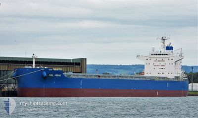
HSL VEGAS
Cargo
Current Trip
| Time Travelled | 3 days |
|---|---|
| Remaining Time | --- |
| Distance Travelled | 1073.62 nm |
| Remaining Distance | --- |
| AVG Speed | 12.1 Knop |
| MAX Speed | 13.4 Knop |
| AVG Wind | 15.3 knots |
| MAX Wind | 22 knots |
| MIN Temp | 17.9°C / 64.22°F |
| MAX Temp | 30.2°C / 86.36°F |
| Djupgående | 10.9 m |
| Position mottagen | 3 d sen |
Current Position
| Longitud | --- |
|---|---|
| Latitude | --- |
| Status | Under way using engine |
| Fart | 12.2 Knop |
| Kurs | 281° |
| Område | Indian Ocean |
| Station | T-AIS |
| Position mottagen | 3 d sen |
Info
Information
The current position of HSL VEGAS is in Indian Ocean with coordinates -32.95244° / 114.43356° as reported on 2025-02-14 15:03 by AIS to our vessel tracker app. The vessel's current speed is 12.2 Knop and is heading at the port of LAS PALMAS. The estimated time of arrival as calculated by MyShipTracking vessel tracking app is 2025-03-21 01:00 LT
The vessel HSL VEGAS (IMO: 9928372, MMSI: 636021352) is a Cargo It's sailing under the flag of [LR] Liberia.
In this page you can find informations about the vessels current position, last detected port calls, and current voyage information. If the vessels is not in coverage by AIS you will find the latest position.
The current position of HSL VEGAS is detected by our AIS receivers and we are not responsible for the reliability of the data. The last position was recorded while the vessel was in Coverage by the Ais receivers of our vessel tracking app.
The current draught of HSL VEGAS as reported by AIS is 10.9 meters
Weather
| Temperature | 19.5°C / 67.1°F |
|---|---|
| Wind Speed | 16 knots |
| Direction | 107° ESE |
| Pressure | 1024.3 hPa |
| Humidity | 72.3 % |
| Cloud Coverage | 100 % |
Featured Company
Most Visited Ports (Last year)
| Port | Arrivals | |
|---|---|---|
| 6 | ||
| 3 | ||
| 2 | ||
| 2 | ||
| 1 | ||
| 1 |
Events
| Tid | Event | Detaljer | Position / Dest | Information |
|---|---|---|---|---|
| 2025-02-14 15:07 | Status ändrad | Default Under way using engine |
-32.94966 / 114.41629
ES LPA
|
Fart: 12.2 kn Kurs: 281° |
| 2025-02-14 15:03 | Status ändrad | Under way using engine Default |
-32.95244 / 114.43356
ES LPA
|
Fart: 12.2 kn Kurs: 280° |
| 2025-02-14 15:03 | UTANFÖR täckningsområde |
-32.95244 / 114.43356
Indian Ocean
|
Fart: 12.2 kn Kurs: 281° |
|
| 2025-02-14 14:48 | I täckningsområde |
-32.95244 / 114.43356
Indian Ocean
|
Fart: 12.2 kn Kurs: 281° |
|
| 2025-02-14 12:36 | Status ändrad | Default Under way using engine |
-33.06139 / 115.01700
ES LPA
|
Fart: 12.2 kn Kurs: 286° |
| 2025-02-14 12:31 | UTANFÖR täckningsområde |
-33.06697 / 115.03978
Indian Ocean
|
Fart: 12.2 kn Kurs: 286° |
|
| 2025-02-14 12:17 | Status ändrad | Under way using engine Default |
-33.07984 / 115.09374
ES LPA
|
Fart: 12.3 kn Kurs: 285° |
| 2025-02-14 11:48 | Status ändrad | Default Under way using engine |
-33.10490 / 115.20785
ES LPA
|
Fart: 12.3 kn Kurs: 283.7° |
| 2025-02-14 09:27 | AVGÅTT HAMN |
|
-33.30234 / 115.65229
ES LPA
|
Fart: 6.3 kn Kurs: 357° |
| 2025-02-14 09:09 | STARTAR förflyttning |
-33.32254 / 115.66399
[AU] BUNBURY
|
Fart: 3.1 kn Kurs: 285° |