
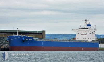
HSL VEGAS
Cargo
Current Trip
| Time Travelled | 43 days |
|---|---|
| Remaining Time | 23 h, 26 mins |
| Distance Travelled | 11166.43 nm |
| Remaining Distance | 314.39 nm |
| AVG Speed | 11.4 Noeuds |
| MAX Speed | 14.4 Noeuds |
| AVG Wind | 14.6 knots |
| MAX Wind | 45.9 knots |
| MIN Temp | 11.1°C / 51.98°F |
| MAX Temp | 33.1°C / 91.58°F |
| Tirant d eau | 10.1 m |
| Position reçue | Maintenant |
Current Position
| Longitude | -2.90942° |
|---|---|
| Latitude | 49.79452° |
| Etat | Under way using engine |
| Vitesse | 14.1 Noeuds |
| Parcours | 62° |
| Zone | English Channel |
| Station | T-AIS |
| Position reçue | Maintenant |
Info
Information
The current position of HSL VEGAS is in English Channel with coordinates 49.79452° / -2.90942° as reported on 2024-09-21 19:56 by AIS to our vessel tracker app. The vessel's current speed is 14.1 Noeuds and is heading at the port of ROTTERDAM. The estimated time of arrival as calculated by MyShipTracking vessel tracking app is 2024-09-22 19:22 LT
The vessel HSL VEGAS (IMO: 9928372, MMSI: 636021352) is a Cargo It's sailing under the flag of [LR] Liberia.
In this page you can find informations about the vessels current position, last detected port calls, and current voyage information. If the vessels is not in coverage by AIS you will find the latest position.
The current position of HSL VEGAS is detected by our AIS receivers and we are not responsible for the reliability of the data. The last position was recorded while the vessel was in Coverage by the Ais receivers of our vessel tracking app.
The current draught of HSL VEGAS as reported by AIS is 10.1 meters
Weather
| Temperature | 17.9°C / 64.22°F |
|---|---|
| Wind Speed | 11 knots |
| Direction | 91° E |
| Pressure | 1013.3 hPa |
| Humidity | 81.2 % |
| Cloud Coverage | 100 % |
Featured Company
Last Trips
Events
| Heure | Evenement | Détails | Position/ Destination | Info |
|---|---|---|---|---|
| 2024-09-21 19:02 | Etat Changé | Under way using engine Default |
49.68578 / -3.17754
NL RTM
|
Vitesse: 13.6 kn Parcours: 61° |
| 2024-09-21 18:55 | Etat Changé | Default Under way using engine |
49.67284 / -3.21411
NL RTM
|
Vitesse: 13.6 kn Parcours: 64.2° |
| 2024-09-21 18:39 | Etat Changé | Under way using engine Default |
49.64761 / -3.29616
NL RTM
|
Vitesse: 13.5 kn Parcours: 64° |
| 2024-09-21 18:15 | Etat Changé | Default Under way using engine |
49.60682 / -3.42277
NL RTM
|
Vitesse: 13.4 kn Parcours: 63.2° |
| 2024-09-21 18:13 | Etat Changé | Under way using engine Default |
49.60367 / -3.43232
NL RTM
|
Vitesse: 13.4 kn Parcours: 63° |
| 2024-09-21 18:11 | Etat Changé | Default Under way using engine |
49.60025 / -3.44249
NL RTM
|
Vitesse: 13.4 kn Parcours: 62.9° |
| 2024-09-21 17:26 | Changement de zone | Guernsey part of the English Channel French part of the English Channel |
49.52431 / -3.66975
English Channel
NL RTM
|
Vitesse: 12.9 kn Parcours: 62.7° |
| 2024-09-21 16:12 | Etat Changé | Under way using engine Default |
49.40536 / -4.02180
NL RTM
|
Vitesse: 12.2 kn Parcours: 62° |
| 2024-09-21 16:11 | Etat Changé | Default Under way using engine |
49.40461 / -4.02394
NL RTM
|
Vitesse: 12.2 kn Parcours: 62.6° |
| 2024-09-21 15:55 | Tirant d'eau modifié | 10.1 11 |
49.37832 / -4.10136
NL RTM
|
Vitesse: 12.1 kn Parcours: 61.8° |