
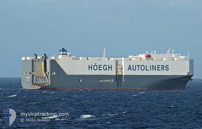
HOEGH KOBE
Vehicles Carrier
Current Trip
| Time Travelled | 9 days |
|---|---|
| Remaining Time | --- |
| Distance Travelled | 2760.20 nm |
| Remaining Distance | --- |
| AVG Speed | 13.2 Knop |
| MAX Speed | 17.4 Knop |
| AVG Wind | 12.9 knots |
| MAX Wind | 24 knots |
| MIN Temp | 14.5°C / 58.1°F |
| MAX Temp | 26°C / 78.8°F |
| Djupgående | 8 m |
| Position mottagen | 6 d sen |
Current Position
| Longitud | -79.40341° |
|---|---|
| Latitude | 26.22892° |
| Status | Under way using engine |
| Fart | 15.6 Knop |
| Kurs | 5.7° |
| Område | North Atlantic Ocean |
| Station | T-AIS |
| Position mottagen | 6 d sen |
Info
Information
The current position of HOEGH KOBE is in North Atlantic Ocean with coordinates 26.22892° / -79.40341° as reported on 2024-04-27 21:40 by AIS to our vessel tracker app. The vessel's current speed is 15.6 Knop and is heading at the port of BREMERHAVEN. The estimated time of arrival as calculated by MyShipTracking vessel tracking app is 2024-05-12 20:20 LT
The vessel HOEGH KOBE (IMO: 9330616, MMSI: 565234000) is a Vehicles Carrier that was built in 2006 ( 18 År gammal ). It's sailing under the flag of [SG] Singapore.
In this page you can find informations about the vessels current position, last detected port calls, and current voyage information. If the vessels is not in coverage by AIS you will find the latest position.
The current position of HOEGH KOBE is detected by our AIS receivers and we are not responsible for the reliability of the data. The last position was recorded while the vessel was in Coverage by the Ais receivers of our vessel tracking app.
The current draught of HOEGH KOBE as reported by AIS is 8 meters
Weather
| Temperature | 15.6°C / 60.08°F |
|---|---|
| Wind Speed | 13 knots |
| Direction | 288° WNW |
| Pressure | 1007.5 hPa |
| Humidity | 78.6 % |
| Cloud Coverage | 100 % |
Featured Company
Last Port Calls
| Port | Arrival | Departure | Time In Port |
|---|---|---|---|
| 2024-04-24 17:45 | 2024-04-25 09:10 | 15 h | |
| 2024-04-21 23:14 | 2024-04-23 05:22 | 1 d | |
| 2024-04-17 11:54 | 2024-04-18 00:15 | 12 h | |
| 2024-04-07 12:27 | 2024-04-08 07:51 | 19 h | |
| 2024-03-21 22:20 | 2024-03-22 09:06 | 10 h | |
| 2024-03-15 04:24 |
Most Visited Ports (Last year)
| Port | Arrivals | |
|---|---|---|
| 2 | ||
| 2 | ||
| 2 | ||
| 2 | ||
| 2 | ||
| 2 |
Last Trips
| Origin | Departure | Destination | Arrival | Distance | |
|---|---|---|---|---|---|
| 2024-04-23 00:22 | 2024-04-24 12:45 | 527.58 nm | |||
| 2024-04-17 19:15 | 2024-04-21 18:14 | 1321.08 nm | |||
| 2024-04-08 02:51 | 2024-04-17 06:54 | 2221.48 nm | |||
| 2024-03-22 18:06 | 2024-04-07 07:27 | 6370.55 nm | |||
| 2024-02-27 16:31 | 2024-03-15 12:24 | 5798.00 nm |
Events
| Tid | Event | Detaljer | Position / Dest | Information |
|---|---|---|---|---|
| 2024-04-27 22:03 | Status ändrad | Default Under way using engine |
26.32775 / -79.39220
USMOB > DEBRV
|
Fart: 15.6 kn Kurs: 5.7° |
| 2024-04-27 21:40 | UTANFÖR täckningsområde |
26.22892 / -79.40341
North Atlantic Ocean
USMOB > DEBRV
|
Fart: 15.6 kn Kurs: 5.7° |
|
| 2024-04-27 18:47 | Byter havsområde | Bahamas part of the North Atlantic Ocean United States part of the Gulf of Mexico |
25.49187 / -79.55002
North Atlantic Ocean
USMOB > DEBRV
|
Fart: 15.6 kn Kurs: 7.9° |
| 2024-04-27 18:45 | Status ändrad | Under way using engine Default |
25.48145 / -79.55162
USMOB > DEBRV
|
Fart: 15.1 kn Kurs: 10° |
| 2024-04-27 18:45 | I täckningsområde |
25.49187 / -79.55002
North Atlantic Ocean
USMOB > DEBRV
|
Fart: 15.6 kn Kurs: 7.9° |
|
| 2024-04-25 17:49 | Status ändrad | Default Under way using engine |
28.72124 / -87.25352
USMOB > DEBRV
|
Fart: 14 kn Kurs: 165.2° |
| 2024-04-25 17:40 | UTANFÖR täckningsområde |
28.75227 / -87.26277
Gulf of Mexico
USMOB > DEBRV
|
Fart: 14 kn Kurs: 165.2° |
|
| 2024-04-25 17:30 | Status ändrad | Under way using engine Default |
28.79064 / -87.27395
USMOB > DEBRV
|
Fart: 14.1 kn Kurs: 165° |
| 2024-04-25 16:53 | Status ändrad | Default Under way using engine |
28.93297 / -87.31695
USMOB > DEBRV
|
Fart: 14.3 kn Kurs: 164.6° |
| 2024-04-25 15:17 | Status ändrad | Under way using engine Default |
29.30425 / -87.45554
USMOB > DEBRV
|
Fart: 14.9 kn Kurs: 159° |