
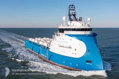
AURORA STORM
Other Type
Current Trip
| Trip Time | 2 days |
|---|---|
| Trip Distance | 78.99 nm |
| AVG Speed | 7 Knop |
| MAX Speed | 10.5 Knop |
| Djupgående | 5 m |
| AVG Wind | 11 knots |
| MAX Wind | 21.8 knots |
| MIN Temp | 3.7°C / 38.66°F |
| MAX Temp | 6.2°C / 43.16°F |
| Position mottagen | Nu |
Current Position
| Longitud | -2.02375° |
|---|---|
| Latitude | 57.19442° |
| Status | Under way using engine |
| Fart | 0.1 Knop |
| Kurs | 245° |
| Område | North Sea |
| Station | T-AIS |
| Position mottagen | Nu |
Info
Information
The current position of AURORA STORM is in North Sea with coordinates 57.19442° / -2.02375° as reported on 2024-04-26 09:08 by AIS to our vessel tracker app. The vessel's current speed is 0.1 Knop and is currently inside the port of ABERDEEN ANCH.
The vessel AURORA STORM (IMO: 9722510, MMSI: 257734000) is a Other Type It's sailing under the flag of [NO] Norway.
In this page you can find informations about the vessels current position, last detected port calls, and current voyage information. If the vessels is not in coverage by AIS you will find the latest position.
The current position of AURORA STORM is detected by our AIS receivers and we are not responsible for the reliability of the data. The last position was recorded while the vessel was in Coverage by the Ais receivers of our vessel tracking app.
The current draught of AURORA STORM as reported by AIS is 5 meters
Weather
| Temperature | 6.4°C / 43.52°F |
|---|---|
| Wind Speed | 7 knots |
| Direction | 341° NNW |
| Pressure | 1006.4 hPa |
| Humidity | 67.1 % |
| Cloud Coverage | 85 % |
Featured Company
Last Port Calls
| Port | Arrival | Departure | Time In Port |
|---|---|---|---|
| 2024-04-26 08:51 | |||
| 2024-04-23 05:57 | 2024-04-23 23:48 | 17 h | |
| 2024-04-19 20:46 | 2024-04-20 14:42 | 17 h | |
| 2024-04-18 23:20 | 2024-04-19 20:05 | 20 h | |
| 2024-04-13 20:37 | 2024-04-16 16:31 | 2 d | |
| 2024-04-12 13:50 | 2024-04-13 20:00 | 1 d | |
| 2024-04-02 18:31 | 2024-04-05 08:40 | 2 d | |
| 2024-03-28 15:18 | 2024-03-29 02:54 | 11 h | |
| 2024-03-21 08:30 | 2024-03-22 21:17 | 1 d | |
| 2024-03-15 16:40 | 2024-03-16 03:56 | 11 h |
Last Trips
| Origin | Departure | Destination | Arrival | Distance | |
|---|---|---|---|---|---|
| 2024-04-24 00:48 | 2024-04-26 09:51 | 78.99 nm | |||
| 2024-04-20 15:42 | 2024-04-23 06:57 | 270.90 nm | |||
| 2024-04-16 17:31 | 2024-04-19 21:46 | 263.61 nm | |||
| 2024-04-16 17:31 | 2024-04-19 00:20 | 259.03 nm | |||
| 2024-04-05 09:40 | 2024-04-13 21:37 | 63.14 nm | |||
| 2024-04-05 09:40 | 2024-04-12 14:50 | 58.50 nm | |||
| 2024-03-29 02:54 | 2024-04-02 19:31 | 298.77 nm | |||
| 2024-03-22 21:17 | 2024-03-28 15:18 | 300.59 nm | |||
| 2024-03-16 03:56 | 2024-03-21 08:30 | 64.39 nm | |||
| 2024-03-10 01:42 | 2024-03-15 16:40 | 270.32 nm |
Events
| Tid | Event | Detaljer | Position / Dest | Information |
|---|---|---|---|---|
| 2024-04-26 08:54 | STOPPAR förflyttning |
57.19413 / -2.02351
[GB] ABERDEEN ANCH
|
Fart: 0.3 kn Kurs: 257° |
|
| 2024-04-26 08:51 | ANLÄNDER HAMN |
|
57.19376 / -2.02373
[GB] ABERDEEN ANCH
|
Fart: 0.8 kn Kurs: 271° |
| 2024-04-26 08:46 | STARTAR förflyttning | 0.62 nm, North East of ABERDEEN ANCH |
57.19503 / -2.01278
ABERDEEN
|
Fart: 5.7 kn Kurs: 255.1° |
| 2024-04-26 05:24 | STOPPAR förflyttning | 0.8 nm, East of ABERDEEN ANCH |
57.19483 / -2.00674
ABERDEEN
|
Fart: 0.3 kn Kurs: 278° |
| 2024-04-26 00:05 | Destination ändrad | ABERDEEN BRITANNIA |
57.46228 / -1.04126
ABERDEEN
|
Fart: 7.3 kn Kurs: 238.3° |
| 2024-04-26 00:05 | ETA ändrat | 2024/04/26 07:00 2024/04/24 12:00 |
57.46228 / -1.04126
ABERDEEN
|
Fart: 7.3 kn Kurs: 238.3° |
| 2024-04-25 23:52 | I täckningsområde |
57.47611 / -1.00040
North Sea
|
Fart: 7.2 kn Kurs: 239.4° |
|
| 2024-04-24 04:02 | UTANFÖR täckningsområde |
57.46890 / -.91606
North Sea
BRITANNIA
|
Fart: 10.4 kn Kurs: 59.7° |
|
| 2024-04-24 00:45 | ETA ändrat | 2024/04/24 12:00 2024/04/23 07:30 |
57.21846 / -1.79004
BRITANNIA
|
Fart: 9.9 kn Kurs: 62.2° |
| 2024-04-24 00:20 | Destination ändrad | BRITANNIA ABERDEEN |
57.18480 / -1.90307
BRITANNIA
|
Fart: 10.1 kn Kurs: 61.1° |