
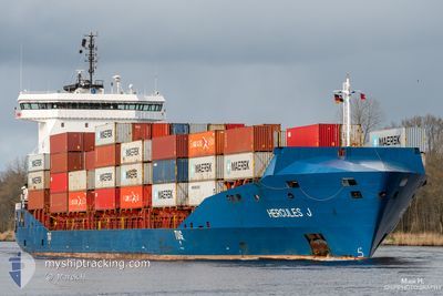
HERCULES J
Container Ship
Current Trip
| Trip Time | 2 days |
|---|---|
| Trip Distance | 1009.86 nm |
| AVG Speed | 16.2 Knop |
| MAX Speed | 18.3 Knop |
| Djupgående | 7.8 m |
| AVG Wind | 9.7 knots |
| MAX Wind | 19.8 knots |
| MIN Temp | 17.7°C / 63.86°F |
| MAX Temp | 22.2°C / 71.96°F |
| Position mottagen | 1 m sen |
Current Position
| Longitud | --- |
|---|---|
| Latitude | --- |
| Status | Under way using engine |
| Fart | 0.6 Knop |
| Kurs | 142° |
| Område | North Atlantic Ocean |
| Station | T-AIS |
| Position mottagen | 1 m sen |
Info
Information
The current position of HERCULES J is in North Atlantic Ocean with coordinates 28.14917° / -15.41325° as reported on 2024-10-21 17:40 by AIS to our vessel tracker app. The vessel's current speed is 0.6 Knop and is currently inside the port of LAS PALMAS.
The vessel HERCULES J (IMO: 9430193, MMSI: 212302000) is a Container Ship that was built in 2009 ( 15 År gammal ). It's sailing under the flag of [CY] Cyprus.
In this page you can find informations about the vessels current position, last detected port calls, and current voyage information. If the vessels is not in coverage by AIS you will find the latest position.
The current position of HERCULES J is detected by our AIS receivers and we are not responsible for the reliability of the data. The last position was recorded while the vessel was in Coverage by the Ais receivers of our vessel tracking app.
The current draught of HERCULES J as reported by AIS is 7.8 meters
Weather
| Temperature | 21.8°C / 71.24°F |
|---|---|
| Wind Speed | 12 knots |
| Direction | 28° NNE |
| Pressure | 1021.5 hPa |
| Humidity | 75.6 % |
| Cloud Coverage | 100 % |
Featured Company
Last Port Calls
| Port | Arrival | Departure | Time In Port |
|---|---|---|---|
| 2024-10-21 17:11 | |||
| 2024-10-18 08:07 | 2024-10-19 03:33 | 19 h | |
| 2024-10-15 14:10 | 2024-10-15 21:10 | 6 h | |
| 2024-10-14 21:11 | 2024-10-15 10:50 | 13 h | |
| 2024-10-11 05:04 | 2024-10-12 08:15 | 1 d | |
| 2024-10-08 06:38 | 2024-10-08 12:57 | 6 h | |
| 2024-10-07 17:09 | 2024-10-08 01:26 | 8 h | |
| 2024-10-04 05:07 | 2024-10-05 05:27 | 1 d | |
| 2024-10-01 06:19 | 2024-10-01 16:50 | 10 h | |
| 2024-09-30 16:45 | 2024-10-01 01:26 | 8 h |
Most Visited Ports (Last year)
| Port | Arrivals | |
|---|---|---|
| 50 | ||
| 43 | ||
| 42 | ||
| 7 | ||
| 2 | ||
| 1 |
Last Trips
| Origin | Departure | Destination | Arrival | Distance | |
|---|---|---|---|---|---|
| 2024-10-19 05:33 | 2024-10-21 18:11 | 1009.86 nm | |||
| 2024-10-15 22:10 | 2024-10-18 10:07 | 1029.36 nm | |||
| 2024-10-15 11:50 | 2024-10-15 15:10 | 54.62 nm | |||
| 2024-10-12 10:15 | 2024-10-14 22:11 | 1007.97 nm | |||
| 2024-10-08 13:57 | 2024-10-11 07:04 | 1045.42 nm | |||
| 2024-10-08 02:26 | 2024-10-08 07:38 | 56.88 nm | |||
| 2024-10-05 07:27 | 2024-10-07 18:09 | 1013.06 nm | |||
| 2024-10-01 17:50 | 2024-10-04 07:07 | 1030.24 nm | |||
| 2024-10-01 02:26 | 2024-10-01 07:19 | 57.05 nm | |||
| 2024-09-28 08:39 | 2024-09-30 17:45 | 1007.92 nm |
Events
| Tid | Event | Detaljer | Position / Dest | Information |
|---|---|---|---|---|
| 2024-10-21 17:11 | ANLÄNDER HAMN |
|
28.11826 / -15.40770
[ES] LAS PALMAS
|
Fart: 6.7 kn Kurs: 340.8° |
| 2024-10-21 15:04 | Status ändrad | Under way using engine Default |
28.49730 / -15.03090
ESLPA
|
Fart: 15.4 kn Kurs: 224° |
| 2024-10-21 14:55 | Status ändrad | Default Under way using engine |
28.49674 / -15.03153
ESLPA
|
Fart: 15.2 kn Kurs: 225° |
| 2024-10-21 14:08 | Status ändrad | Under way using engine Default |
28.65150 / -14.86830
ESLPA
|
Fart: 15.1 kn Kurs: 224° |
| 2024-10-21 13:51 | I täckningsområde |
28.65150 / -14.86830
North Atlantic Ocean
ESLPA
|
Fart: 15.1 kn Kurs: 224.7° |
|
| 2024-10-21 11:39 | Status ändrad | Default Under way using engine |
29.11701 / -14.40119
ESLPA
|
Fart: 15 kn Kurs: 219.9° |
| 2024-10-21 11:12 | UTANFÖR täckningsområde |
29.20093 / -14.31633
North Atlantic Ocean
ESLPA
|
Fart: 15 kn Kurs: 219.9° |
|
| 2024-10-21 10:00 | Status ändrad | Under way using engine Default |
29.43062 / -14.08482
ESLPA
|
Fart: 15.6 kn Kurs: 224° |
| 2024-10-21 09:53 | Status ändrad | Default Under way using engine |
29.45260 / -14.06214
ESLPA
|
Fart: 15.6 kn Kurs: 221.4° |
| 2024-10-21 09:23 | Status ändrad | Under way using engine Default |
29.54954 / -13.96038
ESLPA
|
Fart: 15.9 kn Kurs: 220° |