

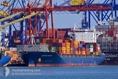
HAMMONIA BALTICA
Container Ship
Current Trip
| Time Travelled | 16 days |
|---|---|
| Remaining Time | 1 day |
| Distance Travelled | 6100.79 nm |
| Remaining Distance | 369.91 nm |
| AVG Speed | 15.1 Knop |
| MAX Speed | 18.7 Knop |
| AVG Wind | 10.2 knots |
| MAX Wind | 27.4 knots |
| MIN Temp | 5.6°C / 42.08°F |
| MAX Temp | 21.6°C / 70.88°F |
| Djupgående | 10.2 m |
| Position mottagen | 1 m sen |
Current Position
| Longitud | --- |
|---|---|
| Latitude | --- |
| Status | Under way using engine |
| Fart | 10.4 Knop |
| Kurs | 319.1° |
| Område | Mediterranean Sea - Eastern Basin |
| Station | T-AIS |
| Position mottagen | 1 m sen |
Information
The current position of HAMMONIA BALTICA is in Mediterranean Sea - Eastern Basin with coordinates 34.53898° / 28.87561° as reported on 2025-03-06 17:41 by AIS to our vessel tracker app. The vessel's current speed is 10.4 Knop and is heading at the port of ALIAGA. The estimated time of arrival as calculated by MyShipTracking vessel tracking app is 2025-03-08 06:24 LT
The vessel HAMMONIA BALTICA (IMO: 9481532, MMSI: 636092181) is a Container Ship that was built in 2011 ( 14 År gammal ). It's sailing under the flag of [LR] Liberia.
In this page you can find informations about the vessels current position, last detected port calls, and current voyage information. If the vessels is not in coverage by AIS you will find the latest position.
The current position of HAMMONIA BALTICA is detected by our AIS receivers and we are not responsible for the reliability of the data. The last position was recorded while the vessel was in Coverage by the Ais receivers of our vessel tracking app.
The current draught of HAMMONIA BALTICA as reported by AIS is 10.2 meters
Weather
| Temperature | 16.2°C / 61.16°F |
|---|---|
| Wind Speed | 10 knots |
| Direction | 317° NW |
| Pressure | 1021.2 hPa |
| Humidity | 75.5 % |
| Cloud Coverage | --- |
Featured Company
Last Port Calls
| Port | Arrival | Departure | Time In Port |
|---|---|---|---|
| 2025-03-04 18:17 | 2025-03-05 15:57 | 21 h | |
| 2025-02-17 08:04 | 2025-02-18 01:26 | 17 h | |
| 2025-02-10 20:54 | 2025-02-11 13:00 | 16 h | |
| 2025-02-08 09:16 | 2025-02-09 23:46 | 1 d | |
| 2025-01-25 15:23 | 2025-01-31 06:33 | 5 d | |
| 2025-01-18 04:53 | 2025-01-19 04:39 | 23 h | |
| 2025-01-13 17:16 | 2025-01-14 12:18 | 19 h | |
| 2025-01-11 19:48 | 2025-01-12 17:29 | 21 h | |
| 2025-01-07 22:29 | 2025-01-09 10:19 | 1 d | |
| 2025-01-07 21:01 | 2025-01-07 22:21 | 1 h |
Last Trips
| Origin | Departure | Destination | Arrival | Distance | |
|---|---|---|---|---|---|
| 2025-02-17 20:26 | 2025-03-04 20:17 | 5824.59 nm | |||
| 2025-02-11 08:00 | 2025-02-17 03:04 | 505.00 nm | |||
| 2025-02-09 18:46 | 2025-02-10 15:54 | 280.79 nm | |||
| 2025-01-31 06:33 | 2025-02-08 04:16 | 3123.12 nm | |||
| 2025-01-19 05:39 | 2025-01-25 15:23 | 1351.69 nm | |||
| 2025-01-14 15:18 | 2025-01-18 05:53 | 825.24 nm | |||
| 2025-01-12 20:29 | 2025-01-13 20:16 | 307.72 nm | |||
| 2025-01-09 13:19 | 2025-01-11 22:48 | 851.49 nm | |||
| 2025-01-08 01:21 | 2025-01-08 01:29 | 1.25 nm | |||
| 2025-01-07 23:56 | 2025-01-08 00:01 | 3.91 nm |
Events
| Tid | Event | Detaljer | Position / Dest | Information |
|---|---|---|---|---|
| 2025-03-06 13:31 | Djupgående ändrat | 10.2 10.1 |
33.98907 / 29.44221
EG PSD>TR ALI
|
Fart: 11.1 kn Kurs: 319.4° |
| 2025-03-06 13:31 | Destination ändrad | EG PSD>TR ALI US SAV>EG PSD |
33.98907 / 29.44221
EG PSD>TR ALI
|
Fart: 11.1 kn Kurs: 319.4° |
| 2025-03-06 13:31 | ETA ändrat | 2025/03/08 06:00 2025/03/04 18:00 |
33.98907 / 29.44221
EG PSD>TR ALI
|
Fart: 11.1 kn Kurs: 319.4° |
| 2025-03-06 13:23 | Upptäckt i hav | Greek part of the Mediterranean Sea - Eastern Basin |
33.97158 / 29.46122
Mediterranean Sea - Eastern Basin
|
Fart: 11 kn Kurs: 317.6° |
| 2025-03-06 13:20 | Status ändrad | Under way using engine Default |
33.96553 / 29.46796
US SAV>EG PSD
|
Fart: 10.9 kn Kurs: 316° |
| 2025-03-06 13:20 | I täckningsområde |
33.97158 / 29.46122
Mediterranean Sea - Eastern Basin
|
Fart: 11 kn Kurs: 317.6° |
|
| 2025-03-05 15:57 | AVGÅTT HAMN |
|
31.22924 / 32.35805
US SAV>EG PSD
|
Fart: 6.8 kn Kurs: 11° |
| 2025-03-05 15:25 | STARTAR förflyttning |
31.19614 / 32.34950
[EG] SUEZ CANAL
|
Fart: 3.5 kn Kurs: 213° |
|
| 2025-03-04 19:00 | STOPPAR förflyttning |
31.20065 / 32.35244
[EG] SUEZ CANAL
|
Fart: Kurs: 192° |
|
| 2025-03-04 18:17 | ANLÄNDER HAMN |
|
31.22628 / 32.35692
[EG] SUEZ CANAL
|
Fart: 8.5 kn Kurs: 193° |