

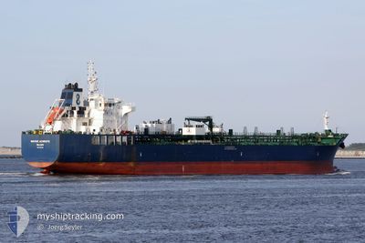
HAFNIA ACHROITE
Tanker

Current Trip
| Time Travelled | 10 days |
|---|---|
| Remaining Time | 1 h, 30 mins |
| Distance Travelled | 1582.72 nm |
| Remaining Distance | 28.65 nm |
| AVG Speed | 11.4 Knop |
| MAX Speed | 15.8 Knop |
| AVG Wind | 9.1 knots |
| MAX Wind | 21.3 knots |
| MIN Temp | -2°C / 28.4°F |
| MAX Temp | 23.8°C / 74.84°F |
| Djupgående | 8 m |
| Position mottagen | 1 d sen |
Current Position
| Longitud | --- |
|---|---|
| Latitude | --- |
| Status | Under way using engine |
| Fart | 11.7 Knop |
| Kurs | 141.3° |
| Område | Red Sea |
| Station | T-AIS |
| Position mottagen | 1 d sen |
Information
The current position of HAFNIA ACHROITE is in Red Sea with coordinates 25.56772° / 35.81796° as reported on 2025-02-18 16:19 by AIS to our vessel tracker app. The vessel's current speed is 11.7 Knop and is heading at the port of RABIGH. The estimated time of arrival as calculated by MyShipTracking vessel tracking app is 2025-02-20 15:15 LT
The vessel HAFNIA ACHROITE (IMO: 9727584, MMSI: 538005786) is a Tanker It's sailing under the flag of [MH] Marshall Is.
In this page you can find informations about the vessels current position, last detected port calls, and current voyage information. If the vessels is not in coverage by AIS you will find the latest position.
The current position of HAFNIA ACHROITE is detected by our AIS receivers and we are not responsible for the reliability of the data. The last position was recorded while the vessel was in Coverage by the Ais receivers of our vessel tracking app.
The current draught of HAFNIA ACHROITE as reported by AIS is 8 meters
Weather
| Temperature | 22.7°C / 72.86°F |
|---|---|
| Wind Speed | 14 knots |
| Direction | 312° NW |
| Pressure | 1014 hPa |
| Humidity | 55.1 % |
| Cloud Coverage | --- |


Featured Company
Last Port Calls
| Port | Arrival | Departure | Time In Port |
|---|---|---|---|
| 2025-02-17 04:29 | 2025-02-17 13:35 | 9 h | |
| 2025-02-08 07:23 | 2025-02-09 20:42 | 1 d | |
| 2025-02-01 18:17 | 2025-02-02 20:41 | 1 d | |
| 2025-01-31 22:22 | 2025-02-01 17:45 | 19 h | |
| 2025-01-29 21:26 | 2025-01-31 02:34 | 1 d | |
| 2025-01-22 17:39 | 2025-01-25 07:46 | 2 d | |
| 2025-01-20 05:17 | 2025-01-20 14:42 | 9 h | |
| 2025-01-15 05:35 | 2025-01-18 13:25 | 3 d | |
| 2025-01-10 14:30 | 2025-01-11 07:17 | 16 h | |
| 2025-01-07 04:42 | 2025-01-09 01:18 | 1 d |
Most Visited Ports (Last year)
| Port | Arrivals | |
|---|---|---|
| 3 | ||
| 3 | ||
| 3 | ||
| 2 | ||
| 1 | ||
| 1 |
Last Trips
| Origin | Departure | Destination | Arrival | Distance | |
|---|---|---|---|---|---|
| 2025-02-09 23:42 | 2025-02-17 06:29 | 876.35 nm | |||
| 2025-02-02 22:41 | 2025-02-08 10:23 | 853.24 nm | |||
| 2025-01-31 04:34 | 2025-02-01 20:17 | 102.23 nm | |||
| 2025-01-31 04:34 | 2025-02-01 00:22 | 17.55 nm | |||
| 2025-01-25 10:46 | 2025-01-29 23:26 | 510.93 nm | |||
| 2025-01-18 16:25 | 2025-01-22 20:39 | 1027.10 nm | |||
| 2025-01-18 16:25 | 2025-01-20 07:17 | 400.80 nm | |||
| 2025-01-11 10:17 | 2025-01-15 08:35 | 935.80 nm | |||
| 2025-01-09 04:18 | 2025-01-10 17:30 | 98.86 nm | |||
| 2024-12-28 11:55 | 2025-01-07 07:42 | 1862.05 nm |
Events
| Tid | Event | Detaljer | Position / Dest | Information |
|---|---|---|---|---|
| 2025-02-18 16:25 | Status ändrad | Default Under way using engine |
25.55326 / 35.83140
SARAB
|
Fart: 11.7 kn Kurs: 141.3° |
| 2025-02-18 16:19 | UTANFÖR täckningsområde |
25.56772 / 35.81796
Red Sea
SARAB
|
Fart: 11.7 kn Kurs: 141.3° |
|
| 2025-02-18 15:59 | Upptäckt i hav | Saudi Arabian part of the Red Sea |
25.61759 / 35.77159
Red Sea
SARAB
|
Fart: 12 kn Kurs: 141.9° |
| 2025-02-18 15:59 | Status ändrad | Under way using engine Default |
25.61759 / 35.77159
SARAB
|
Fart: 12 kn Kurs: 142° |
| 2025-02-18 15:39 | I täckningsområde |
25.61759 / 35.77159
Red Sea
SARAB
|
Fart: 12 kn Kurs: 141.9° |
|
| 2025-02-18 12:40 | Status ändrad | Default Under way using engine |
26.12111 / 35.31976
SARAB
|
Fart: 12 kn Kurs: 142.9° |
| 2025-02-18 12:38 | UTANFÖR täckningsområde |
26.12423 / 35.31714
Red Sea
SARAB
|
Fart: 12 kn Kurs: 142.9° |
|
| 2025-02-18 12:31 | Status ändrad | Under way using engine Default |
26.14458 / 35.29971
SARAB
|
Fart: 11.8 kn Kurs: 142° |
| 2025-02-18 12:23 | Status ändrad | Default Under way using engine |
26.16408 / 35.28314
SARAB
|
Fart: 11.8 kn Kurs: 143.2° |
| 2025-02-18 11:57 | Status ändrad | Under way using engine Default |
26.23341 / 35.22099
SARAB
|
Fart: 12.3 kn Kurs: 141° |