
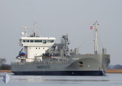
GREENLAND
Cargo
Current Trip
| Time Travelled | 11 h, 14 mins |
|---|---|
| Remaining Time | 13 h, 21 mins |
| Distance Travelled | 136.58 nm |
| Remaining Distance | 176.19 nm |
| AVG Speed | 12.6 Knop |
| MAX Speed | 13.5 Knop |
| AVG Wind | 10.9 knots |
| MAX Wind | 16.2 knots |
| MIN Temp | -1.5°C / 29.3°F |
| MAX Temp | 2.5°C / 36.5°F |
| Djupgående | 5 m |
| Position mottagen | Nu |
Current Position
| Longitud | --- |
|---|---|
| Latitude | --- |
| Status | Under way using engine |
| Fart | 12.6 Knop |
| Kurs | 59.5° |
| Område | Baltic Sea |
| Station | T-AIS |
| Position mottagen | Nu |
Info
Information
The current position of GREENLAND is in Baltic Sea with coordinates 55.72989° / 15.70202° as reported on 2026-01-05 22:30 by AIS to our vessel tracker app. The vessel's current speed is 12.6 Knop and is heading at the port of SLITE. The estimated time of arrival as calculated by MyShipTracking vessel tracking app is 2026-01-06 12:52 LT
The vessel GREENLAND (IMO: 9734264, MMSI: 244140468) is a Cargo It's sailing under the flag of [NL] Netherlands.
In this page you can find informations about the vessels current position, last detected port calls, and current voyage information. If the vessels is not in coverage by AIS you will find the latest position.
The current position of GREENLAND is detected by our AIS receivers and we are not responsible for the reliability of the data. The last position was recorded while the vessel was in Coverage by the Ais receivers of our vessel tracking app.
The current draught of GREENLAND as reported by AIS is 5 meters
Weather
| Temperature | 2.5°C / 36.5°F |
|---|---|
| Wind Speed | 14 knots |
| Direction | 228° SW |
| Pressure | 1010.4 hPa |
| Humidity | 73.1 % |
| Cloud Coverage | 100 % |
Featured Company
Last Port Calls
| Port | Arrival | Departure | Time In Port |
|---|---|---|---|
| 2026-01-04 20:09 | 2026-01-05 12:17 | 16 h | |
| 2026-01-02 22:44 | 2026-01-03 16:11 | 17 h | |
| 2025-12-31 04:45 | 2026-01-02 10:44 | 2 d | |
| 2025-12-29 09:38 | 2025-12-29 16:09 | 6 h | |
| 2025-12-28 16:23 | 2025-12-29 01:22 | 8 h | |
| 2025-12-24 08:10 | 2025-12-27 04:30 | 2 d | |
| 2025-12-23 18:51 | 2025-12-23 19:34 | 42 m | |
| 2025-12-22 10:26 | 2025-12-23 12:30 | 1 d | |
| 2025-12-22 03:11 | 2025-12-22 03:36 | 25 m | |
| 2025-12-20 19:59 | 2025-12-21 14:28 | 18 h |
Most Visited Ports (Last year)
| Port | Arrivals | |
|---|---|---|
| 63 | ||
| 32 | ||
| 22 | ||
| 16 | ||
| 16 | ||
| 12 |
Last Trips
| Origin | Departure | Destination | Arrival | Distance | |
|---|---|---|---|---|---|
| 2026-01-03 16:11 | 2026-01-04 20:09 | 311.12 nm | |||
| 2026-01-02 10:44 | 2026-01-02 22:44 | 152.89 nm | |||
| 2025-12-29 16:09 | 2025-12-31 04:45 | 351.72 nm | |||
| 2025-12-29 01:22 | 2025-12-29 09:38 | 99.09 nm | |||
| 2025-12-27 04:30 | 2025-12-28 16:23 | 404.33 nm | |||
| 2025-12-23 19:34 | 2025-12-24 08:10 | 131.44 nm | |||
| 2025-12-23 12:30 | 2025-12-23 18:51 | 65.82 nm | |||
| 2025-12-22 03:36 | 2025-12-22 10:26 | 66.38 nm | |||
| 2025-12-21 14:28 | 2025-12-22 03:11 | 132.91 nm | |||
| 2025-12-19 06:08 | 2025-12-20 19:59 | 452.68 nm |
Events
| Tid | Event | Detaljer | Position / Dest | Information |
|---|---|---|---|---|
| 2026-01-05 21:25 | Byter havsområde | Swedish part of the Baltic Sea Danish part of the Kattegat |
55.62244 / 15.34484
Baltic Sea
SLITE
|
Fart: 12.7 kn Kurs: 60° |
| 2026-01-05 17:58 | Byter havsområde | Danish part of the Kattegat Swedish part of the Baltic Sea |
55.18256 / 14.30245
Kattegat
SLITE
|
Fart: 12.7 kn Kurs: 71° |
| 2026-01-05 13:22 | Upptäckt i hav | Swedish part of the Baltic Sea |
55.32196 / 12.64148
Baltic Sea
SLITE
|
Fart: 12.4 kn Kurs: 189.7° |
| 2026-01-05 12:38 | Byter havsområde | Swedish part of the Kattegat Danish part of the Kattegat |
55.46530 / 12.68332
Kattegat
SLITE
|
Fart: 10.5 kn Kurs: 190.8° |
| 2026-01-05 12:25 | Byter havsområde | Danish part of the Kattegat Swedish part of the Kattegat |
55.50205 / 12.71573
Kattegat
SLITE
|
Fart: 12 kn Kurs: 221.1° |
| 2026-01-05 11:34 | Destination ändrad | SLITE MALMO |
55.62154 / 12.89569
SLITE
|
Fart: 11.7 kn Kurs: 220.8° |
| 2026-01-05 11:17 | AVGÅTT HAMN |
|
55.62751 / 12.97998
MALMO
|
Fart: 9.5 kn Kurs: 322° |
| 2026-01-05 11:06 | STARTAR förflyttning |
55.62555 / 13.01389
[SE] MALMO
|
Fart: 3.9 kn Kurs: 256° |
|
| 2026-01-05 10:58 | ETA ändrat | 2026/01/06 12:00 2026/01/04 19:00 |
55.62623 / 13.01696
[SE] MALMO
|
Fart: Kurs: 263° |
| 2026-01-05 10:57 | Status ändrad | Under way using engine Moored |
55.62624 / 13.01696
[SE] MALMO
|
Fart: Kurs: 262° |