
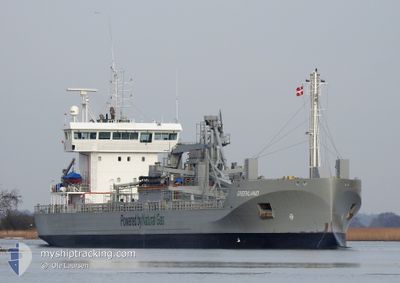
GREENLAND
Cargo
Current Trip
| Time Travelled | 12 h, 41 mins |
|---|---|
| Remaining Time | 1 day |
| Distance Travelled | 145.77 nm |
| Remaining Distance | 382.30 nm |
| AVG Speed | 11.6 Noeuds |
| MAX Speed | 12.6 Noeuds |
| AVG Wind | 18.7 knots |
| MAX Wind | 26.5 knots |
| MIN Temp | 2°C / 35.6°F |
| MAX Temp | 3.6°C / 38.48°F |
| Tirant d eau | 6.7 m |
| Position reçue | 1 m depuis |
Current Position
| Longitude | --- |
|---|---|
| Latitude | --- |
| Etat | Under way using engine |
| Vitesse | 11.2 Noeuds |
| Parcours | 316.5° |
| Zone | Baltic Sea |
| Station | T-AIS |
| Position reçue | 1 m depuis |
Info
Information
The current position of GREENLAND is in Baltic Sea with coordinates 59.78850° / 19.75653° as reported on 2025-03-18 00:56 by AIS to our vessel tracker app. The vessel's current speed is 11.2 Noeuds and is heading at the port of LULEA. The estimated time of arrival as calculated by MyShipTracking vessel tracking app is 2025-03-19 12:05 LT
The vessel GREENLAND (IMO: 9734264, MMSI: 244140468) is a Cargo It's sailing under the flag of [NL] Netherlands.
In this page you can find informations about the vessels current position, last detected port calls, and current voyage information. If the vessels is not in coverage by AIS you will find the latest position.
The current position of GREENLAND is detected by our AIS receivers and we are not responsible for the reliability of the data. The last position was recorded while the vessel was in Coverage by the Ais receivers of our vessel tracking app.
The current draught of GREENLAND as reported by AIS is 6.7 meters
Weather
| Temperature | 2.5°C / 36.5°F |
|---|---|
| Wind Speed | 23 knots |
| Direction | 308° NW |
| Pressure | 1015.8 hPa |
| Humidity | 83 % |
| Cloud Coverage | 99 % |
Featured Company
Last Port Calls
| Port | Arrival | Departure | Time In Port |
|---|---|---|---|
| 2025-03-16 23:45 | 2025-03-17 13:16 | 13 h | |
| 2025-03-13 10:22 | 2025-03-15 00:46 | 1 d | |
| 2025-03-12 08:56 | 2025-03-12 19:30 | 10 h | |
| 2025-03-11 19:31 | 2025-03-11 20:14 | 42 m | |
| 2025-03-10 15:20 | 2025-03-11 01:21 | 10 h | |
| 2025-03-10 02:16 | 2025-03-10 09:08 | 6 h | |
| 2025-03-08 11:25 | 2025-03-09 14:04 | 1 d | |
| 2025-03-06 18:53 | 2025-03-07 09:44 | 14 h | |
| 2025-03-04 21:51 | 2025-03-05 13:28 | 15 h | |
| 2025-03-04 10:16 | 2025-03-04 10:57 | 40 m |
Last Trips
| Origin | Departure | Destination | Arrival | Distance | |
|---|---|---|---|---|---|
| 2025-03-15 00:46 | 2025-03-16 23:45 | 149.15 nm | |||
| 2025-03-12 19:30 | 2025-03-13 10:22 | 142.99 nm | |||
| 2025-03-11 20:14 | 2025-03-12 08:56 | 132.11 nm | |||
| 2025-03-11 01:21 | 2025-03-11 19:31 | 81.69 nm | |||
| 2025-03-10 09:08 | 2025-03-10 15:20 | 66.46 nm | |||
| 2025-03-09 14:04 | 2025-03-10 02:16 | 133.38 nm | |||
| 2025-03-07 09:44 | 2025-03-08 11:25 | 318.79 nm | |||
| 2025-03-05 13:28 | 2025-03-06 18:53 | 312.04 nm | |||
| 2025-03-04 10:57 | 2025-03-04 21:51 | 132.00 nm | |||
| 2025-03-04 05:46 | 2025-03-04 10:16 | 49.41 nm |
Events
| Heure | Evenement | Détails | Position/ Destination | Info |
|---|---|---|---|---|
| 2025-03-18 00:56 | Changement de zone | Finnish part of the Gulf of Bothnia Finnish part of the Baltic Sea |
59.78850 / 19.75653
Gulf of Bothnia
LULEA
|
Vitesse: 11.2 kn Parcours: 316.5° |
| 2025-03-17 22:46 | Detecté en mer | Finnish part of the Baltic Sea |
59.46142 / 20.13825
Baltic Sea
LULEA
|
Vitesse: 11.8 kn Parcours: 12.8° |
| 2025-03-17 22:23 | Etat Changé | Under way using engine Default |
59.38865 / 20.10503
LULEA
|
Vitesse: 11.8 kn Parcours: 13° |
| 2025-03-17 22:22 | Etat Changé | Default Under way using engine |
59.38435 / 20.10305
LULEA
|
Vitesse: 11.7 kn Parcours: 12.8° |
| 2025-03-17 22:15 | Etat Changé | Under way using engine Default |
59.36173 / 20.09255
LULEA
|
Vitesse: 11.7 kn Parcours: 13° |
| 2025-03-17 22:14 | Dans la zone couverte |
59.36220 / 20.09273
Baltic Sea
LULEA
|
Vitesse: 11.7 kn Parcours: 12.8° |
|
| 2025-03-17 17:22 | Etat Changé | Default Under way using engine |
58.42792 / 19.68198
LULEA
|
Vitesse: 11.5 kn Parcours: 11.2° |
| 2025-03-17 17:15 | Hors de la zone couverte |
58.40550 / 19.67277
Baltic Sea
LULEA
|
Vitesse: 11.5 kn Parcours: 11.2° |
|
| 2025-03-17 17:03 | Etat Changé | Under way using engine Default |
58.36775 / 19.65833
LULEA
|
Vitesse: 11.7 kn Parcours: 11° |
| 2025-03-17 16:50 | Etat Changé | Default Under way using engine |
58.32700 / 19.64333
LULEA
|
Vitesse: 11.8 kn Parcours: 12° |