
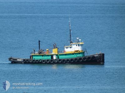
GLEN COVE
Towing
Current Trip
| Time Travelled | 5 days |
|---|---|
| Remaining Time | 2 h, 35 mins |
| Distance Travelled | 24.95 nm |
| Remaining Distance | 16.89 nm |
| AVG Speed | 6.5 Knop |
| MAX Speed | 11.7 Knop |
| AVG Wind | 6.2 knots |
| MAX Wind | 15.8 knots |
| MIN Temp | 8.1°C / 46.58°F |
| MAX Temp | 11.7°C / 53.06°F |
| Djupgående | 3.5 m |
| Position mottagen | Nu |
Current Position
| Longitud | -123.02752° |
|---|---|
| Latitude | 48.21213° |
| Status | Under way using engine |
| Fart | 6.3 Knop |
| Kurs | 278° |
| Område | The Coastal Waters of Southeast Alaska and British Columbia |
| Station | T-AIS |
| Position mottagen | Nu |
Info
Information
The current position of GLEN COVE is in The Coastal Waters of Southeast Alaska and British Columbia with coordinates 48.21213° / -123.02752° as reported on 2024-05-29 07:35 by AIS to our vessel tracker app. The vessel's current speed is 6.3 Knop and is heading at the port of PORT ANGELES. The estimated time of arrival as calculated by MyShipTracking vessel tracking app is 2024-05-29 03:11 LT
The vessel GLEN COVE (IMO: 8991619, MMSI: 366993160) is a Towing It's sailing under the flag of [US] USA.
In this page you can find informations about the vessels current position, last detected port calls, and current voyage information. If the vessels is not in coverage by AIS you will find the latest position.
The current position of GLEN COVE is detected by our AIS receivers and we are not responsible for the reliability of the data. The last position was recorded while the vessel was in Coverage by the Ais receivers of our vessel tracking app.
The current draught of GLEN COVE as reported by AIS is 3.5 meters
Weather
| Temperature | 9.9°C / 49.82°F |
|---|---|
| Wind Speed | 15 knots |
| Direction | 261° W |
| Pressure | 1021.9 hPa |
| Humidity | 84 % |
| Cloud Coverage | 43 % |
Featured Company
Last Port Calls
| Port | Arrival | Departure | Time In Port |
|---|---|---|---|
| 2024-05-23 18:46 | 2024-05-23 20:40 | 1 h | |
| 2024-05-21 03:32 | 2024-05-21 16:27 | 12 h | |
| 2024-05-20 11:28 | 2024-05-20 19:12 | 7 h | |
| 2024-05-20 02:00 | 2024-05-20 03:18 | 1 h | |
| 2024-05-17 05:50 | 2024-05-17 06:07 | 16 m | |
| 2024-05-17 01:17 | 2024-05-17 02:35 | 1 h | |
| 2024-05-15 09:40 | 2024-05-16 16:33 | 1 d | |
| 2024-05-15 00:48 | 2024-05-15 02:01 | 1 h | |
| 2024-05-14 19:26 | 2024-05-14 20:36 | 1 h | |
| 2024-05-08 05:12 | 2024-05-08 06:26 | 1 h |
Most Visited Ports (Last year)
| Port | Arrivals | |
|---|---|---|
| 103 | ||
| 74 | ||
| 29 | ||
| 7 | ||
| 6 | ||
| 1 |
Last Trips
| Origin | Departure | Destination | Arrival | Distance | |
|---|---|---|---|---|---|
| 2024-05-21 16:27 | 2024-05-23 18:46 | 41.01 nm | |||
| 2024-05-20 19:12 | 2024-05-21 03:32 | 58.88 nm | |||
| 2024-05-20 03:18 | 2024-05-20 11:28 | 60.48 nm | |||
| 2024-05-17 06:07 | 2024-05-20 02:00 | 30.56 nm | |||
| 2024-05-17 02:35 | 2024-05-17 05:50 | 29.76 nm | |||
| 2024-05-16 16:33 | 2024-05-17 01:17 | 59.73 nm | |||
| 2024-05-15 02:01 | 2024-05-15 09:40 | 60.91 nm | |||
| 2024-05-14 20:36 | 2024-05-15 00:48 | 46.83 nm | |||
| 2024-05-08 06:26 | 2024-05-14 19:26 | 102.19 nm | |||
| 2024-05-07 20:10 | 2024-05-08 05:12 | 58.98 nm |
Events
| Tid | Event | Detaljer | Position / Dest | Information |
|---|---|---|---|---|
| 2024-05-29 04:33 | STARTAR förflyttning | 2.02 nm, South West of PORT TOWNSEND |
48.08805 / -122.79183
SALISH SEA OPS
|
Fart: 3.3 kn Kurs: 44.4° |
| 2024-05-29 04:12 | STOPPAR förflyttning | 2.07 nm, South West of PORT TOWNSEND |
48.08626 / -122.79112
SALISH SEA OPS
|
Fart: Kurs: 511° |
| 2024-05-29 03:47 | STARTAR förflyttning | 4.42 nm, South of PORT TOWNSEND |
48.03668 / -122.75298
SALISH SEA OPS
|
Fart: 8.1 kn Kurs: 345.6° |
| 2024-05-29 03:03 | I täckningsområde |
48.03480 / -122.75213
The Coastal Waters of Southeast Alaska and British Columbia
|
Fart: 0.1 kn Kurs: 49.4° |
|
| 2024-05-24 04:17 | UTANFÖR täckningsområde |
48.03480 / -122.75212
The Coastal Waters of Southeast Alaska and British Columbia
|
Fart: Kurs: 352.4° |
|
| 2024-05-24 04:07 | STOPPAR förflyttning | 4.53 nm, South of PORT TOWNSEND |
48.03480 / -122.75208
SALISH SEA OPS
|
Fart: 0.3 kn Kurs: 511° |
| 2024-05-24 03:45 | STARTAR förflyttning | 2.06 nm, South West of PORT TOWNSEND |
48.08492 / -122.78865
SALISH SEA OPS
|
Fart: 10.2 kn Kurs: 137.3° |
| 2024-05-24 03:42 | STOPPAR förflyttning | 2.1 nm, South West of PORT TOWNSEND |
48.08565 / -122.79129
SALISH SEA OPS
|
Fart: 0.2 kn Kurs: 511° |
| 2024-05-24 03:40 | AVGÅTT HAMN |
|
48.08564 / -122.78973
SALISH SEA OPS
|
Fart: 2.3 kn Kurs: 511° |
| 2024-05-24 03:35 | STARTAR förflyttning |
48.09046 / -122.79398
[US] PORT TOWNSEND
|
Fart: 6.3 kn Kurs: 135.7° |