

GLEN COVE
Towing

Current Trip
SALISH SEA OPS
| Time Travelled | 3 days |
|---|---|
| Remaining Time | --- |
| Distance Travelled | 34.61 nm |
| Remaining Distance | --- |
| AVG Speed | 8.7 Knots |
| MAX Speed | 10.8 Knots |
| AVG Wind | 3.5 knots |
| MAX Wind | 6.3 knots |
| MIN Temp | 8.9°C / 48.02°F |
| MAX Temp | 10.7°C / 51.26°F |
| Dybgang | 3.5 m |
| Position Modtaget | 1 d siden |
Current Position
| Longitude | --- |
|---|---|
| Latitude | --- |
| Status | Under way using engine |
| Fart | |
| Kurs | --- |
| Område | The Coastal Waters of Southeast Alaska and British Columbia |
| Station | T-AIS |
| Position Modtaget | 1 d siden |
Information
The current position of GLEN COVE is in The Coastal Waters of Southeast Alaska and British Columbia with coordinates 48.03510° / -122.75273° as reported on 2025-03-26 17:10 by AIS to our vessel tracker app. The vessel's current speed is 0 Knots
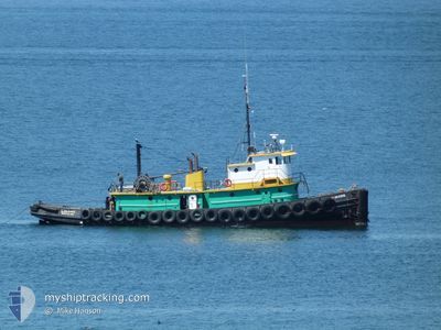
The vessel GLEN COVE (IMO: 8991619, MMSI: 366993160) is a Towing It's sailing under the flag of [US] USA.
In this page you can find informations about the vessels current position, last detected port calls, and current voyage information. If the vessels is not in coverage by AIS you will find the latest position.
The current position of GLEN COVE is detected by our AIS receivers and we are not responsible for the reliability of the data. The last position was recorded while the vessel was in Coverage by the Ais receivers of our vessel tracking app.
The current draught of GLEN COVE as reported by AIS is 3.5 meters
Weather
| Temperature | 11.2°C / 52.16°F |
|---|---|
| Wind Speed | 4 knots |
| Direction | 342° NNW |
| Pressure | 1007.4 hPa |
| Humidity | 87.8 % |
| Cloud Coverage | 100 % |


Featured Company
Last Port Calls
| Port | Arrival | Departure | Time In Port |
|---|---|---|---|
| 2025-03-24 13:33 | 2025-03-24 14:29 | 56 m | |
| 2025-03-21 13:40 | 2025-03-21 14:36 | 56 m | |
| 2025-03-21 04:40 | 2025-03-21 05:04 | 23 m | |
| 2025-03-21 03:55 | 2025-03-21 04:27 | 31 m | |
| 2025-03-20 23:22 | 2025-03-21 01:00 | 1 h | |
| 2025-03-19 03:00 | 2025-03-20 14:49 | 1 d | |
| 2025-03-17 21:54 | 2025-03-18 19:26 | 21 h | |
| 2025-03-13 21:01 | 2025-03-14 08:48 | 11 h | |
| 2025-03-10 12:29 | 2025-03-10 13:49 | 1 h | |
| 2025-03-07 13:11 | 2025-03-07 13:20 | 9 m |
Most Visited Ports (Last year)
| Port | Arrivals | |
|---|---|---|
| 66 | ||
| 46 | ||
| 40 | ||
| 13 | ||
| 10 | ||
| 7 |
Last Trips
| Origin | Departure | Destination | Arrival | Distance | |
|---|---|---|---|---|---|
| 2025-03-21 14:36 | 2025-03-24 13:33 | 67.37 nm | |||
| 2025-03-21 05:04 | 2025-03-21 13:40 | 69.31 nm | |||
| 2025-03-21 04:27 | 2025-03-21 04:40 | 0.83 nm | |||
| 2025-03-21 01:00 | 2025-03-21 03:55 | 26.11 nm | |||
| 2025-03-20 14:49 | 2025-03-20 23:22 | 59.31 nm | |||
| 2025-03-18 19:26 | 2025-03-19 03:00 | 60.53 nm | |||
| 2025-03-14 08:48 | 2025-03-17 21:54 | 64.29 nm | |||
| 2025-03-10 13:49 | 2025-03-13 21:01 | 31.44 nm | |||
| 2025-03-07 13:20 | 2025-03-10 12:29 | 7.98 nm | |||
| 2025-03-07 09:15 | 2025-03-07 13:11 | 29.92 nm |
Events
| Tid | Hændelsen | Detaljer | Position / Dest | Info |
|---|---|---|---|---|
| 2025-03-26 17:10 | Udenfor Dækning |
48.03510 / -122.75273
The Coastal Waters of Southeast Alaska and British Columbia
|
Fart: Kurs: 357.2° |
|
| 2025-03-26 16:29 | Indenfor Dækning |
48.03468 / -122.75200
The Coastal Waters of Southeast Alaska and British Columbia
|
Fart: 0.2 kn Kurs: 109.5° |
|
| 2025-03-25 01:41 | Udenfor Dækning |
48.03487 / -122.75222
The Coastal Waters of Southeast Alaska and British Columbia
|
Fart: Kurs: 35.1° |
|
| 2025-03-25 01:37 | STOP Sejllads | 4.53 nm, South of PORT TOWNSEND |
48.03484 / -122.75223
SALISH SEA OPS
|
Fart: 0.2 kn Kurs: 511° |
| 2025-03-25 01:36 | START Sejllads | 4.53 nm, South of PORT TOWNSEND |
48.03481 / -122.75111
SALISH SEA OPS
|
Fart: 3.4 kn Kurs: 258.9° |
| 2025-03-25 01:24 | STOP Sejllads | 4.4 nm, South of PORT TOWNSEND |
48.03712 / -122.74896
SALISH SEA OPS
|
Fart: 0.3 kn Kurs: 511° |
| 2025-03-24 21:29 | Afsejlet fra sidste havn |
|
48.12868 / -123.39435
SALISH SEA OPS
|
Fart: 9.1 kn Kurs: 83° |
| 2025-03-24 21:19 | START Sejllads |
48.12678 / -123.43336
[US] PORT ANGELES
|
Fart: 6.5 kn Kurs: 85.7° |
|
| 2025-03-24 21:16 | STOP Sejllads |
48.12663 / -123.43647
[US] PORT ANGELES
|
Fart: 0.3 kn Kurs: 511° |
|
| 2025-03-24 21:11 | START Sejllads |
48.12450 / -123.43888
[US] PORT ANGELES
|
Fart: 4.1 kn Kurs: 85° |