
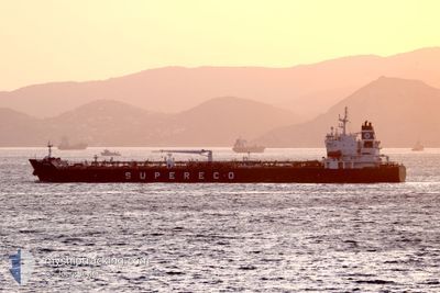
GEMMA
Tanker
Current Trip
ES ALG>AT SEA
| Time Travelled | 9 h, 47 mins |
|---|---|
| Remaining Time | --- |
| Distance Travelled | 30.57 nm |
| Remaining Distance | --- |
| AVG Speed | 7.1 Knop |
| MAX Speed | 13.5 Knop |
| AVG Wind | 15.6 knots |
| MAX Wind | 24 knots |
| MIN Temp | 14.4°C / 57.92°F |
| MAX Temp | 17.1°C / 62.78°F |
| Djupgående | 7.5 m |
| Position mottagen | 1 m sen |
Current Position
| Longitud | --- |
|---|---|
| Latitude | --- |
| Status | Under way using engine |
| Fart | 1.4 Knop |
| Kurs | 201° |
| Område | Alboran Sea |
| Station | T-AIS |
| Position mottagen | 1 m sen |
Info
Information
The current position of GEMMA is in Alboran Sea with coordinates 36.14785° / -5.01314° as reported on 2025-02-26 01:09 by AIS to our vessel tracker app. The vessel's current speed is 1.4 Knop
The vessel GEMMA (IMO: 9808314, MMSI: 248768000) is a Tanker It's sailing under the flag of [MT] Malta.
In this page you can find informations about the vessels current position, last detected port calls, and current voyage information. If the vessels is not in coverage by AIS you will find the latest position.
The current position of GEMMA is detected by our AIS receivers and we are not responsible for the reliability of the data. The last position was recorded while the vessel was in Coverage by the Ais receivers of our vessel tracking app.
The current draught of GEMMA as reported by AIS is 7.5 meters
Weather
| Temperature | 14.5°C / 58.1°F |
|---|---|
| Wind Speed | 11 knots |
| Direction | 280° W |
| Pressure | 1025.6 hPa |
| Humidity | 80.7 % |
| Cloud Coverage | 100 % |
Featured Company
Last Port Calls
Last Trips
| Origin | Departure | Destination | Arrival | Distance | |
|---|---|---|---|---|---|
| 2025-02-24 07:12 | 2025-02-24 09:15 | 17.17 nm | |||
| 2025-02-17 05:31 | 2025-02-22 10:26 | 1443.66 nm | |||
| 2025-01-31 12:00 | 2025-02-09 13:05 | 1440.35 nm | |||
| 2025-01-19 11:24 | 2025-01-28 07:14 | 1629.22 nm | |||
| 2024-11-27 17:24 | 2025-01-14 12:14 | 12052.39 nm |
Events
| Tid | Event | Detaljer | Position / Dest | Information |
|---|---|---|---|---|
| 2025-02-25 23:50 | STARTAR förflyttning | 17.36 nm, East of GIBRALTAR |
36.22765 / -5.01926
ES ALG>AT SEA
|
Fart: 3.1 kn Kurs: 151° |
| 2025-02-25 20:43 | STOPPAR förflyttning | 16.1 nm, East of GIBRALTAR |
36.20034 / -5.03777
ES ALG>AT SEA
|
Fart: 0.3 kn Kurs: 352° |
| 2025-02-25 16:55 | Byter havsområde | Spanish part of the Alboran Sea Gibraltarian part of the Alboran Sea |
36.14032 / -5.11434
Alboran Sea
ES ALG>AT SEA
|
Fart: 12.6 kn Kurs: 71.9° |
| 2025-02-25 16:05 | Byter havsområde | Gibraltarian part of the Alboran Sea Gibraltarian part of the Strait of Gibraltar |
36.08802 / -5.32735
Alboran Sea
ES ALG>AT SEA
|
Fart: 13 kn Kurs: 78.5° |
| 2025-02-25 15:40 | Byter havsområde | Gibraltarian part of the Strait of Gibraltar Spanish part of the Strait of Gibraltar |
36.13066 / -5.39433
Strait of Gibraltar
ES ALG>AT SEA
|
Fart: 11 kn Kurs: 136.4° |
| 2025-02-25 15:23 | AVGÅTT HAMN |
|
36.14924 / -5.42800
ES ALG>AT SEA
|
Fart: 4.7 kn Kurs: 89° |
| 2025-02-25 15:16 | Status ändrad | Under way using engine Moored |
36.14042 / -5.43247
[ES] ALGECIRAS
|
Fart: 3.2 kn Kurs: 5° |
| 2025-02-25 15:15 | STARTAR förflyttning |
36.14013 / -5.43251
[ES] ALGECIRAS
|
Fart: 3.1 kn Kurs: 5° |
|
| 2025-02-25 14:35 | Destination ändrad | ES ALG>AT SEA ES CEU>ES ALG |
36.13689 / -5.43058
[ES] ALGECIRAS
|
Fart: Kurs: 1° |
| 2025-02-25 13:46 | Djupgående ändrat | 7.5 7.9 |
36.13688 / -5.43060
[ES] ALGECIRAS
|
Fart: Kurs: 1° |