

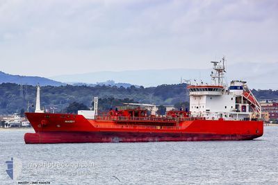
GAS ELISABETH
Lpg Tanker

Current Trip
UA IZM
| Time Travelled | 15 days |
|---|---|
| Remaining Time | --- |
| Distance Travelled | 1323.59 nm |
| Remaining Distance | --- |
| AVG Speed | 9.4 Knop |
| MAX Speed | 12.5 Knop |
| AVG Wind | 12.9 knots |
| MAX Wind | 27.8 knots |
| MIN Temp | -2.5°C / 27.5°F |
| MAX Temp | 15.4°C / 59.72°F |
| Djupgående | 5.9 m |
| Position mottagen | 9 d sen |
Current Position
| Longitud | --- |
|---|---|
| Latitude | --- |
| Status | Under way using engine |
| Fart | 7.3 Knop |
| Kurs | 12.4° |
| Område | Black Sea |
| Station | T-AIS |
| Position mottagen | 9 d sen |
Information
The current position of GAS ELISABETH is in Black Sea with coordinates 41.49956° / 29.05603° as reported on 2025-02-18 22:48 by AIS to our vessel tracker app. The vessel's current speed is 7.3 Knop
The vessel GAS ELISABETH (IMO: 9261578, MMSI: 255802440) is a Lpg Tanker that was built in 2004 ( 21 År gammal ). It's sailing under the flag of [PT] Portugal.
In this page you can find informations about the vessels current position, last detected port calls, and current voyage information. If the vessels is not in coverage by AIS you will find the latest position.
The current position of GAS ELISABETH is detected by our AIS receivers and we are not responsible for the reliability of the data. The last position was recorded while the vessel was in Coverage by the Ais receivers of our vessel tracking app.
The current draught of GAS ELISABETH as reported by AIS is 5.9 meters
Weather
| Temperature | 6.2°C / 43.16°F |
|---|---|
| Wind Speed | 9 knots |
| Direction | 131° SE |
| Pressure | 1023.2 hPa |
| Humidity | 74.6 % |
| Cloud Coverage | 100 % |


Featured Company
Last Port Calls
| Port | Arrival | Departure | Time In Port |
|---|---|---|---|
| 2025-02-12 08:57 | 2025-02-13 03:57 | 18 h | |
| 2025-01-11 06:42 | 2025-01-12 00:36 | 17 h | |
| 2024-12-29 02:01 | 2024-12-29 02:49 | 48 m | |
| 2024-12-23 13:31 | 2024-12-24 03:11 | 13 h | |
| 2024-12-18 13:34 | 2024-12-20 06:05 | 1 d | |
| 2024-12-12 06:53 | 2024-12-16 09:32 | 4 d |
Most Visited Ports (Last year)
| Port | Arrivals | |
|---|---|---|
| 18 | ||
| 13 | ||
| 12 | ||
| 9 | ||
| 8 | ||
| 6 |
Last Trips
| Origin | Departure | Destination | Arrival | Distance | |
|---|---|---|---|---|---|
| 2025-01-12 01:36 | 2025-02-12 11:57 | 6003.66 nm | |||
| 2024-12-29 03:49 | 2025-01-11 07:42 | 766.01 nm | |||
| 2024-12-24 04:11 | 2024-12-29 03:01 | 487.02 nm | |||
| 2024-12-20 07:05 | 2024-12-23 14:31 | 722.46 nm | |||
| 2024-12-16 10:32 | 2024-12-18 14:34 | 95.47 nm | |||
| 2024-11-14 10:02 | 2024-12-12 07:53 | 1419.32 nm |
Events
| Tid | Event | Detaljer | Position / Dest | Information |
|---|---|---|---|---|
| 2025-02-27 14:53 | STARTAR förflyttning | 9.39 nm, North of TULCEA |
45.33727 / 28.80518
UA IZM
|
Fart: 7.4 kn Kurs: 262° |
| 2025-02-24 15:29 | STOPPAR förflyttning | 9.46 nm, North of TULCEA |
45.33823 / 28.81157
UA IZM
|
Fart: Kurs: 281° |
| 2025-02-24 07:45 | STARTAR förflyttning | 1.15 nm, East of SULINA |
45.15946 / 29.67475
UA IZM
|
Fart: 7.4 kn Kurs: 253° |
| 2025-02-24 05:53 | STOPPAR förflyttning | 2.29 nm, East of SULINA |
45.16468 / 29.70083
UA IZM
|
Fart: Kurs: 263° |
| 2025-02-23 20:41 | STOPPAR förflyttning | 11.71 nm, East of SULINA |
45.11182 / 29.91592
UA IZM
|
Fart: 0.3 kn Kurs: 307° |
| 2025-02-22 18:21 | STOPPAR förflyttning | 12.49 nm, East of SULINA |
45.11713 / 29.93650
UA IZM
|
Fart: 0.2 kn Kurs: 53° |
| 2025-02-22 09:37 | STARTAR förflyttning | 10.89 nm, East of SULINA |
45.09630 / 29.88917
UA IZM
|
Fart: 3.8 kn Kurs: 60° |
| 2025-02-18 22:54 | Status ändrad | Default Under way using engine |
41.51128 / 29.05936
UA IZM
|
Fart: 7.3 kn Kurs: 12.4° |
| 2025-02-18 22:48 | UTANFÖR täckningsområde |
41.49956 / 29.05603
Black Sea
|
Fart: 7.3 kn Kurs: 12.4° |
|
| 2025-02-18 21:03 | STARTAR förflyttning | 6.31 nm, North West of RUMELI FENERI |
41.28175 / 28.99065
UA IZM
|
Fart: 4.5 kn Kurs: 27° |