
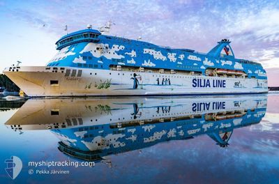
GALAXY
Ro-Ro/Passenger Ship
Current Trip
| Trip Time | 6 h, 37 mins |
|---|---|
| Trip Distance | 70.66 nm |
| AVG Speed | 10.7 Knop |
| MAX Speed | 11.9 Knop |
| Djupgående | 5.1 m |
| AVG Wind | 10.5 knots |
| MAX Wind | 17.8 knots |
| MIN Temp | 20°C / 68°F |
| MAX Temp | 22.5°C / 72.5°F |
| Position mottagen | 21 h, 33 m sen |
Current Position
| Longitud | 19.05927° |
|---|---|
| Latitude | 40.50246° |
| Status | Under way using engine |
| Fart | 10.2 Knop |
| Kurs | 103.4° |
| Område | Adriatic Sea |
| Station | T-AIS |
| Position mottagen | 21 h, 33 m sen |
Info
Information
The current position of GALAXY is in Adriatic Sea with coordinates 40.50246° / 19.05927° as reported on 2024-05-21 03:08 by AIS to our vessel tracker app. The vessel's current speed is 10.2 Knop and is currently inside the port of VLORE.
The vessel GALAXY (IMO: 7516773, MMSI: 210652000) is a Ro-Ro/Passenger Ship that was built in 1979 ( 45 År gammal ). It's sailing under the flag of [CY] Cyprus.
In this page you can find informations about the vessels current position, last detected port calls, and current voyage information. If the vessels is not in coverage by AIS you will find the latest position.
The current position of GALAXY is detected by our AIS receivers and we are not responsible for the reliability of the data. The last position was recorded while the vessel was in Coverage by the Ais receivers of our vessel tracking app.
The current draught of GALAXY as reported by AIS is 5.1 meters
Weather
| Temperature | 21.6°C / 70.88°F |
|---|---|
| Wind Speed | 12 knots |
| Direction | 177° S |
| Pressure | 1010 hPa |
| Humidity | 69.5 % |
| Cloud Coverage | --- |
Featured Company
Last Port Calls
| Port | Arrival | Departure | Time In Port |
|---|---|---|---|
| 2024-05-21 05:03 | |||
| 2024-05-20 04:43 | 2024-05-20 22:26 | 17 h | |
| 2024-05-19 05:22 | 2024-05-19 22:44 | 17 h | |
| 2024-05-18 04:46 | 2024-05-18 23:52 | 19 h | |
| 2024-05-17 05:06 | 2024-05-17 21:51 | 16 h | |
| 2024-05-16 04:36 | 2024-05-16 21:20 | 16 h | |
| 2024-05-15 05:31 | 2024-05-15 21:25 | 15 h | |
| 2024-05-14 04:37 | 2024-05-14 21:43 | 17 h | |
| 2024-05-12 05:15 | 2024-05-13 21:04 | 1 d | |
| 2024-05-11 17:29 | 2024-05-11 23:49 | 6 h |
Last Trips
| Origin | Departure | Destination | Arrival | Distance | |
|---|---|---|---|---|---|
| 2024-05-21 00:26 | 2024-05-21 07:03 | 70.66 nm | |||
| 2024-05-20 00:44 | 2024-05-20 06:43 | 70.52 nm | |||
| 2024-05-19 01:52 | 2024-05-19 07:22 | 66.20 nm | |||
| 2024-05-17 23:51 | 2024-05-18 06:46 | 69.08 nm | |||
| 2024-05-16 23:20 | 2024-05-17 07:06 | 72.43 nm | |||
| 2024-05-15 23:25 | 2024-05-16 06:36 | 67.06 nm | |||
| 2024-05-14 23:43 | 2024-05-15 07:31 | 68.72 nm | |||
| 2024-05-13 23:04 | 2024-05-14 06:37 | 68.84 nm | |||
| 2024-05-12 01:49 | 2024-05-12 07:15 | 69.22 nm | |||
| 2024-05-11 14:52 | 2024-05-11 19:29 | 67.21 nm |
Events
| Tid | Event | Detaljer | Position / Dest | Information |
|---|---|---|---|---|
| 2024-05-21 05:18 | STOPPAR förflyttning |
40.44810 / 19.48085
[AL] VLORE
|
Fart: Kurs: 162° |
|
| 2024-05-21 05:03 | ANLÄNDER HAMN |
|
40.44661 / 19.48151
[AL] VLORE
|
Fart: 11 kn Kurs: 93° |
| 2024-05-21 03:13 | Status ändrad | Default Under way using engine |
40.49960 / 19.07552
AL VOA
|
Fart: 10.2 kn Kurs: 103.4° |
| 2024-05-21 03:08 | UTANFÖR täckningsområde |
40.50246 / 19.05927
Adriatic Sea
AL VOA
|
Fart: 10.2 kn Kurs: 103.4° |
|
| 2024-05-21 02:29 | Status ändrad | Under way using engine Default |
40.53120 / 18.91654
AL VOA
|
Fart: 10.3 kn Kurs: 106° |
| 2024-05-21 02:23 | Status ändrad | Default Under way using engine |
40.53627 / 18.89359
AL VOA
|
Fart: 10.4 kn Kurs: 105.7° |
| 2024-05-21 01:53 | Upptäckt i hav | Albanian part of the Adriatic Sea |
40.56060 / 18.78291
Adriatic Sea
AL VOA
|
Fart: 10.4 kn Kurs: 107.1° |
| 2024-05-20 23:05 | Destination ändrad | AL VOA IT BDS |
40.70611 / 18.13425
AL VOA
|
Fart: 10.6 kn Kurs: 102.8° |
| 2024-05-20 23:05 | ETA ändrat | 2024/05/22 05:00 2024/05/21 04:30 |
40.70611 / 18.13425
AL VOA
|
Fart: 10.6 kn Kurs: 102.8° |
| 2024-05-20 22:26 | AVGÅTT HAMN |
|
40.66271 / 17.99978
IT BDS
|
Fart: 8.1 kn Kurs: 50° |