

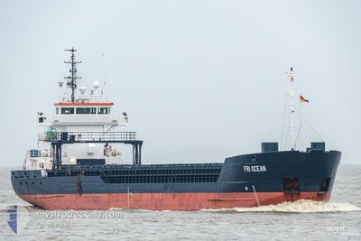
FRI OCEAN
General Cargo

Current Trip
| Time Travelled | 8 days |
|---|---|
| Remaining Time | --- |
| Distance Travelled | 759.97 nm |
| Remaining Distance | --- |
| AVG Speed | 8.9 Knop |
| MAX Speed | 11.7 Knop |
| AVG Wind | 7.3 knots |
| MAX Wind | 15.8 knots |
| MIN Temp | 5.4°C / 41.72°F |
| MAX Temp | 13.2°C / 55.76°F |
| Djupgående | 3.2 m |
| Position mottagen | 34 m sen |
Current Position
| Longitud | --- |
|---|---|
| Latitude | --- |
| Status | At anchor |
| Fart | 0.2 Knop |
| Kurs | 339° |
| Område | Bay of Biscay |
| Station | T-AIS |
| Position mottagen | 34 m sen |
Information
The current position of FRI OCEAN is in Bay of Biscay with coordinates 46.46598° / -1.78127° as reported on 2025-03-12 15:01 by AIS to our vessel tracker app. The vessel's current speed is 0.2 Knop
The vessel FRI OCEAN (IMO: 9195690, MMSI: 309467000) is a General Cargo that was built in 2000 ( 25 År gammal ). It's sailing under the flag of [BS] Bahamas.
In this page you can find informations about the vessels current position, last detected port calls, and current voyage information. If the vessels is not in coverage by AIS you will find the latest position.
The current position of FRI OCEAN is detected by our AIS receivers and we are not responsible for the reliability of the data. The last position was recorded while the vessel was in Coverage by the Ais receivers of our vessel tracking app.
The current draught of FRI OCEAN as reported by AIS is 3.2 meters
Weather
| Temperature | 7.6°C / 45.68°F |
|---|---|
| Wind Speed | 8 knots |
| Direction | 6° N |
| Pressure | 1000.4 hPa |
| Humidity | 73.4 % |
| Cloud Coverage | 100 % |


Featured Company
Last Port Calls
| Port | Arrival | Departure | Time In Port |
|---|---|---|---|
| 2025-03-03 06:58 | 2025-03-03 19:14 | 12 h | |
| 2025-03-03 05:44 | 2025-03-03 05:59 | 15 m | |
| 2025-02-24 19:10 | 2025-02-26 19:16 | 2 d | |
| 2025-02-18 11:31 | 2025-02-21 18:27 | 3 d | |
| 2025-02-06 13:56 | 2025-02-09 16:40 | 3 d | |
| 2025-01-21 10:11 | 2025-01-25 13:44 | 4 d | |
| 2025-01-16 20:32 | 2025-01-17 23:06 | 1 d | |
| 2025-01-12 17:17 | 2025-01-15 14:55 | 2 d | |
| 2025-01-09 11:54 | 2025-01-10 23:14 | 1 d |
Last Trips
| Origin | Departure | Destination | Arrival | Distance | |
|---|---|---|---|---|---|
| 2025-03-03 05:59 | 2025-03-03 06:58 | 5.17 nm | |||
| 2025-02-26 20:16 | 2025-03-03 05:44 | 456.90 nm | |||
| 2025-02-21 18:27 | 2025-02-24 20:10 | 280.68 nm | |||
| 2025-02-09 17:40 | 2025-02-18 11:31 | 1433.96 nm | |||
| 2025-01-25 13:44 | 2025-02-06 14:56 | 2407.68 nm | |||
| 2025-01-18 00:06 | 2025-01-21 10:11 | 748.51 nm | |||
| 2025-01-15 15:55 | 2025-01-16 21:32 | 273.73 nm | |||
| 2025-01-10 23:14 | 2025-01-12 18:17 | 398.94 nm | |||
| 2024-12-30 06:41 | 2025-01-09 11:54 | 1117.44 nm |
Events
| Tid | Event | Detaljer | Position / Dest | Information |
|---|---|---|---|---|
| 2025-03-12 15:19 | Status ändrad | Default At anchor |
46.46593 / -1.78192
FRLSO
|
Fart: 0.2 kn Kurs: 339° |
| 2025-03-12 14:43 | Status ändrad | At anchor Default |
46.46592 / -1.78129
FRLSO
|
Fart: Kurs: 359° |
| 2025-03-12 14:37 | Status ändrad | Default At anchor |
46.46590 / -1.78161
FRLSO
|
Fart: 0.2 kn Kurs: 344° |
| 2025-03-12 12:37 | Status ändrad | At anchor Default |
46.46596 / -1.78150
FRLSO
|
Fart: 0.3 kn Kurs: 7° |
| 2025-03-12 12:20 | Status ändrad | Default At anchor |
46.46591 / -1.78196
FRLSO
|
Fart: 0.3 kn Kurs: 7° |
| 2025-03-12 11:49 | Status ändrad | At anchor Default |
46.46593 / -1.78180
FRLSO
|
Fart: Kurs: 348° |
| 2025-03-12 11:26 | Status ändrad | Default At anchor |
46.46594 / -1.78159
FRLSO
|
Fart: Kurs: 348° |
| 2025-03-12 10:31 | Status ändrad | At anchor Default |
46.46596 / -1.78174
FRLSO
|
Fart: 0.1 kn Kurs: 7° |
| 2025-03-12 10:19 | Status ändrad | Default At anchor |
46.46594 / -1.78216
FRLSO
|
Fart: 0.3 kn Kurs: 3° |
| 2025-03-12 10:13 | Status ändrad | At anchor Default |
46.46591 / -1.78195
FRLSO
|
Fart: Kurs: 17° |