
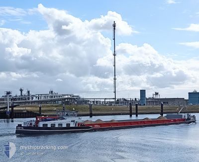
FREYA
Cargo
Current Trip
| Time Travelled | 1 h, 5 mins |
|---|---|
| Remaining Time | 7 mins |
| Distance Travelled | 5.11 nm |
| Remaining Distance | 2.80 nm |
| AVG Speed | 6.4 Knop |
| MAX Speed | 6.8 Knop |
| AVG Wind | 7.8 knots |
| MAX Wind | 8.5 knots |
| MIN Temp | 17.5°C / 63.5°F |
| MAX Temp | 18.7°C / 65.66°F |
| Djupgående | 2.5 m |
| Position mottagen | 10 m sen |
Current Position
| Longitud | 5.92834° |
|---|---|
| Latitude | 53.16900° |
| Status | Under way using engine |
| Fart | 6.5 Knop |
| Kurs | 247.8° |
| Område | North Sea |
| Station | T-AIS |
| Position mottagen | 10 m sen |
Info
Information
The current position of FREYA is in North Sea with coordinates 53.16900° / 5.92834° as reported on 2024-05-16 16:42 by AIS to our vessel tracker app. The vessel's current speed is 6.5 Knop and is heading at the port of LEEUWARDEN. The estimated time of arrival as calculated by MyShipTracking vessel tracking app is 2024-05-16 17:00 LT
The vessel FREYA (IMO: 102515712, MMSI: 244690633) is a Cargo It's sailing under the flag of [NL] Netherlands.
In this page you can find informations about the vessels current position, last detected port calls, and current voyage information. If the vessels is not in coverage by AIS you will find the latest position.
The current position of FREYA is detected by our AIS receivers and we are not responsible for the reliability of the data. The last position was recorded while the vessel was in Coverage by the Ais receivers of our vessel tracking app.
The current draught of FREYA as reported by AIS is 2.5 meters
Weather
| Temperature | 18.1°C / 64.58°F |
|---|---|
| Wind Speed | 8 knots |
| Direction | 155° SSE |
| Pressure | 1004.7 hPa |
| Humidity | 86.9 % |
| Cloud Coverage | 100 % |
Featured Company
Last Port Calls
| Port | Arrival | Departure | Time In Port |
|---|---|---|---|
| 2024-05-16 15:46 | 2024-05-16 15:48 | 1 m | |
| 2024-05-16 04:43 | 2024-05-16 07:11 | 2 h | |
| 2024-05-15 19:34 | 2024-05-16 04:13 | 8 h | |
| 2024-05-15 17:49 | 2024-05-15 18:17 | 27 m | |
| 2024-05-15 12:10 | 2024-05-15 13:39 | 1 h | |
| 2024-05-14 15:40 | 2024-05-15 09:44 | 18 h | |
| 2024-05-14 13:17 | 2024-05-14 14:04 | 46 m | |
| 2024-05-14 11:24 | 2024-05-14 12:12 | 47 m | |
| 2024-05-13 19:40 | 2024-05-14 06:12 | 10 h | |
| 2024-05-13 14:33 | 2024-05-13 16:44 | 2 h |
Last Trips
| Origin | Departure | Destination | Arrival | Distance | |
|---|---|---|---|---|---|
| 2024-05-16 09:11 | 2024-05-16 17:46 | 24.99 nm | |||
| 2024-05-16 06:13 | 2024-05-16 06:43 | 1.07 nm | |||
| 2024-05-15 20:17 | 2024-05-15 21:34 | 8.52 nm | |||
| 2024-05-15 15:39 | 2024-05-15 19:49 | 28.45 nm | |||
| 2024-05-15 11:44 | 2024-05-15 14:10 | 12.65 nm | |||
| 2024-05-14 16:04 | 2024-05-14 17:40 | 6.08 nm | |||
| 2024-05-14 14:12 | 2024-05-14 15:17 | 4.39 nm | |||
| 2024-05-14 08:12 | 2024-05-14 13:24 | 27.78 nm | |||
| 2024-05-13 18:44 | 2024-05-13 21:40 | 12.56 nm | |||
| 2024-05-13 14:45 | 2024-05-13 16:33 | 12.21 nm |
Events
| Tid | Event | Detaljer | Position / Dest | Information |
|---|---|---|---|---|
| 2024-05-16 15:48 | AVGÅTT HAMN |
|
53.20264 / 6.08115
SKULENBOARCH
|
Fart: 7.5 kn Kurs: 254° |
| 2024-05-16 15:46 | ANLÄNDER HAMN |
|
53.20339 / 6.08618
[NL] KOOTSTERTILLE
|
Fart: 0.7 kn Kurs: 276° |
| 2024-05-16 15:43 | STARTAR förflyttning | 0.79 nm, South West of KOOTSTERTILLE |
53.20251 / 6.08103
SKULENBOARCH
|
Fart: 7.5 kn Kurs: 75.5° |
| 2024-05-16 12:35 | STOPPAR förflyttning | 0.91 nm, South West of KOOTSTERTILLE |
53.20179 / 6.07811
SKULENBOARCH
|
Fart: 0.3 kn Kurs: 79° |
| 2024-05-16 11:46 | Status ändrad | Under way using engine Default |
53.18416 / 5.97063
SKULENBOARCH
|
Fart: 5 kn Kurs: 59° |
| 2024-05-16 11:38 | Status ändrad | Default Under way using engine |
53.17833 / 5.95167
SKULENBOARCH
|
Fart: 5.4 kn Kurs: 55.5° |
| 2024-05-16 11:31 | Status ändrad | Under way using engine Default |
53.17314 / 5.93833
SKULENBOARCH
|
Fart: 5 kn Kurs: 93° |
| 2024-05-16 11:20 | I täckningsområde |
53.17314 / 5.93833
North Sea
|
Fart: 5.1 kn Kurs: 40.5° |
|
| 2024-05-16 10:08 | Status ändrad | Default Under way using engine |
53.18438 / 5.78172
SKULENBOARCH
|
Fart: 3.7 kn Kurs: 100° |
| 2024-05-16 10:04 | UTANFÖR täckningsområde |
53.18518 / 5.77398
North Sea
|
Fart: 3.7 kn Kurs: 99.9° |