
FREDERIK
General Cargo
Current Trip
| Time Travelled | 4 days |
|---|---|
| Remaining Time | --- |
| Distance Travelled | 593.16 nm |
| Remaining Distance | --- |
| AVG Speed | 8.9 Knop |
| MAX Speed | 11.3 Knop |
| AVG Wind | 8.5 knots |
| MAX Wind | 19 knots |
| MIN Temp | 7.9°C / 46.22°F |
| MAX Temp | 13.6°C / 56.48°F |
| Djupgående | 5.1 m |
| Position mottagen | 2 m sen |
Current Position
| Longitud | -6.96798° |
|---|---|
| Latitude | 52.14125° |
| Status | At anchor |
| Fart | |
| Kurs | 241° |
| Område | Celtic Sea |
| Station | T-AIS |
| Position mottagen | 2 m sen |
Info
Information
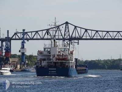
The current position of FREDERIK is in Celtic Sea with coordinates 52.14125° / -6.96798° as reported on 2024-05-04 13:47 by AIS to our vessel tracker app. The vessel's current speed is 0 Knop
The vessel FREDERIK (IMO: 9518402, MMSI: 304058000) is a General Cargo that was built in 2009 ( 15 År gammal ). It's sailing under the flag of [AG] Antigua Barbuda.
In this page you can find informations about the vessels current position, last detected port calls, and current voyage information. If the vessels is not in coverage by AIS you will find the latest position.
The current position of FREDERIK is detected by our AIS receivers and we are not responsible for the reliability of the data. The last position was recorded while the vessel was in Coverage by the Ais receivers of our vessel tracking app.
The current draught of FREDERIK as reported by AIS is 5.1 meters
Weather
| Temperature | 10.4°C / 50.72°F |
|---|---|
| Wind Speed | 6 knots |
| Direction | 226° SW |
| Pressure | 1009.6 hPa |
| Humidity | 89.9 % |
| Cloud Coverage | 100 % |
Featured Company
Last Port Calls
| Port | Arrival | Departure | Time In Port |
|---|---|---|---|
| 2024-04-27 07:05 | 2024-04-30 06:05 | 2 d | |
| 2024-04-26 15:35 | 2024-04-26 17:03 | 1 h | |
| 2024-04-24 16:12 | 2024-04-26 14:50 | 1 d | |
| 2024-04-24 15:48 | 2024-04-24 15:57 | 8 m | |
| 2024-04-24 15:16 | 2024-04-24 15:35 | 18 m | |
| 2024-04-14 10:17 | 2024-04-16 10:19 | 2 d | |
| 2024-04-09 15:32 | 2024-04-10 23:23 | 1 d | |
| 2024-04-07 10:34 | 2024-04-09 01:28 | 1 d | |
| 2024-04-03 16:49 | 2024-04-05 14:15 | 1 d | |
| 2024-04-01 10:51 | 2024-04-01 10:57 | 6 m |
Last Trips
| Origin | Departure | Destination | Arrival | Distance | |
|---|---|---|---|---|---|
| 2024-04-26 19:03 | 2024-04-27 09:05 | 118.77 nm | |||
| 2024-04-26 16:50 | 2024-04-26 17:35 | 5.04 nm | |||
| 2024-04-24 17:57 | 2024-04-24 18:12 | 1.03 nm | |||
| 2024-04-24 17:35 | 2024-04-24 17:48 | 1.00 nm | |||
| 2024-04-16 11:19 | 2024-04-24 17:16 | 1372.30 nm | |||
| 2024-04-11 01:23 | 2024-04-14 11:17 | 586.15 nm | |||
| 2024-04-09 03:28 | 2024-04-09 17:32 | 103.43 nm | |||
| 2024-04-05 15:15 | 2024-04-07 12:34 | 375.44 nm | |||
| 2024-04-01 11:57 | 2024-04-03 17:49 | 0.79 nm | |||
| 2024-03-29 00:30 | 2024-04-01 11:51 | 627.48 nm |
Events
| Tid | Event | Detaljer | Position / Dest | Information |
|---|---|---|---|---|
| 2024-05-04 07:35 | Status ändrad | At anchor Default |
52.14037 / -6.97063
IEWAT
|
Fart: 0.2 kn Kurs: 89° |
| 2024-05-04 07:32 | Status ändrad | Default At anchor |
52.14045 / -6.97072
IEWAT
|
Fart: Kurs: 91° |
| 2024-05-04 02:23 | Status ändrad | At anchor Default |
52.14105 / -6.96733
IEWAT
|
Fart: 0.1 kn Kurs: 273° |
| 2024-05-04 02:20 | Status ändrad | Default At anchor |
52.14107 / -6.96733
IEWAT
|
Fart: Kurs: 272° |
| 2024-05-04 00:11 | Status ändrad | At anchor Default |
52.14150 / -6.96748
IEWAT
|
Fart: Kurs: 248° |
| 2024-05-04 00:08 | Status ändrad | Default At anchor |
52.14150 / -6.96750
IEWAT
|
Fart: Kurs: 246° |
| 2024-05-03 06:47 | Status ändrad | At anchor Default |
52.14065 / -6.96960
IEWAT
|
Fart: Kurs: 89° |
| 2024-05-03 06:44 | Status ändrad | Default At anchor |
52.14063 / -6.96962
IEWAT
|
Fart: Kurs: 87° |
| 2024-05-03 00:35 | Status ändrad | At anchor Default |
52.14173 / -6.96648
IEWAT
|
Fart: Kurs: 259° |
| 2024-05-03 00:32 | Status ändrad | Default At anchor |
52.14170 / -6.96645
IEWAT
|
Fart: Kurs: 258° |