
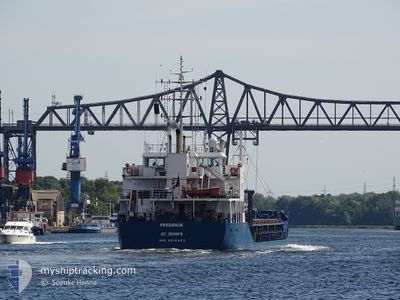
FREDERIK
General Cargo
Current Trip
| Time Travelled | 11 h, 34 mins |
|---|---|
| Remaining Time | 16 h, 42 mins |
| Distance Travelled | 103.16 nm |
| Remaining Distance | 157.56 nm |
| AVG Speed | 8.8 Knopen |
| MAX Speed | 10.5 Knopen |
| AVG Wind | 8.5 knots |
| MAX Wind | 13.8 knots |
| MIN Temp | 9.1°C / 48.38°F |
| MAX Temp | 12.9°C / 55.22°F |
| Diepgang | 4.5 M |
| Positie ontvangen | 9 m geleden |
Current Position
| Lengtegraad | --- |
|---|---|
| Breedtegraat | --- |
| Status | Under way using engine |
| Snelheid | 10.5 Knopen |
| Koers | 39° |
| Gebied | English Channel |
| Station | T-AIS |
| Positie ontvangen | 9 m geleden |
Info
Information
The current position of FREDERIK is in English Channel with coordinates 50.50440° / 1.05828° as reported on 2025-02-20 00:36 by AIS to our vessel tracker app. The vessel's current speed is 10.5 Knopen and is heading at the port of ROTTERDAM. The estimated time of arrival as calculated by MyShipTracking vessel tracking app is 2025-02-20 17:28 LT
The vessel FREDERIK (IMO: 9518402, MMSI: 304058000) is a General Cargo that was built in 2009 ( 16 Jaar oud ). It's sailing under the flag of [AG] Antigua Barbuda.
In this page you can find informations about the vessels current position, last detected port calls, and current voyage information. If the vessels is not in coverage by AIS you will find the latest position.
The current position of FREDERIK is detected by our AIS receivers and we are not responsible for the reliability of the data. The last position was recorded while the vessel was in Coverage by the Ais receivers of our vessel tracking app.
The current draught of FREDERIK as reported by AIS is 4.5 meters
Weather
| Temperature | 9.2°C / 48.56°F |
|---|---|
| Wind Speed | 13 knots |
| Direction | 204° SSW |
| Pressure | 1017.4 hPa |
| Humidity | 92.6 % |
| Cloud Coverage | 100 % |
Featured Company
Last Port Calls
| Port | Arrival | Departure | Time In Port |
|---|---|---|---|
| 2025-02-18 23:15 | 2025-02-19 13:12 | 13 h | |
| 2025-02-16 21:16 | 2025-02-17 13:02 | 15 h | |
| 2025-02-13 21:54 | 2025-02-15 17:25 | 1 d | |
| 2025-02-09 19:31 | 2025-02-10 22:53 | 1 d | |
| 2025-02-06 03:59 | 2025-02-06 17:10 | 13 h | |
| 2025-02-04 20:57 | 2025-02-05 22:51 | 1 d | |
| 2025-01-31 07:52 | 2025-02-01 22:02 | 1 d | |
| 2025-01-26 19:22 | 2025-01-27 18:17 | 22 h | |
| 2025-01-22 22:44 | 2025-01-23 17:07 | 18 h | |
| 2025-01-18 10:39 | 2025-01-20 16:30 | 2 d |
Last Trips
| Origin | Departure | Destination | Arrival | Distance | |
|---|---|---|---|---|---|
| 2025-02-17 14:02 | 2025-02-19 00:15 | 279.32 nm | |||
| 2025-02-15 18:25 | 2025-02-16 22:16 | 256.15 nm | |||
| 2025-02-10 22:53 | 2025-02-13 22:54 | 468.35 nm | |||
| 2025-02-06 18:10 | 2025-02-09 19:31 | 656.40 nm | |||
| 2025-02-05 23:51 | 2025-02-06 04:59 | 12.52 nm | |||
| 2025-02-01 22:02 | 2025-02-04 21:57 | 635.98 nm | |||
| 2025-01-27 19:17 | 2025-01-31 07:52 | 620.92 nm | |||
| 2025-01-23 18:07 | 2025-01-26 20:22 | 301.24 nm | |||
| 2025-01-20 17:30 | 2025-01-22 23:44 | 528.78 nm | |||
| 2025-01-14 17:19 | 2025-01-18 11:39 | 683.10 nm |
Events
| Tijd | Evenement | Details | Positie / Bestemming | Info |
|---|---|---|---|---|
| 2025-02-20 00:41 | Status Changed | Default Under way using engine |
50.51673 / 1.07485
NLRTM
|
Snelheid: 10.5 kn Koers: 39° |
| 2025-02-20 00:33 | Status Changed | Under way using engine Default |
50.49860 / 1.05057
NLRTM
|
Snelheid: 10.5 kn Koers: 39° |
| 2025-02-20 00:33 | Binnenbereik |
50.49897 / 1.05107
English Channel
NLRTM
|
Snelheid: 10.4 kn Koers: 39° |
|
| 2025-02-19 21:44 | Status Changed | Default Under way using engine |
50.17245 / .52912
NLRTM
|
Snelheid: 9.3 kn Koers: 44° |
| 2025-02-19 21:39 | Status Changed | Under way using engine Default |
50.16182 / .51248
NLRTM
|
Snelheid: 9.1 kn Koers: 44° |
| 2025-02-19 21:39 | Buitenbereik |
50.16182 / .51248
English Channel
NLRTM
|
Snelheid: 9.3 kn Koers: 44° |
|
| 2025-02-19 21:30 | Status Changed | Default Under way using engine |
50.14583 / .48760
NLRTM
|
Snelheid: 9 kn Koers: 44° |
| 2025-02-19 21:25 | Status Changed | Under way using engine Default |
50.13743 / .47468
NLRTM
|
Snelheid: 8.9 kn Koers: 46° |
| 2025-02-19 21:02 | Status Changed | Default Under way using engine |
50.09778 / .40992
NLRTM
|
Snelheid: 8.7 kn Koers: 46° |
| 2025-02-19 21:00 | Status Changed | Under way using engine Default |
50.09445 / .40432
NLRTM
|
Snelheid: 8.7 kn Koers: 47° |