
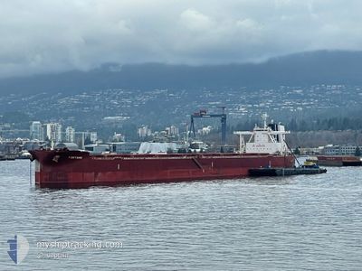
FORTUNE
Cargo
Current Trip
CO POB
| Time Travelled | 35 days |
|---|---|
| Remaining Time | --- |
| Distance Travelled | 10075.12 nm |
| Remaining Distance | --- |
| AVG Speed | 11.7 Knop |
| MAX Speed | 16 Knop |
| AVG Wind | 13.6 knots |
| MAX Wind | 29.3 knots |
| MIN Temp | 15.1°C / 59.18°F |
| MAX Temp | 28.8°C / 83.84°F |
| Djupgående | 11.5 m |
| Position mottagen | 9 d sen |
Current Position
| Longitud | --- |
|---|---|
| Latitude | --- |
| Status | Under way using engine |
| Fart | 9.9 Knop |
| Kurs | 289.5° |
| Område | South Atlantic Ocean |
| Station | T-AIS |
| Position mottagen | 9 d sen |
Info
Information
The current position of FORTUNE is in South Atlantic Ocean with coordinates -34.59531° / 18.18559° as reported on 2025-02-07 22:53 by AIS to our vessel tracker app. The vessel's current speed is 9.9 Knop
The vessel FORTUNE (IMO: 9737838, MMSI: 249062000) is a Cargo It's sailing under the flag of [MT] Malta.
In this page you can find informations about the vessels current position, last detected port calls, and current voyage information. If the vessels is not in coverage by AIS you will find the latest position.
The current position of FORTUNE is detected by our AIS receivers and we are not responsible for the reliability of the data. The last position was recorded while the vessel was in Coverage by the Ais receivers of our vessel tracking app.
The current draught of FORTUNE as reported by AIS is 11.5 meters
Weather
| Temperature | 27.1°C / 80.78°F |
|---|---|
| Wind Speed | 13 knots |
| Direction | 117° ESE |
| Pressure | 1011.2 hPa |
| Humidity | 80.7 % |
| Cloud Coverage | 27 % |
Featured Company
Last Port Calls
| Port | Arrival | Departure | Time In Port |
|---|---|---|---|
| 2025-01-07 04:33 | 2025-01-13 06:49 | 6 d | |
| 2024-12-06 23:21 | 2024-12-08 14:23 | 1 d |
Last Trips
| Origin | Departure | Destination | Arrival | Distance | |
|---|---|---|---|---|---|
| 2024-12-08 06:23 | 2025-01-07 12:33 | 6629.38 nm | |||
| 2024-11-28 11:34 | 2024-12-06 15:21 | 45.90 nm |
Events
| Tid | Event | Detaljer | Position / Dest | Information |
|---|---|---|---|---|
| 2025-02-07 22:59 | Status ändrad | Default Under way using engine |
-34.58928 / 18.16696
CO POB
|
Fart: 9.9 kn Kurs: 289.5° |
| 2025-02-07 22:53 | Status ändrad | Under way using engine Default |
-34.59531 / 18.18559
CO POB
|
Fart: 10 kn Kurs: 292° |
| 2025-02-07 22:53 | UTANFÖR täckningsområde |
-34.59531 / 18.18559
South Atlantic Ocean
CO POB
|
Fart: 9.9 kn Kurs: 289.5° |
|
| 2025-02-07 22:51 | Status ändrad | Default Under way using engine |
-34.59730 / 18.19180
CO POB
|
Fart: 9.9 kn Kurs: 290.1° |
| 2025-02-07 22:47 | Status ändrad | Under way using engine Default |
-34.60081 / 18.20271
CO POB
|
Fart: 9.9 kn Kurs: 289° |
| 2025-02-07 22:39 | Status ändrad | Default Under way using engine |
-34.60876 / 18.22840
CO POB
|
Fart: 10 kn Kurs: 291.4° |
| 2025-02-07 22:29 | Status ändrad | Under way using engine Default |
-34.61836 / 18.25905
CO POB
|
Fart: 9.9 kn Kurs: 290° |
| 2025-02-07 22:24 | Status ändrad | Default Under way using engine |
-34.62415 / 18.27657
CO POB
|
Fart: 10.2 kn Kurs: 302.3° |
| 2025-02-07 22:15 | Status ändrad | Under way using engine Default |
-34.63492 / 18.30167
CO POB
|
Fart: 10.1 kn Kurs: 298° |
| 2025-02-07 22:03 | I täckningsområde |
-34.63474 / 18.30122
South Atlantic Ocean
CO POB
|
Fart: 10.1 kn Kurs: 298.8° |