

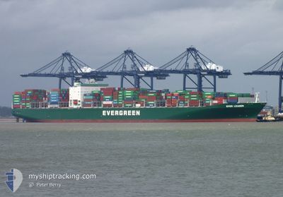
EVER LEADER
Container Ship

Current Trip
| Time Travelled | 4 days |
|---|---|
| Remaining Time | 5 days |
| Distance Travelled | 1507.34 nm |
| Remaining Distance | 1822.87 nm |
| AVG Speed | 14.2 Knop |
| MAX Speed | 16.5 Knop |
| AVG Wind | 6 knots |
| MAX Wind | 11 knots |
| MIN Temp | 27.2°C / 80.96°F |
| MAX Temp | 29.5°C / 85.1°F |
| Djupgående | 13.6 m |
| Position mottagen | 7 m sen |
Current Position
| Longitud | --- |
|---|---|
| Latitude | --- |
| Status | Under way using engine |
| Fart | 13.8 Knop |
| Kurs | 294.7° |
| Område | Laccadive Sea |
| Station | T-AIS |
| Position mottagen | 7 m sen |
Information
The current position of EVER LEADER is in Laccadive Sea with coordinates 6.95360° / 77.39427° as reported on 2025-03-29 19:08 by AIS to our vessel tracker app. The vessel's current speed is 13.8 Knop and is heading at the port of JEBEL ALI. The estimated time of arrival as calculated by MyShipTracking vessel tracking app is 2025-04-04 11:53 LT
The vessel EVER LEADER (IMO: 9595503, MMSI: 566794000) is a Container Ship that was built in 2013 ( 12 År gammal ). It's sailing under the flag of [SG] Singapore.
In this page you can find informations about the vessels current position, last detected port calls, and current voyage information. If the vessels is not in coverage by AIS you will find the latest position.
The current position of EVER LEADER is detected by our AIS receivers and we are not responsible for the reliability of the data. The last position was recorded while the vessel was in Coverage by the Ais receivers of our vessel tracking app.
The current draught of EVER LEADER as reported by AIS is 13.6 meters
Weather
| Temperature | 28.8°C / 83.84°F |
|---|---|
| Wind Speed | 9 knots |
| Direction | 286° WNW |
| Pressure | 1008.7 hPa |
| Humidity | 76.7 % |
| Cloud Coverage | 19 % |


Featured Company
Last Port Calls
| Port | Arrival | Departure | Time In Port |
|---|---|---|---|
| 2025-03-25 05:50 | 2025-03-25 17:14 | 11 h | |
| 2025-03-19 00:39 | 2025-03-19 22:01 | 21 h | |
| 2025-03-16 23:14 | 2025-03-17 20:46 | 21 h | |
| 2025-03-13 12:21 | 2025-03-14 00:42 | 12 h | |
| 2025-03-08 08:09 | 2025-03-09 18:53 | 1 d | |
| 2025-02-28 20:29 | 2025-03-02 09:37 | 1 d | |
| 2025-01-27 05:09 | 2025-01-28 16:21 | 1 d | |
| 2025-01-25 02:01 | 2025-01-26 05:11 | 1 d | |
| 2025-01-19 03:18 | 2025-01-22 14:37 | 3 d | |
| 2025-01-15 09:36 | 2025-01-16 20:54 | 1 d |
Last Trips
| Origin | Departure | Destination | Arrival | Distance | |
|---|---|---|---|---|---|
| 2025-03-19 22:01 | 2025-03-25 05:50 | 1671.78 nm | |||
| 2025-03-17 20:46 | 2025-03-19 00:39 | 369.72 nm | |||
| 2025-03-14 00:42 | 2025-03-16 23:14 | 771.75 nm | |||
| 2025-03-09 18:53 | 2025-03-13 12:21 | 745.70 nm | |||
| 2025-03-02 09:37 | 2025-03-08 08:09 | 2071.83 nm | |||
| 2025-01-28 16:21 | 2025-02-28 20:29 | 12398.11 nm | |||
| 2025-01-26 05:11 | 2025-01-27 05:09 | 226.73 nm | |||
| 2025-01-22 14:37 | 2025-01-25 02:01 | 356.78 nm | |||
| 2025-01-16 20:54 | 2025-01-19 03:18 | 715.38 nm | |||
| 2025-01-06 13:39 | 2025-01-15 09:36 | 1739.72 nm |
Events
| Tid | Event | Detaljer | Position / Dest | Information |
|---|---|---|---|---|
| 2025-03-29 18:12 | Status ändrad | Under way using engine Default |
6.86794 / 77.59102
MYPKL>AEJEA
|
Fart: 13.5 kn Kurs: 294° |
| 2025-03-29 17:56 | Status ändrad | Default Under way using engine |
6.84478 / 77.64456
MYPKL>AEJEA
|
Fart: 13.4 kn Kurs: 293.1° |
| 2025-03-29 17:38 | Status ändrad | Under way using engine Default |
6.81684 / 77.70879
MYPKL>AEJEA
|
Fart: 13.8 kn Kurs: 296° |
| 2025-03-29 17:04 | Status ändrad | Default Under way using engine |
6.76248 / 77.82599
MYPKL>AEJEA
|
Fart: 13.7 kn Kurs: 296.1° |
| 2025-03-29 16:56 | Status ändrad | Under way using engine Default |
6.74813 / 77.85534
MYPKL>AEJEA
|
Fart: 13.7 kn Kurs: 296° |
| 2025-03-29 16:49 | Status ändrad | Default Under way using engine |
6.73693 / 77.87826
MYPKL>AEJEA
|
Fart: 13.7 kn Kurs: 295.8° |
| 2025-03-29 16:46 | Upptäckt i hav | Indian part of the Laccadive Sea |
6.73126 / 77.88985
Laccadive Sea
MYPKL>AEJEA
|
Fart: 13.7 kn Kurs: 295.9° |
| 2025-03-29 16:45 | I täckningsområde |
6.73126 / 77.88985
Laccadive Sea
MYPKL>AEJEA
|
Fart: 13.7 kn Kurs: 295.9° |
|
| 2025-03-29 16:44 | Status ändrad | Under way using engine Default |
6.72822 / 77.89613
MYPKL>AEJEA
|
Fart: 13.7 kn Kurs: 297° |
| 2025-03-29 14:22 | UTANFÖR täckningsområde |
6.49460 / 78.38733
Laccadive Sea
MYPKL>AEJEA
|
Fart: 13.9 kn Kurs: 293.7° |