
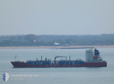
EPIC BREEZE
Tanker
Current Trip
| Trip Time | 6 days |
|---|---|
| Trip Distance | 875.56 nm |
| AVG Speed | 10.5 Knop |
| MAX Speed | 13 Knop |
| Djupgående | 6.5 m |
| AVG Wind | 14.4 knots |
| MAX Wind | 25.4 knots |
| MIN Temp | 8.3°C / 46.94°F |
| MAX Temp | 24.3°C / 75.74°F |
| Position mottagen | 12 h, 52 m sen |
Current Position
| Longitud | -9.63853° |
|---|---|
| Latitude | 30.42351° |
| Status | Moored |
| Fart | |
| Kurs | 230° |
| Område | North Atlantic Ocean |
| Station | T-AIS |
| Position mottagen | 12 h, 52 m sen |
Info
Information
The current position of EPIC BREEZE is in North Atlantic Ocean with coordinates 30.42351° / -9.63853° as reported on 2024-05-09 04:05 by AIS to our vessel tracker app. The vessel's current speed is 0 Knop and is currently inside the port of AGADIR.
The vessel EPIC BREEZE (IMO: 9892808, MMSI: 215858000) is a Tanker It's sailing under the flag of [MT] Malta.
In this page you can find informations about the vessels current position, last detected port calls, and current voyage information. If the vessels is not in coverage by AIS you will find the latest position.
The current position of EPIC BREEZE is detected by our AIS receivers and we are not responsible for the reliability of the data. The last position was recorded while the vessel was in Coverage by the Ais receivers of our vessel tracking app.
The current draught of EPIC BREEZE as reported by AIS is 6.5 meters
Weather
| Temperature | 20.6°C / 69.08°F |
|---|---|
| Wind Speed | 9 knots |
| Direction | 288° WNW |
| Pressure | 1009.7 hPa |
| Humidity | 58 % |
| Cloud Coverage | 100 % |
Featured Company
Last Port Calls
| Port | Arrival | Departure | Time In Port |
|---|---|---|---|
| 2024-05-08 10:23 | |||
| 2024-04-30 13:19 | 2024-05-02 08:54 | 1 d | |
| 2024-04-25 12:59 | 2024-04-27 00:44 | 1 d | |
| 2024-04-23 05:15 | 2024-04-24 04:35 | 23 h | |
| 2024-04-19 20:39 | 2024-04-19 21:12 | 32 m | |
| 2024-04-17 19:19 | 2024-04-18 12:29 | 17 h | |
| 2024-04-10 13:53 | 2024-04-12 19:57 | 2 d | |
| 2024-04-01 19:48 | 2024-04-10 08:07 | 8 d | |
| 2024-03-29 13:44 | 2024-03-30 11:22 | 21 h | |
| 2024-03-26 04:12 | 2024-03-26 21:57 | 17 h |
Last Trips
| Origin | Departure | Destination | Arrival | Distance | |
|---|---|---|---|---|---|
| 2024-05-02 10:54 | 2024-05-08 11:23 | 875.56 nm | |||
| 2024-04-27 02:44 | 2024-04-30 15:19 | 694.79 nm | |||
| 2024-04-24 06:35 | 2024-04-25 14:59 | 259.24 nm | |||
| 2024-04-19 23:12 | 2024-04-23 07:15 | 392.85 nm | |||
| 2024-04-18 14:29 | 2024-04-19 22:39 | 368.72 nm | |||
| 2024-04-12 21:57 | 2024-04-17 21:19 | 949.91 nm | |||
| 2024-04-10 10:07 | 2024-04-10 15:53 | 37.29 nm | |||
| 2024-03-30 12:22 | 2024-04-01 21:48 | 268.67 nm | |||
| 2024-03-26 22:57 | 2024-03-29 14:44 | 197.69 nm | |||
| 2024-03-25 05:10 | 2024-03-26 05:12 | 263.19 nm |
Events
| Tid | Event | Detaljer | Position / Dest | Information |
|---|---|---|---|---|
| 2024-05-09 04:08 | Status ändrad | Default Moored |
30.42350 / -9.63854
[MA] AGADIR
|
Fart: Kurs: 230° |
| 2024-05-09 04:05 | UTANFÖR täckningsområde |
30.42351 / -9.63853
North Atlantic Ocean
[MA] AGADIR
|
Fart: Kurs: 129.3° |
|
| 2024-05-09 04:02 | Status ändrad | Moored Default |
30.42352 / -9.63852
[MA] AGADIR
|
Fart: Kurs: 230° |
| 2024-05-09 04:02 | I täckningsområde |
30.42352 / -9.63852
North Atlantic Ocean
[MA] AGADIR
|
Fart: Kurs: 129.3° |
|
| 2024-05-08 10:23 | ANLÄNDER HAMN |
|
30.41929 / -9.64052
[MA] AGADIR
|
Fart: 4.9 kn Kurs: 18° |
| 2024-05-08 09:53 | STARTAR förflyttning | 2.61 nm, West of AGADIR |
30.42909 / -9.68256
MA AGA
|
Fart: 4.7 kn Kurs: 131° |
| 2024-05-08 03:53 | Status ändrad | Default At anchor |
30.43311 / -9.68550
MA AGA
|
Fart: Kurs: 173° |
| 2024-05-08 03:50 | UTANFÖR täckningsområde |
30.43311 / -9.68554
North Atlantic Ocean
|
Fart: Kurs: 91.1° |
|
| 2024-05-08 03:38 | Status ändrad | At anchor Default |
30.43305 / -9.68563
MA AGA
|
Fart: Kurs: 172° |
| 2024-05-08 03:38 | I täckningsområde |
30.43305 / -9.68563
North Atlantic Ocean
|
Fart: Kurs: 249.1° |