
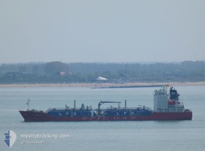
EPIC BREEZE
Tanker
Current Trip
| Trip Time | 2 days |
|---|---|
| Trip Distance | 255.39 nm |
| AVG Speed | 10.6 Knopen |
| MAX Speed | 15.6 Knopen |
| Diepgang | 5 M |
| AVG Wind | 5.9 knots |
| MAX Wind | 13 knots |
| MIN Temp | 12.9°C / 55.22°F |
| MAX Temp | 14.9°C / 58.82°F |
| Positie ontvangen | 5 h, 47 m geleden |
Current Position
| Lengtegraad | --- |
|---|---|
| Breedtegraat | --- |
| Status | Under way using engine |
| Snelheid | 3.9 Knopen |
| Koers | 145° |
| Gebied | Mediterranean Sea - Western Basin |
| Station | T-AIS |
| Positie ontvangen | 5 h, 47 m geleden |
Info
Information
The current position of EPIC BREEZE is in Mediterranean Sea - Western Basin with coordinates 37.56962° / -0.96242° as reported on 2026-01-03 08:51 by AIS to our vessel tracker app. The vessel's current speed is 3.9 Knopen and is currently inside the port of ESCOMBRERAS.
The vessel EPIC BREEZE (MMSI: 215858000) is a Tanker It's sailing under the flag of [MT] Malta.
In this page you can find informations about the vessels current position, last detected port calls, and current voyage information. If the vessels is not in coverage by AIS you will find the latest position.
The current position of EPIC BREEZE is detected by our AIS receivers and we are not responsible for the reliability of the data. The last position was recorded while the vessel was in Coverage by the Ais receivers of our vessel tracking app.
The current draught of EPIC BREEZE as reported by AIS is 5 meters
Weather
| Temperature | 15.8°C / 60.44°F |
|---|---|
| Wind Speed | 8 knots |
| Direction | 14° NNE |
| Pressure | 1001.5 hPa |
| Humidity | 77 % |
| Cloud Coverage | 100 % |
Featured Company
Last Port Calls
| Port | Arrival | Departure | Time In Port |
|---|---|---|---|
| 2026-01-03 09:51 | |||
| 2025-12-31 11:41 | 2025-12-31 19:20 | 7 h | |
| 2025-12-25 11:40 | 2025-12-26 10:33 | 22 h | |
| 2025-12-10 20:20 | 2025-12-12 02:56 | 1 d | |
| 2025-11-29 09:36 | 2025-11-30 11:16 | 1 d | |
| 2025-11-27 13:42 | 2025-11-28 12:13 | 22 h | |
| 2025-11-25 07:25 | 2025-11-26 12:55 | 1 d | |
| 2025-11-23 12:57 | 2025-11-24 07:44 | 18 h | |
| 2025-11-18 08:21 | 2025-11-19 08:46 | 1 d | |
| 2025-11-13 15:04 | 2025-11-15 01:31 | 1 d |
Last Trips
| Origin | Departure | Destination | Arrival | Distance | |
|---|---|---|---|---|---|
| 2025-12-31 19:20 | 2026-01-03 09:51 | 255.39 nm | |||
| 2025-12-26 10:33 | 2025-12-31 11:41 | 492.85 nm | |||
| 2025-12-12 02:56 | 2025-12-25 11:40 | 901.34 nm | |||
| 2025-11-30 11:16 | 2025-12-10 20:20 | 1206.81 nm | |||
| 2025-11-28 12:13 | 2025-11-29 09:36 | 286.86 nm | |||
| 2025-11-26 12:55 | 2025-11-27 13:42 | 290.52 nm | |||
| 2025-11-24 07:44 | 2025-11-25 07:25 | 289.27 nm | |||
| 2025-11-19 08:46 | 2025-11-23 12:57 | 745.18 nm | |||
| 2025-11-15 01:31 | 2025-11-18 08:21 | 891.07 nm | |||
| 2025-11-04 12:20 | 2025-11-13 15:04 | 1083.69 nm |
Events
| Tijd | Evenement | Details | Positie / Bestemming | Info |
|---|---|---|---|---|
| 2026-01-03 09:07 | Stop beweging |
37.56615 / -.95864
[ES] ESCOMBRERAS
|
Snelheid: Koers: 327° |
|
| 2026-01-03 08:59 | Status Changed | Default Under way using engine |
37.56656 / -.95950
[ES] ESCOMBRERAS
|
Snelheid: 3.9 kn Koers: 145° |
| 2026-01-03 08:51 | Buitenbereik |
37.56962 / -.96242
Mediterranean Sea - Western Basin
[ES] ESCOMBRERAS
|
Snelheid: 3.9 kn Koers: 131° |
|
| 2026-01-03 08:51 | Aankomsthaven |
|
37.56962 / -.96242
[ES] ESCOMBRERAS
|
Snelheid: 4.9 kn Koers: 90° |
| 2026-01-03 08:44 | Status Changed | Under way using engine Default |
37.57138 / -.97594
ES CAR
|
Snelheid: 5.2 kn Koers: 76° |
| 2026-01-03 08:43 | Status Changed | Default Under way using engine |
37.57137 / -.97847
ES CAR
|
Snelheid: 4.9 kn Koers: 69° |
| 2026-01-03 08:42 | Status Changed | Under way using engine Default |
37.57098 / -.97997
ES CAR
|
Snelheid: 5.6 kn Koers: 67° |
| 2026-01-03 08:31 | Status Changed | Default Under way using engine |
37.56555 / -.99474
ES CAR
|
Snelheid: 5.6 kn Koers: 59.3° |
| 2026-01-03 08:25 | Status Changed | Under way using engine Default |
37.56201 / -1.00240
ES CAR
|
Snelheid: 5.4 kn Koers: 59° |
| 2026-01-03 08:19 | Status Changed | Default Under way using engine |
37.55763 / -1.01207
ES CAR
|
Snelheid: 4.9 kn Koers: 57° |