

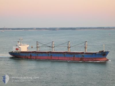
EMERALD BAY
General Cargo

Current Trip
GIGIB>LCCAS
| Time Travelled | 12 days |
|---|---|
| Remaining Time | --- |
| Distance Travelled | 1136.03 nm |
| Remaining Distance | --- |
| AVG Speed | 10.6 Knop |
| MAX Speed | 13.1 Knop |
| AVG Wind | 10.6 knots |
| MAX Wind | 17.9 knots |
| MIN Temp | 22.7°C / 72.86°F |
| MAX Temp | 28.8°C / 83.84°F |
| Djupgående | 9 m |
| Position mottagen | 17 d sen |
Current Position
| Longitud | --- |
|---|---|
| Latitude | --- |
| Status | Under way using engine |
| Fart | 13.1 Knop |
| Kurs | 233° |
| Område | Caribbean Sea |
| Station | T-AIS |
| Position mottagen | 17 d sen |
Information
The current position of EMERALD BAY is in Caribbean Sea with coordinates 13.96006° / -61.11430° as reported on 2025-02-01 17:58 by AIS to our vessel tracker app. The vessel's current speed is 13.1 Knop
The vessel EMERALD BAY (IMO: 9385075, MMSI: 235102768) is a General Cargo that was built in 2008 ( 17 År gammal ). It's sailing under the flag of [GB] United Kingdom.
In this page you can find informations about the vessels current position, last detected port calls, and current voyage information. If the vessels is not in coverage by AIS you will find the latest position.
The current position of EMERALD BAY is detected by our AIS receivers and we are not responsible for the reliability of the data. The last position was recorded while the vessel was in Coverage by the Ais receivers of our vessel tracking app.
The current draught of EMERALD BAY as reported by AIS is 9 meters
Weather
| Temperature | 25.8°C / 78.44°F |
|---|---|
| Wind Speed | 8 knots |
| Direction | 55° NE |
| Pressure | 1010.7 hPa |
| Humidity | 86 % |
| Cloud Coverage | 58 % |


Featured Company
Most Visited Ports (Last year)
| Port | Arrivals | |
|---|---|---|
| 2 | ||
| 2 | ||
| 2 | ||
| 1 | ||
| 1 | ||
| 1 |
Last Trips
| Origin | Departure | Destination | Arrival | Distance | |
|---|---|---|---|---|---|
| 2025-02-01 13:23 | 2025-02-03 07:37 | 479.31 nm | |||
| 2025-01-28 21:03 | 2025-01-29 14:05 | 5.13 nm | |||
| 2024-12-22 09:43 | 2025-01-23 18:27 | 5997.81 nm | |||
| 2024-12-17 20:52 | 2024-12-19 07:06 | 311.84 nm | |||
| 2024-11-21 03:05 | 2024-12-10 13:30 | 4649.31 nm |
Events
| Tid | Event | Detaljer | Position / Dest | Information |
|---|---|---|---|---|
| 2025-02-15 20:13 | STOPPAR förflyttning | 8.55 nm, North of SAO LUIS |
-2.38303 / -44.35035
GIGIB>LCCAS
|
Fart: 0.2 kn Kurs: 41° |
| 2025-02-15 19:17 | STARTAR förflyttning | 4.51 nm, North of SAO LUIS |
-2.44581 / -44.29939
GIGIB>LCCAS
|
Fart: 3.3 kn Kurs: 328° |
| 2025-02-13 18:30 | STOPPAR förflyttning | 4.39 nm, North of SAO LUIS |
-2.44799 / -44.29921
GIGIB>LCCAS
|
Fart: 0.1 kn Kurs: 44° |
| 2025-02-09 12:36 | STARTAR förflyttning |
7.01602 / -57.80619
GIGIB>LCCAS
|
Fart: 9.7 kn Kurs: 89° |