
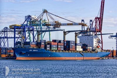
EM CORFU
Cargo
Current Trip
BZBKG
| Time Travelled | 3 days |
|---|---|
| Remaining Time | --- |
| Distance Travelled | 825.31 nm |
| Remaining Distance | --- |
| AVG Speed | 9.2 Knop |
| MAX Speed | 15.6 Knop |
| AVG Wind | 7.6 knots |
| MAX Wind | 12.3 knots |
| MIN Temp | 21.7°C / 71.06°F |
| MAX Temp | 27.2°C / 80.96°F |
| Djupgående | 9.2 m |
| Position mottagen | 2 m sen |
Current Position
| Longitud | --- |
|---|---|
| Latitude | --- |
| Status | Under way using engine |
| Fart | 10 Knop |
| Kurs | 103.6° |
| Område | Caribbean Sea |
| Station | T-AIS |
| Position mottagen | 2 m sen |
Info
Information
The current position of EM CORFU is in Caribbean Sea with coordinates 9.51243° / -80.02212° as reported on 2025-02-27 07:30 by AIS to our vessel tracker app. The vessel's current speed is 10 Knop
The vessel EM CORFU (IMO: 923149400, MMSI: 538007209) is a Cargo It's sailing under the flag of [MH] Marshall Is.
In this page you can find informations about the vessels current position, last detected port calls, and current voyage information. If the vessels is not in coverage by AIS you will find the latest position.
The current position of EM CORFU is detected by our AIS receivers and we are not responsible for the reliability of the data. The last position was recorded while the vessel was in Coverage by the Ais receivers of our vessel tracking app.
The current draught of EM CORFU as reported by AIS is 9.2 meters
Weather
| Temperature | 26.9°C / 80.42°F |
|---|---|
| Wind Speed | 12 knots |
| Direction | 352° N |
| Pressure | 1010.9 hPa |
| Humidity | 79.3 % |
| Cloud Coverage | 100 % |
Featured Company
Last Port Calls
| Port | Arrival | Departure | Time In Port |
|---|---|---|---|
| 2025-02-22 13:44 | 2025-02-23 12:51 | 23 h | |
| 2025-02-07 03:25 | 2025-02-08 03:59 | 1 d | |
| 2025-02-04 12:12 | 2025-02-06 03:21 | 1 d | |
| 2025-02-02 14:56 | 2025-02-03 16:58 | 1 d | |
| 2025-01-12 13:00 | 2025-01-13 12:22 | 23 h | |
| 2025-01-05 13:59 | 2025-01-06 12:27 | 22 h | |
| 2025-01-01 17:13 | 2025-01-02 10:11 | 16 h | |
| 2024-12-13 04:52 | 2024-12-14 11:24 | 1 d | |
| 2024-12-11 04:46 | 2024-12-12 05:12 | 1 d | |
| 2024-12-09 05:20 | 2024-12-10 01:36 | 20 h |
Most Visited Ports (Last year)
| Port | Arrivals | |
|---|---|---|
| 7 | ||
| 7 | ||
| 7 | ||
| 6 | ||
| 6 | ||
| 5 |
Last Trips
| Origin | Departure | Destination | Arrival | Distance | |
|---|---|---|---|---|---|
| 2025-02-08 04:59 | 2025-02-22 07:44 | 5615.00 nm | |||
| 2025-02-06 04:21 | 2025-02-07 04:25 | 348.08 nm | |||
| 2025-02-03 16:58 | 2025-02-04 13:12 | 264.28 nm | |||
| 2025-01-13 07:22 | 2025-02-02 14:56 | 6045.60 nm | |||
| 2025-01-06 06:27 | 2025-01-12 08:00 | 993.18 nm | |||
| 2025-01-02 04:11 | 2025-01-05 07:59 | 1079.78 nm | |||
| 2024-12-14 12:24 | 2025-01-01 11:13 | 6278.13 nm | |||
| 2024-12-12 06:12 | 2024-12-13 05:52 | 347.88 nm | |||
| 2024-12-10 01:36 | 2024-12-11 05:46 | 294.97 nm | |||
| 2024-11-25 06:07 | 2024-12-09 05:20 | 5182.46 nm |
Events
| Tid | Event | Detaljer | Position / Dest | Information |
|---|---|---|---|---|
| 2025-02-27 04:31 | Status ändrad | Under way using engine Default |
9.81656 / -80.11717
BZBKG
|
Fart: 6.3 kn Kurs: 172° |
| 2025-02-27 03:32 | Status ändrad | Default Under way using engine |
9.91732 / -80.12934
BZBKG
|
Fart: 6.1 kn Kurs: 176.6° |
| 2025-02-27 03:30 | Status ändrad | Under way using engine Default |
9.92133 / -80.12971
BZBKG
|
Fart: 6.2 kn Kurs: 175° |
| 2025-02-27 03:30 | Upptäckt i hav | Panamanian part of the Caribbean Sea |
9.92133 / -80.12971
Caribbean Sea
|
Fart: 6.1 kn Kurs: 176.6° |
| 2025-02-27 03:17 | I täckningsområde |
9.92133 / -80.12971
Caribbean Sea
|
Fart: 6.1 kn Kurs: 176.6° |
|
| 2025-02-23 12:51 | AVGÅTT HAMN |
|
16.45423 / -88.38775
BZBKG
|
Fart: 6.5 kn Kurs: 159° |
| 2025-02-22 13:44 | ANLÄNDER HAMN |
|
16.51497 / -88.40520
[BZ] BIG CREEK
|
Fart: 7.8 kn Kurs: 341° |
| 2025-02-22 11:15 | STARTAR förflyttning | 12.63 nm, South of HARVEST CAYE |
16.26433 / -88.42892
BZBKG
|
Fart: 3.1 kn Kurs: 12° |
| 2025-02-21 22:12 | STOPPAR förflyttning | 13.02 nm, South of HARVEST CAYE |
16.25752 / -88.42631
BZBKG
|
Fart: 0.1 kn Kurs: 31° |