

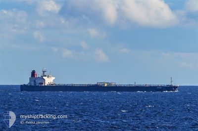
ELEPHANT
Crude Oil Tanker

Current Trip
| Time Travelled | 10 days |
|---|---|
| Remaining Time | 5 days |
| Distance Travelled | 2933.17 nm |
| Remaining Distance | 1815.18 nm |
| AVG Speed | 11.4 Knop |
| MAX Speed | 18.8 Knop |
| AVG Wind | 10.8 knots |
| MAX Wind | 29 knots |
| MIN Temp | -0.9°C / 30.38°F |
| MAX Temp | 17.1°C / 62.78°F |
| Djupgående | 15 m |
| Position mottagen | 1 h, 49 m sen |
Current Position
| Longitud | --- |
|---|---|
| Latitude | --- |
| Status | Under way using engine |
| Fart | 13.6 Knop |
| Kurs | 83.8° |
| Område | Alboran Sea |
| Station | T-AIS |
| Position mottagen | 1 h, 49 m sen |
Information
The current position of ELEPHANT is in Alboran Sea with coordinates 36.24762° / -3.07990° as reported on 2025-03-27 21:36 by AIS to our vessel tracker app. The vessel's current speed is 13.6 Knop and is heading at the port of PORT SAID. The estimated time of arrival as calculated by MyShipTracking vessel tracking app is 2025-04-02 13:58 LT
The vessel ELEPHANT (IMO: 9374868, MMSI: 574005510) is a Crude Oil Tanker that was built in 2007 ( 18 År gammal ). It's sailing under the flag of [VN] Vietnam.
In this page you can find informations about the vessels current position, last detected port calls, and current voyage information. If the vessels is not in coverage by AIS you will find the latest position.
The current position of ELEPHANT is detected by our AIS receivers and we are not responsible for the reliability of the data. The last position was recorded while the vessel was in Coverage by the Ais receivers of our vessel tracking app.
The current draught of ELEPHANT as reported by AIS is 15 meters
Weather
| Temperature | 16.4°C / 61.52°F |
|---|---|
| Wind Speed | 9 knots |
| Direction | 236° SW |
| Pressure | 1015.5 hPa |
| Humidity | 84.3 % |
| Cloud Coverage | 5 % |


Featured Company
Last Port Calls
| Port | Arrival | Departure | Time In Port |
|---|---|---|---|
| 2025-03-15 14:05 | 2025-03-17 13:46 | 1 d | |
| 2025-02-28 05:03 | |||
| 2025-02-28 04:53 | |||
| 2025-02-28 00:17 | 2025-02-28 03:48 | 3 h | |
| 2025-02-27 22:54 | 2025-02-27 23:45 | 50 m | |
| 2025-02-27 22:38 | 2025-02-27 22:41 | 3 m | |
| 2025-02-27 21:25 | 2025-02-27 22:24 | 59 m | |
| 2025-01-31 07:16 | 2025-01-31 16:21 | 9 h | |
| 2025-01-16 13:13 | 2025-01-16 22:28 | 9 h |
Most Visited Ports (Last year)
| Port | Arrivals | |
|---|---|---|
| 9 | ||
| 7 | ||
| 3 | ||
| 2 |
Last Trips
| Origin | Departure | Destination | Arrival | Distance | |
|---|---|---|---|---|---|
| 2025-02-28 03:48 | 2025-03-15 14:05 | 119.94 nm | |||
| 2025-02-28 04:53 | 2025-02-28 05:03 | 3.49 nm | |||
| 2025-02-27 23:45 | 2025-02-28 00:17 | 11.61 nm | |||
| 2025-02-27 22:41 | 2025-02-27 22:54 | 7.03 nm | |||
| 2025-02-27 22:24 | 2025-02-27 22:38 | 4.95 nm | |||
| 2024-12-28 04:16 | 2025-02-27 21:25 | 10344.54 nm | |||
| 2024-12-28 04:16 | 2025-01-31 07:16 | 6378.42 nm | |||
| 2024-12-28 04:16 | 2025-01-16 13:13 | 4748.58 nm |
Events
| Tid | Event | Detaljer | Position / Dest | Information |
|---|---|---|---|---|
| 2025-03-27 21:38 | Status ändrad | Default Under way using engine |
36.24837 / -3.07054
PORT SAID EG
|
Fart: 13.6 kn Kurs: 83.8° |
| 2025-03-27 21:36 | UTANFÖR täckningsområde |
36.24762 / -3.07990
Alboran Sea
PORT SAID EG
|
Fart: 13.6 kn Kurs: 83.8° |
|
| 2025-03-27 21:21 | Status ändrad | Under way using engine Default |
36.24105 / -3.14835
PORT SAID EG
|
Fart: 13.5 kn Kurs: 85° |
| 2025-03-27 21:05 | Status ändrad | Default Under way using engine |
36.23598 / -3.22192
PORT SAID EG
|
Fart: 13.5 kn Kurs: 83.2° |
| 2025-03-27 17:17 | Status ändrad | Under way using engine Default |
36.09169 / -4.29067
PORT SAID EG
|
Fart: 13.6 kn Kurs: 82° |
| 2025-03-27 17:16 | Status ändrad | Default Under way using engine |
36.09108 / -4.29694
PORT SAID EG
|
Fart: 13.6 kn Kurs: 81.6° |
| 2025-03-27 13:49 | Byter havsområde | Spanish part of the Alboran Sea Spanish part of the Strait of Gibraltar |
35.97985 / -5.30994
Alboran Sea
PORT SAID EG
|
Fart: 15.3 kn Kurs: 80.6° |
| 2025-03-27 13:37 | Byter havsområde | Spanish part of the Strait of Gibraltar Moroccan part of the Strait of Gibraltar |
35.96745 / -5.37265
Strait of Gibraltar
PORT SAID EG
|
Fart: 15 kn Kurs: 73.1° |
| 2025-03-27 12:09 | Status ändrad | Under way using engine Default |
35.90825 / -5.76147
PORT SAID EG
|
Fart: 12.1 kn Kurs: 88° |
| 2025-03-27 12:08 | Status ändrad | Default Under way using engine |
35.90788 / -5.76706
PORT SAID EG
|
Fart: 12.1 kn Kurs: 82.2° |